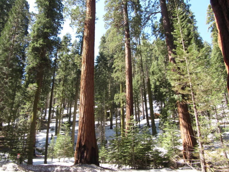
The forests in the state provide water, habitat for animals, lumber and tourism dollars, and they sequester carbon. (Photo: Molly Samuel)
For decades the federal government has touted the nearly 200 million acres of national forests and grasslands under its control as a “land of many uses.” But one “use” that’s seldom discussed is as a huge repository for carbon.
But clearly it’s on the minds of officials and scientists as the Forest Service seeks comments on its proposed new planning rule. National Forests and Grasslands are managed individually, but the planning rule guides how those management plans are developed. This new one is replacing a Planning Rule from 1982. Continue reading California’s Giant Carbon Sponge→
As if drought and wildfires weren’t enough, California’s coniferous forests face another climate-related threat
(Photo: Reed Galin/Lone Tree Productions)
In the last decade, tiny forest-dwelling beetles have wiped out pine trees on millions of acres in the Canadian and American West, including Southern California. The rest of the state has been largely spared, but forest ecologists say that’s likely to change.
Pacific storm makes for some high tides and scary waves on the Bay
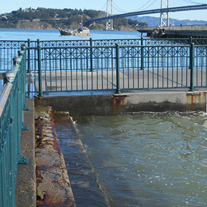
Waves slosh on to San Francisco's Embarcadero during Thursday's "king tide" (Photo: Gretchen Weber)
Take naturally-occurring extremely high tides, and add to them high winds and torrential rain, and you get some pretty big seas.
At least, that’s what I got out on the San Francisco Bay today. How big exactly, is hard to say (our uneducated guessed ran the gamut), but they were big enough to wash over the bow of our 26-foot boat on more than one occasion and to keep most of us aboard holding on for dear life for much of the three-hour voyage. What I can say for sure is that as I type this blog post, four hours later, my body still feels like I’m rolling up and down and back and forth on some stormy seas.
We braved the weather today to check out the latest round of “king tides” and see how they affect low-lying shorelines in places like Crissy Field, Treasure Island, and SFO. The seas were so rough that we didn’t make it all the way to the airport, but we did see waves crashing over the sea wall along the Embarcadero just south of the Ferry Building (see video below). At Crissy Field, the beach was nearly submerged and a small footbridge near the mouth of the estuary was almost awash. Continue reading Storm Surges and King Tides→
High tide at Pier 14 in San Francisco on January 19, 2011 (Photo: Jack Gregg)
This week another round of extremely high tides will hit the California coast, providing a glimpse of what the state can expect as sea levels continue to rise. These “king tides” will roll in from February 16th through the 18th, with the highest swells expected on the morning of the 17th, between 7:30 and 9 a.m.
The wind energy industry faces multiple challenges in California.
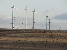
Flocks of birds near wind turbines in Solano County. (Photo: Craig Miller)
It’s hard to find people who are just flat out against wind energy. As with real estate, attitudes seem to come down to location, location, location. That’s why three of the thorniest issues with wind are project siting, transmission (lines for the power produced), and the industry’s turbulent history with birds and bats.
Last fall, even the National Audubon Society, one of the nation’s most stalwart protectors of winged creatures, published a position statement generally favorable toward wind power, calling it a “good news, bad news” proposition. The statement calls California’s Altamont Pass “notorious for killing many raptors, including golden eagles.” A 2003 study by the National Renewable Energy Lab calculated that on average, each turbine in the pass was claiming a bird about once every five years (0.19 birds/turbine/year) — but there are thousands of turbines in the pass, many older models that are more of a danger to birds.
Developers are in the process of “repowering” the pass with newer, larger turbines, less lethal to birds. That may seem counterintuitive but the older, smaller models caused more problems. Since they had lower output, more of them were required. The blades were positioned lower, spun faster, and supported by lattice towers that provided inviting nesting spots, unlike the smooth tubular towers of new turbines.
Altamont is the oldest of California’s four biggest wind energy zones, highlighted on this interactive map.
The Audubon statement concedes that newer turbine designs are becoming more bird-friendly, and finds climate change a bigger threat to avian critters in the long run. The Society went on to call for an extension of the federal Production Tax Credit for wind development, fearing its expiration next year encourages wind developers to rush projects along and “cut corners” on siting.
Taking global climate models and “downscaling” them for use at the local level is an ongoing challenge for scientists and for planners. But thanks to new climate projections from NASA, the Bay Area now has a sharper view of what may be in store.
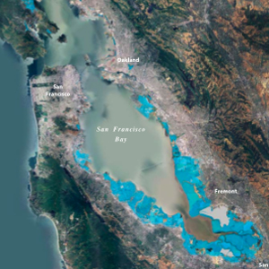
BCDC map showing 16 inches of sea level rise in the SF Bay, which the agency projects will occur by mid-century.
NASA says two-thirds of its facilities are at risk from sea-level rise, including Ames Research Center, which sits at the southern edge of San Francisco Bay. So, it’s not exactly altruism that motivated the agency to deploy its own scientists to take a closer look at what climate change will really mean on the ground in places where it’s heavily invested.Continue reading NASA’s Closer Look at the Bay Area→
A new iPhone app aims to make recording and sharing observations of the natural world fast, easy, and could eventually help bring climate models into better focus.
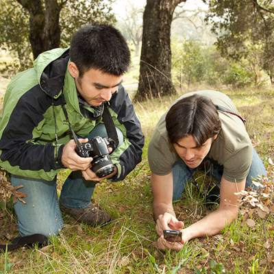
Ken-ichi Ueda and Scott Loarie demonstrating the new iNaturalist iPhone app at Stanford’s Jasper Ridge Biological Preserve (Photo: Richard Morgenstein)
At Jasper Ridge, a biological preserve and study area on the Stanford campus, a dozen of the preserve’s docents gathered this week to learn about a new iPhone application that could ultimately help scientists study how ecosystems are adapting to climate change.
The new app, called iNaturalist, is the mobile version of a citizen-science website by the same name. The iPhone app is still in testing and not yet available, but the website, iNaturalist.org, is already an active online community of citizen-scientists around the world who use the site to record and share their sightings. Continue reading Citizen Science: The iPhone App→
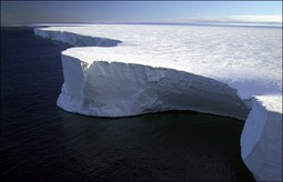
Occasional Climate Watch contributor Tom Banse reports today for Oregon Pubic Broadcasting about a just-released recording of a massive iceberg cracking, creaking, snapping, and groaning as it broke up in 2005 off the coast of Antarctica. The recording has been condensed, so that you can listen to the five-hour process in just two minutes.
According to Seeyle Martin, the University of Washington scientist who released the recording, the iceberg was 76 miles long and 17 miles wide — about the size of Puget Sound. It shattered when it hit an underwater shoal. Martin says the sound was recorded by seismic equipment 700 miles away at the South Pole.
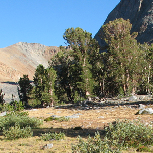
As the climate warms, plants and animals will need to move uphill to more hospitable climes, right? Some are — but it turns out that in other cases, the process seems to have shifted into reverse.
According to a new study published in the journal Science, some plants in Northern California are actually moving downhill in response to climate change. Aided by historical data, researchers from UC Davis and the University of Montana determined that between 1930 and 2000, many California species shifted downward an average of 260 feet.
The reason, according to UC Remote Sensing scientist Jonathan Greenberg, is increased precipitation, which, in some cases is overriding temperature as the main driver for species distribution.
“These wetter conditions are allowing plants to exist in warmer locations than they were previously capable of,” said Greenberg in a press release about the study.
Imagine 45 days of rain brought by a series of winter storms so strong and wet that they turned the Sacramento Valley into an inland sea, making the state capital virtually inaccessible.
Well, that happened in California in the winter of 1861-1862, and scientists say it will happen again, bringing massive flooding, landslides and property damage across the state.
To help emergency agencies plan for such an event, the US Geological Survey released the “ARkStorm Scenario” in Sacramento this week, detailing the repercussions of a storm that produces up to ten feet of rain and forces the evacuations of more than a million people.
“Vast floods would basically take out all the farm land,” said Marcia McNutt, director of the USGS. “They would destroy homes, animals would die, roads would be impassable, infrastructure would be rendered unusable, dikes would fail, levees, would fail.”
Scientists created this hypothetical storm by combining two actual storms, one from 1969 and one from 1986, and putting them back to back. Together, they rival the 1860’s storm in magnitude, which was the last time California saw a storm this size. Continue reading Planning for the Other “Big One”→
 Imagine 45 days of rain brought by a