Environment and Electrons Create Sparks in SoCal

Hear the companion radio feature about opposition to the Sunrise Powerlink at The California Report, starting Friday morning.

By Ruxandra Guidi

The road that takes you from the sleepy town of Boulevard into the path of the Sunrise Powerlink is a dusty, unmarked path that’s a couple of miles long. It ends at a gate without a sign, where a guard stands in the hot midday sun. He knows to keep any unauthorized visitors away; there’s a party going on inside, while the protesters make noise for hours outside.
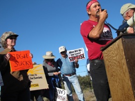
David Elliott speaks to protesters outside the Sunrise Powerlink headquarters in the town of Boulevard. (Photo: Ruxandra Guidi)

No one yet knows what the Sunrise Powerlink will end up looking like, and at what cost — and that’s just two of the main issues people have with it. Opponents of the giant network of powerlines, towers, and substations, say it will run for 120 miles, through delicate ecosystems and fire-prone areas. Its impact on local residents and wildlife will be irreparable.

On the other hand, SDG&E says its “superhighway” for transporting electrons from remote solar and wind farms to coastal population centers, will respect state and federal lands and go around delicate areas of the desert; that it will generate much-needed jobs while meeting state goals for green energy development. In the process, the California Imperial Valley is being touted as a so-called “mega-region;” a showcase for clean energy production. Continue reading Environment and Electrons Create Sparks in SoCal
Ask the Experts: 1 Million EVs by 2015?

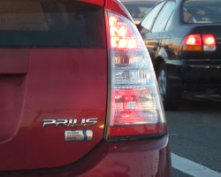
The US already has more than a million hybrid-electric vehicles on the road.  (Photo: Craig Miller)

Continuing an exercise I started in yesterday’s post, I’ve asked a few experts to weigh in on two national goals laid out by President Obama in this week’s State of the Union address. The experts seemed split on the viability of getting 80% of the nation’s electricity from “clean energy” by 2035. Today they address Obama’s call for one million electric vehicles “on the road” by 2015 (less than five years from now): Continue reading Ask the Experts: 1 Million EVs by 2015?

Ask the Experts: Obama Energy Goals Realistic?

During his State of the Union speech last evening, President Obama articulated two national goals that jumped out at me: 80% of electricity from “clean” energy by 2035 and one million electric vehicles “on the road” by 2015 (just five years from now).

Keeping in mind that California’s goal of 33% renewable energy by 2020 is considered extremely ambitious, I put the question to a few experts in the renewable energy/alternative fuels field: Are these goals realistic? I’ll post their responses here as they come in. I’ve had to condense some of the replies for space considerations. Let’s take the 80% clean energy challenge first: Continue reading Ask the Experts: Obama Energy Goals Realistic?

CA Doubled Pace of Renewables Last Year

California Regulators say the state’s utilities about doubled the growth of new renewable energy sources last year. The California Public Utilities Commission says developers added 653 megawatts of capacity in 2010, nearly twice the pace of 2009.

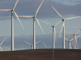
Recently erected wind turbines at the Solano County Wind Resource Area. (Photo: Craig Miller)

For all that, utilities did not quite make the state-imposed requirement that they get 20% of their electrical generation from renewables by last year. That requirement was affirmed by the legislature. In September of last year, former Governor Arnold Schwarzenegger moved the goalposts to 33% by 2020. But that mandate is backed by an executive order, not by state law. Continue reading CA Doubled Pace of Renewables Last Year

Creeping Along Toward New Fuel Standards

Photo: Craig Miller

This week, California and federal regulators gave themselves a fall deadline in their collaboration to create national fuel economy and greenhouse gas standards for model year 2017-2025 cars and light trucks.  The agencies say they will propose the new standards by September 1, 2011.

The September deadline is something of a setback for California, which had planned to release state standards in March.

Last October, the federal EPA and Department of Transportation announced plans to work with California Air Resources Board (CARB) to create the standards, under direction from the Obama Administration.   This builds on the agencies’ work setting the  new federal fuel standard, based on California’s, for model years 2012 through 2016.

According to a statement from CARB, a unified state/national standard will “provide manufacturers with with the regulatory certainty needed to invest today in the kind of new technologies that will provide consumers a full range of efficient clean vehicle choices.”

Tiffancy Hsu of the Los Angeles Times has more.

Death Rattle of an Iceberg

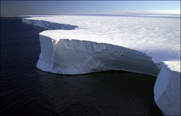
Iceberg B-15A was 76 miles long and 17 miles wide. (Phot0: Josh Landis, NSF)

I know it’s only January but my vote for the year’s Really Cool Sound Award: A  massive iceberg cracks up.

Occasional Climate Watch contributor Tom Banse reports today for Oregon Pubic Broadcasting about a just-released recording of a massive iceberg cracking, creaking, snapping, and groaning as it broke up in 2005 off the coast of Antarctica.  The recording has been condensed, so that you can listen to the five-hour process in just two minutes.

According to Seeyle Martin, the University of Washington scientist who released the recording, the iceberg was 76 miles long and 17 miles wide — about the size of Puget Sound. It shattered when it hit an underwater shoal.  Martin says the sound was recorded by seismic equipment 700 miles away at the South Pole.

Climate Warms, Trees Head Downhill?

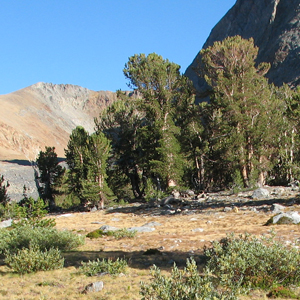
Near Tioga Pass, Yosemite (Photo: Gretchen Weber)

As the climate warms, plants and animals will need to move uphill to more hospitable climes, right?  Some are — but it turns out that in other cases, the process seems to have shifted into reverse.

According to a new study published in the journal Science, some plants in Northern California are actually moving downhill in response to climate change.   Aided by historical data, researchers from UC Davis and the University of Montana determined that between 1930 and 2000, many California species shifted downward an average of 260 feet.

The reason, according to UC Remote Sensing scientist Jonathan Greenberg, is increased precipitation, which, in some cases is overriding temperature as the main driver for species distribution.

“These wetter conditions are allowing plants to exist in warmer locations than they were previously capable of,” said Greenberg in a press release about the study.

NPR’s Richard Harris has more on the study and on what it could signal for California’s changing ecosystems.

Photos From the Future?

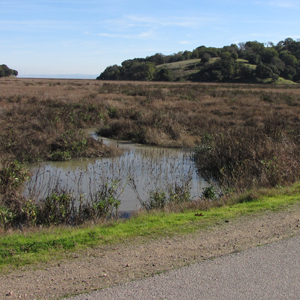
From my vantage point this morning at the edge of San Francisco Bay at China Camp State Park in San Rafael, today’s king tide wasn’t all that dramatic.  There was no flooded road, as I had been told there might be, and there was so little wind that the water level just silently crept higher, about a foot higher than usual, with zero fanfare.

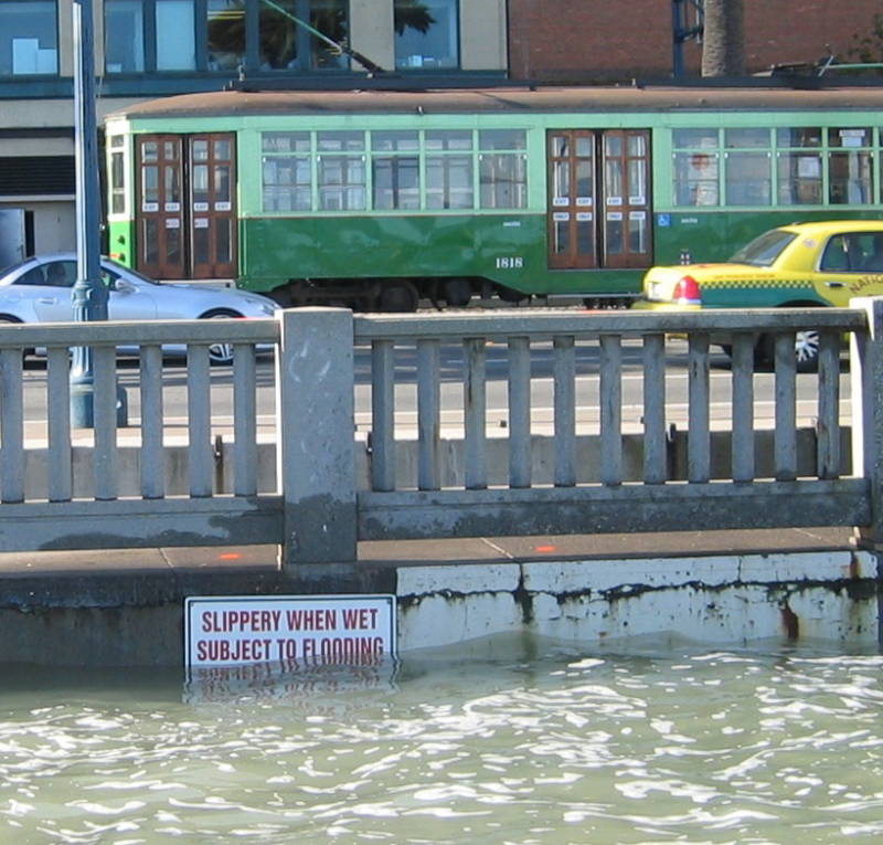
Wednesday’s King Tide along the Embarcadero in San Francisco (Photo: Noah Knowles)

But I snapped photos anyway, for the Bay Area King Tide Photo Initiative, a project aimed at documenting these extreme high tides in order to identify local areas vulnerable to sea level rise.

Reportedly, things at San Francisco’s Embarcadero, however, were a little more dramatic. USGS scientist Noah Knowles was there to take pictures of yesterday’s king tide.

“There was already water splashing over the sides [of the sea wall] yesterday,” he said.  “This was of course on a very calm day, and clearly there was no storm surge, which could have added another half-meter and had the water up on the streets.”

That’s the thing about sea level rise.  The San Francisco Bay Conservation and Development Commission (BCDC)  advises people to plan for 11-18 inches of sea level rise by mid-century.  That by itself might not cause huge amounts of damage on a normal day, just as today’s extra-high tide didn’t flood the road in China Camp State Park.  What it will do, however, is raise the baseline for what a high tide is, making storm surges more apt to cause destructive flooding.

Just before the “King Tide” at China Camp State Park in San Rafael, CA (Photo: Gretchen Weber)

Knowles said that it’s important to raise awareness about what the potential effects of sea level rise could mean for the Bay Area.

“I think it doesn’t always hit home how low-lying so many area around the Bay already are,” said Knowles.

For photos of the king tides around the Bay Area, visit the Bay Area King Tide Photo Initiative on Flickr, or wait for the next one on February 18th and snap your own.

King Tides Could Preview Sea Level Rise

Photo: jsutton8, Flickr

This week, seasonal high tides, known as “King Tides” will roll into the Bay Area, providing a preview of what the region might face if sea level rises over the coming decades as predicted.

So the organizers of the Bay Area King Tide Photo Initiative want you to grab your camera and help document the tides.  The San Francisco Bay National Estuarine Research Reserve (NERR) has set up a Flickr site for the photos, where participants can upload their “before, during, and after” shots. Continue reading King Tides Could Preview Sea Level Rise

Planning for the Other “Big One”

Imagine 45 days of rain brought by a series of winter storms so strong and wet that they turned the Sacramento Valley into an inland sea, making the state capital virtually inaccessible.

Well, that happened in California in the winter of 1861-1862, and scientists say it will happen again, bringing massive flooding, landslides and property damage across the state.

To help emergency agencies plan for such an event, the US Geological Survey released the “ARkStorm Scenario” in Sacramento this week, detailing the repercussions of a storm that produces up to ten feet of rain and forces the evacuations of more than a million people.

“Vast floods would basically take out all the farm land,” said Marcia McNutt, director of the USGS. “They would destroy homes, animals would die, roads would be impassable, infrastructure would be rendered unusable, dikes would fail, levees, would fail.”

Scientists created this hypothetical storm by combining two actual storms, one from 1969 and one from 1986, and putting them back to back.  Together, they rival the 1860’s storm in magnitude, which was the last time California saw a storm this size.
Continue reading Planning for the Other “Big One”