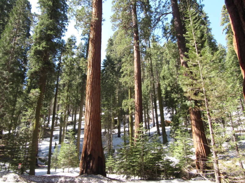
For decades the federal government has touted the nearly 200 million acres of national forests and grasslands under its control as a “land of many uses.” But one “use” that’s seldom discussed is as a huge repository for carbon.
But clearly it’s on the minds of officials and scientists as the Forest Service seeks comments on its proposed new planning rule. National Forests and Grasslands are managed individually, but the planning rule guides how those management plans are developed. This new one is replacing a Planning Rule from 1982.
According to the Forest Service press release, some of the highlights in this new Planning Rule include
- Improved ability to respond to climate change and other stressors through provisions to restore and maintain healthy and resilient ecosystems
- Increased protections for water resources and watersheds
- More effective and proactive requirements to provide for diverse native plant and animal species
The Forest Service manages just under half of the forest land in California. Below is a handy map from their website (If you want to see all the federal land in California — not just National Forest — nationalatlas.gov offers this PDF map).
In celebration of the UN’s “International Year of Forests,” I recently went down the rabbit hole of trying to understand how much carbon California’s forests hold. Figuring that out is, according to Forest Service research forester Jeremy Fried, “An accounting problem. And like any accounting problem, you need to have accurate data.”
That’s been a challenge. Fried works on the Forest Inventory and Analysis Program (FIA), which is the Forest Service’s annual census of the nation’s trees. Unlike the census of the nation’s people, the goal isn’t to count every individual, but to count and measure plots of trees all over the country. But the sizes and locations of those plots have changed over the years, and that makes for unreliable data.
In fact, last year was the first time that Fried and other researchers were able to go back and re-measure the same plots. What he found was that on the 15 million acres of forested lands that the Forest Service manage in California, trees sequester somewhere on the order of 1.8 teragrams of carbon a year (almost two million metric tons).
Going forward, Fried says, as long as the funding holds up, the FIA will continue measuring the same plots, and not just in National Forests, but plots in all kinds of public and private forests.
One last note. Fried explained that carbon generally makes up half of the biomass of a tree. To calculate the biomass of a tree, researchers measure its width and height. But a tree isn’t a box, so you have to add in the branches, maybe you measure the stump separately, and what about the bark versus the stem? The list goes on. Just to give me a sense of how complicated this is, he gave me this number: 102,905. That’s how many ways there are of calculating the carbon content of a Douglas Fir. 102,905.
2 thoughts on “California’s Giant Carbon Sponge”
Comments are closed.

The California Air Resources Board came up with (or at least uses) another term for forests: “standing live carbon.” It sounds just slightly more poetic than “paved horizontal petrocarbons” — my pet name for parking lots.
As the Earth continues to warm the threat to these forests grows.By 2150 co2 content may stabilize at 1000 ppm.Current levels are approaching 400 ppm, and, for the past 800,000 years levels were steady at 200 ppm.The rise of the Anthropocene Era (Epoch) has occurred.There is a real , quite dangerous possibility that the methal hydrates (frozen methane deposits) in the shallow waters off the Arctic may, along with huge amounts of Arctic tundra and permafrost, melt and release gigatons of methane and co2 into the air.See the work of Peter Ward and James Hansen).These releases would come in addition to all the human caused emissions, and precipitate a tipping point, or feedback loop, whereby the rest of the Arctic would melt.With the loss of the albeido effect (the reflection of sunlight back into space from hitting the white snow) and the increase in open ocean (black color absorbs sunlight) there would be an addition of two more dangerous feedback loops.I’ve read everything written on climate change in the press since 1987, and most all of the scientific studies. It now seems that my beloved forests of Marin County (Muir Woods and Mt. Tamalpais) here in California are at severe risk due to a lack of coastal fog and a rise in temperature.Also, the pine bark beetle loves the higher temperatures, and has been killing millions of trees in the US.I could go on for another 25, 000 paragraphs, but, you get the idea…
Mark J. Fiore, Harvard University, Boston College Law School