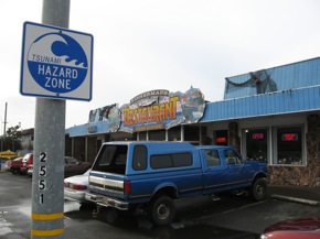
Crescent City has the drill down

Of course, after facing down 34 tsunami events in the past 100 years, I suppose they should have it down. When I was there to cover the aftermath of the March 11 event that pretty much took out the working harbor, it was clear that the possibility of a seismically-triggered surge is never far from the public consciousness in Del Norte County.
“It’s here with us from the names of buildings to the names of the businesses,” Cindy Henderson told me. “Tsunami is our world. So yeah, it is a very big threat,” said Henderson, who heads emergency services for the county. “We do have others we have to prepare for but in the backs of our minds, we are always thinking about tsunamis — every time there’s a big earthquake.”
Which isn’t to say that the northwest corner of California has a lock on tsunami preparedness. Crescent City is one of 17 California communities that has earned the “Tsunami-Ready” designation by NOAA. You can check this map to see if your town is one of them.
The California Dept. of Conservation has inundation maps for every coastal county and NOAA has a project to develop inundation models for all US coastal areas, to better predict the impact of tsunamis.
My companion radio feature for The California Report (Friday morning, 3/25) profiles some ways in which Crescent City has prepared.
