
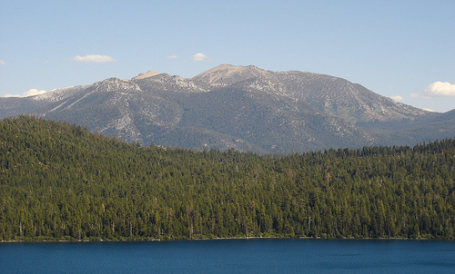
Scientists stumbled on Fallen Leaf Lake and the ancient trees under its surface

Graham Kent wasn’t researching megadroughts when he and a team of scientists began studying Fallen Leaf Lake, just south of Lake Tahoe. They were mapping faults. The little lake is a good place to study West Tahoe Fault, which cuts right through it.
“Little did we know it was a natural lab for droughts, as well,” Kent, director of the Nevada Seismological Lab at University of Nevada, Reno, told me over the phone. “So what started out as a seismic hazard endeavor became both a seismic hazard and climate study.”
There was a handful of trees standing upright on the bottom of the 400-foot-deep lake. Kent and his team from UNR and Scripps Institution of Oceanography decided to look at them a little more closely. “We used a whole bunch of different techniques including side scan sonar, which people are mostly familiar with when people are looking for treasure and sunken ships on the seashore like the Titanic,” Kent said. “We ultimately went down there in a submersible to actually look at these trees.”
They wanted to confirm that the trees had really grown where they were standing, at the bottom of the lake, rather than grown somewhere else, and slid down at some point.
Kent’s team discovered that the trees had grown where the shoreline of Fallen Leaf Lake once was. Clumps of trees of different ages — going back more than a thousand years — showed where the shoreline had been and how it had changed.
“That poor lake changed its level 120, 140 feet, while Tahoe changed maybe ten,” Kent said. The difference is in the geology of the lakes. Fallen Leaf Lake is much more sensitive to changes in precipitation than Tahoe is. “Fallen Leaf Lake probably has the best recorded history of the Medieval Warm Period in all of the Sierra.”
By studying the trees and the ancient shorelines they grew along, Kent learned more specific details than had been previously known about the megadrought that hit California between the 10th and 13th centuries. It lasted for 200 years and during that time, precipitation was 60% of what we now consider “normal.”
[module align=”left” width=”half” type=”pull-quote”]”A lot of California…is probably in a relatively wetter climate than has happened in the past.[/module]
“A lot of California, the way that it’s industrialized and grown, is probably in a relatively wetter climate than has happened in the past,” Kent told me. “It [was] kind of like the Dust Bowl era. But again, it’s sustained not over half a decade or a decade. It’s sustained over two centuries.”
And it wasn’t a one-time occurrence. While the two-hundred year-long drought during Medieval times is the best-documented because it’s the most recent, it’s not the only megadrought the ancient trees at the bottom of the lake reveal. “This wasn’t just a one-trick pony where we have relatively normal climate and then the Medieval Dry. We have these kinds of ups and downs throughout the Holocene.”
A host of causes go into climate patterns: tectonic plates can cause changes on the scale of tens of thousands of years, there are the cycles that caused the ice ages, solar variability, different currents in the oceans. So it’s difficult to figure out how human-caused climate change will affect — or be affected by — the possibility of a future megadrought. “You can’t put it on the back of an envelope, you probably have to put it in a big book, it’s so complicated,” Kent said. “But as we look into the future it helps to know what the past was.”
Nice reminder that California’s climate is not necessarily long-term stable. Dr. Scott Stine of CSU East Bay found this same drought in tree stumps at Mono Lake, Walker River, and other locations along the Sierra.
the past can really show us the way