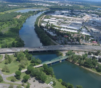
A new project to visually map American waterways will start with California’s Sacramento

By the end of the summer, you may be able to float down the Sacramento River from your computer, thanks to the Riverview Project. It’s an initiative to document and map rivers, using similar tools to the ones Google used to create Street View, and with similar results: the ability to drop into a place on a map, click to move down the street (or float down the river), and take a look around.
“There’s reams of data (about rivers),” Jared Criscuolo, one of the founders of the Riverview Project told me. “But the thing we’ve noticed we’re missing is a visual piece.”
He aims to change that by documenting 27 American rivers from headwaters to mouth, over the next five or six years. First on the bucket list is the Sacramento, where Criscuolo plans to start shooting this summer. The website will begin growing after that and include a crowd-sourcing element: a companion project called Streamview, also launching this summer, will offer a smartphone app you can use to upload images of any river or stream.
Criscuolo is collaborating with the U.S. Geological Survey on the project. Beyond being a good workplace distraction for those who’d rather be fishing or paddling, he says it has the potential to aid our understanding of changing river ecosystems.

“Things are changing,” he says. “Humans have an impact. We can show land eroding. Over time, we can see how vegetation changes.”
Criscuolo says he wants to create a visual record of how rivers look and are used now. And if he can get the funding, he’ll go back and do it again, to keep up with how they change.
The New York Times‘ Green blog also profiled the project this week.

