Ambitious mapping & data effort accompanies KQED multimedia series

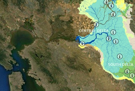
If, like most Californians, you’re a bit fuzzy on why the Sacramento-San Joaquin Delta matters to you, take a tour through the impressive new online resource from KQED’s science unit, the San Francisco Estuary Institute, and Stanford’s Bill Lane Center for the American West.
“California’s Deadlocked Delta” is more than a data trove for water geeks, it’s a visually pleasing deep dive into the single most important piece of California’s persistent water puzzle. It provides some eye-opening glimpses of how this critical intersection for the state’s freshwater supply has changed over generations.
The work is an outgrowth of reporter Lauren Sommer’s three-part series on the Delta for KQED’s QUEST science & environmental reporting unit. Sommer says it took weeks of collaboration with Institute scientists and the Lane Center’s data-viz wiz Geoff McGhee, who designed and built the visual layout, while Sommer pored over a 400-page Institute report, mining it for nuggets.
The mapping effort steers well clear of the current political swamp surrounding the Delta. Sommer says one goal was to create, “a new way for people to understand and explore the Delta,” a way that a traditional text or radio story could not provide.” Another was to convey some of the complexity of this ecosystem that’s been lost. “It’s hard to know how to fix something unless you know what you’ve lost,” she told me.

