Federal grant enables major new network of Sierra water sensors

Researchers at UC Merced are set to open a whole new window on the Sierra Nevada. Using two million dollars from the National Science Foundation, hydrologist Roger Bales and his colleagues can now expand on a pilot project to measure the mountains’ “vital signs.”
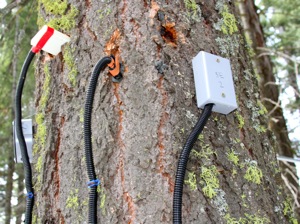
Bales says beginning next summer, he, UC Berkeley’s Steven Glaser and their team will start installing a network of 20-to-30 instrument clusters throughout the American River watershed, casting a watchful eye over about 2,000 square kilometers that typically gets snow cover. The instruments record factors that affect the mountain’s hydrology, such as temperature, humidity, soil moisture, stream flow and even how much solar radiation penetrates the tree canopy.
Bales says the pilot phase has taught them how to put together a network of wireless sensors that will endure the extreme alpine conditions and still remain reliable (see Sasha Khokha’s post and slide show from March).
But the work has also produced some meaty data. Bales says the pilot network has already revealed that evapotranspiration (water lost to the atmosphere through evaporation and plants) in the Sierra’s mixed conifer forests is about 20-to-30% larger than previously thought. More evapotranspiration means less runoff for farms, cities and hydropower.
“If we extend the growing season by having a warmer climate, there’s the potential for even more evapotranspiration,” Bales told me. Knowing how to better predict such aspects of the “water balance” should yield better forecasts for how much water we can expect to squeeze out of California’s “frozen reservoir” each summer.
“Part of it is not knowing the physical system out there,” Bales told me in an interview. “My position is that you can’t model your way out of these uncertainties. You need data.”
Bales’ goal is to build more than a “research platform,” but a system that will provide water managers and others with usable real-time information, accessible over the Internet. He’s already teaming up with Sacramento’s municipal utility (SMUD) and the state Department of Water Resources on some of the field installations, and says he’s hopeful that NASA’s Jet Propulsion Lab in Pasadena will provide an additional layer of satellite data to track snow cover.
