Opening California’s “spillway” is not the sort of thing that brings out CNN
This week officials made the uncomfortable decision to place thousands of homes and businesses in harm’s way, in order to avoid an even bigger catastrophe on the lower Mississippi River.
But as the opening of the Morganza Spillway was the subject of national media attention, California’s version had already been deployed a month earlier — and hardly anyone noticed.
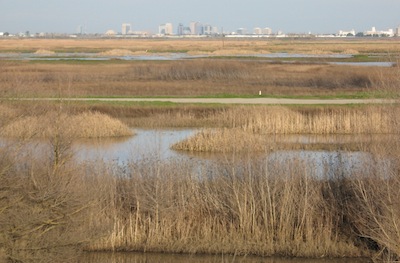
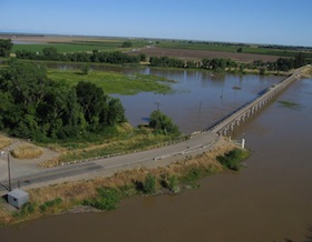
The Yolo Bypass may be California’s most ingenious contrivance for flood protection and yet, many people drive over it every day without knowing its purpose.

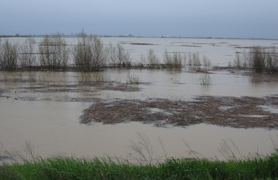
The bypass is a 59,000-acre funnel designed to catch the overflow of the Sacramento River and divert it harmlessly downstream, dumping it back into the main channel near Rio Vista. Generally speaking, it works like a charm. And it does so without fanfare because there are nobody lives there. That’s the idea.

“It is genius,” says Jeff Mount, who heads the Center for Watershed Science at UC Davis. “People come from all over the world to look at it because it the classic example of providing multiple benefits while managing floods.”

Part of a system of weirs and bypasses that starts farther up the Sacramento Valley, the Yolo Bypass doubles as a wildlife refuge, providing wetlands habitat, and when it’s not flooded — which is most of the time — farmers grow rice there. Mount says the huge volumes of water creeping through the bypass also help recharge groundwater stores beneath the surface.
Part of the system is self-regulating. When the Sacramento River tops 33 feet at a point north of Davis, it flows over a fixed barrier known as the Fremont Weir, and into the bypass (captured in this video, posted in 2010). In more extreme situations, state water officials can open the Sacramento Weir, a series of manual gates that provides additional relief.
“It really is extraordinary,” Mount told me. “Sacramento would be wiped off the map by a vanilla (i.e. modest) flood, if it weren’t for the Yolo Bypass.” Mount has been a vocal critic of what he calls “serial engineering,” ongoing efforts to contain rivers to accommodate urban development. But setting aside buffers of land where rivers can flood naturally requires putting large swaths of valuable real estate off limits to development.
The idea is anything but new, first proposed by a 19th-century newspaper editor in the Sacramento Valley. But the idea took about 50 years to become reality. The Sacramento Weir was completed in 1916. To this day, when conditions warrant, crews from the state Department of Water Resources have to manually lift the cantankerous “timber-and-needle”gates, one at a time.
But the whole notion of the bypass has stood the test of time. “It is a miracle,” says Mount. “It’s the most happy accident you can come up with in this whole system (in which) somebody chose a dumb place to build the capital, at the confluence of these two rivers that get up and roar.”
But given the seemingly irresistible tendency to develop riverfront property, it’s a happy accident that’s not likely to be repeated.
