
Tonight, on KQED Public Television, Quest: California at the Tipping Point explores some of the ways in which climate change will likely affect our state, including an increased risk of wildfire.
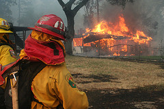
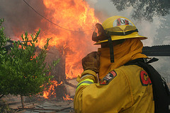
Last year, California’s fire season got off to an early and catastrophic start–and this year, generous spring rains could not cover the shortfall from two previous years of scarce precipitation. The late rains might forestall fire conditions for a while but more fires are inevitable.
Last June, more than 1,000 wildfires started in one weekend. Throughout the course of the season, thousands more fires burned and hundreds of homes were damaged. But if you’re among those who live in the “urban-wildland interface,” there are steps you can take to lower your home’s vulnerability to wildfire.
In the video clip below, a CalFire official tells Vicki Liviakis, who lost her home in the 1991 Oakland Hills firestorm, how vegetation around the house can feed a wildfire, and explains how Californians can create landscapes that reduce fire risk. (You can watch the full 28-minute video, co-hosted by Liviakis and Climate Watch Sr. Editor Craig Miller, on YouTube.)
CalFire maintains this map, which tracks current fire incidents in California. You can check this throughout the fire season for an overview of the state’s burns.
On tonight’s Quest program, Climate Watch Sr. Editor Craig Miller talks with CalFire’s Chief Deputy Director Crawford Tuttle about the increasing fire risk California faces due to rising temperatures and changing precipitation patterns.
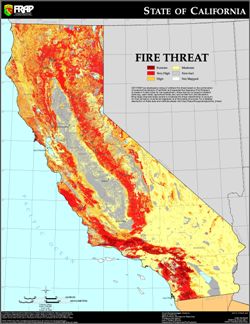
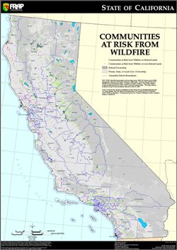
Below are the latest maps from CalFire depicting California’s regions and communities most at risk.


