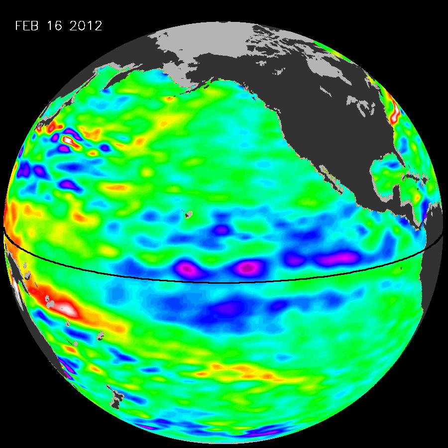
La Niña is weakening, but don’t hold your breath for a “March miracle”

This has been a historically dry winter, dry enough that it’s likely to land a spot as one of the top ten driest since the Gold Rush. And even though La Niña is waning, that probably won’t make much of a difference, because there’s a delay between when ocean surface temperatures change, and when that change actually has an effect on our weather.
“March 20 is just around the corner, and that’s the first day of spring. Our winter — our snowpack and our rain — is essentially over,” NASA Jet Propulsion Laboratory climatologist Bill Patzert told me. Though Patzert’s observation comes as three Pacific storms are poised to potentially bring a week of rain to Northern California, he said, “a weakening La Niña won’t necessarily give us a March miracle in terms of snowpack and rainfall.”
La Niña is caused by colder-than-average ocean surface temperatures in the equatorial Pacific. It typically makes for warm, dry winters in California. But not always. Last year was also affected by La Niña, and it was historically wet.
“I find that as a great teaching moment,” adds Jan Null, from Golden Gate Weather Services. “We look at 20 La Niña years since 1950, and you come up with the average conditions. Well, those averages are made up of a wide range and we’ve seen both ends of that range in the past two years.”
Or, as Jim Mathews, lead forecaster at the National Weather Service Forecast Office in Sacramento put it with a laugh, “Normal here in California is the average of two extremes. It seems to be wet and dry and then we take an average and call that normal.”
3 thoughts on “La Niña on its Way Out, but so Is Winter”
Comments are closed.

Learn to be pleased with everything; with wealth,
so far as it makes us beneficial to others; with poverty, for not having
much to care for; and with obscurity, for being unenvied.
Dear Ms. Samuel: Please replace “affect” with “effect” in the first paragraph.
Done. Thank you!