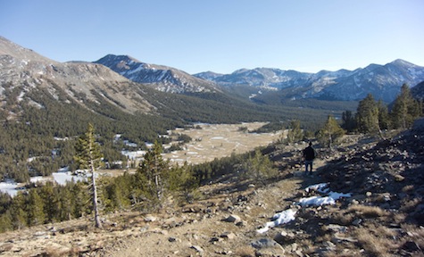
Authorities finally closed California’s highest mountain pass this week. Right before they did, Climate Watch contributor Dan Brekke got to see what few of us glimpse this time of year.

It first captivated me back when I was an adolescent map reader back in the Midwest. I was poring over maps of California for a trip that didn’t happen—then—and took note of the roads across the Sierra Nevada. And the highest of all the mountain routes I could see crossed Tioga Pass, at an altitude that rounds to 10,000 feet. Nearly two miles above sea level.
Eventually I took that trip to California, but it was still a long time before I actually saw the place the map depicted. A good 15 years or so after I moved out here, I managed to scramble up there on a long weekend and spent a single afternoon driving Highway 120, the Tioga Road.
The stark beauty of the Sierra always manages to surprise me, but there’s an extra degree of immediacy to the grandeur along the road to the pass. After rising through a stretch densely lined with conifers, you emerge into a world of granite domes and alpine meadows. It almost seems wrong to be driving through this landscape instead of walking through it (although there’s plenty of opportunity to do that on dozens of trails, if you give yourself time). Approaching from the west, the pass itself is a little anticlimactic. You note the country is getting a little drier, you pass the Tioga Pass entrance sign with the announcement of the spot’s elevation—9,943 feet above sea level—and then you begin a nonstop plummet toward the town of Lee Vining and Mono Lake.
[module align=”left” width=”half” type=”pull-quote”]”…a sense of having been allowed to see a stretch of road that’s a little bit of a secret.”[/module]
The feeling I came away with, and that I’ve experienced every time I’ve been across the road, is a sense of having been allowed to see a stretch of road that’s a little bit of a secret – it’s much less traveled than most routes into and out of Yosemite – and, without having had to work very hard for it, have been given access to one of California’s greatest treasures.
All of which goes to explain that when high country fanatics began writing about how the road was open in December because of this season’s dry weather, I got the urge to go up there and see what the winter scene looked like. And at the first excuse, I headed up to the pass.
That feeling of being allowed to enter a special world was stronger than ever. I hadn’t planned on doing a radio piece about the trip, but I had brought my little sound kit, which fits into a fanny pack, just in case. When I climbed out of the car at Tenaya Lake, elevation 8,150 feet, I slowly realized that the weird moaning-whale song sound I was hearing was the lake’s thick ice expanding in the sunlight. I just had to record that. And then maybe talk to some people.
Virtually everyone I talked to on the lake and later, on a trail above Tioga Pass, shared the opinion that this was a once-in-a-lifetime opportunity, to be able to drive into the middle of the high country. They talked about the special quality of the winter light on the landscape, the opportunity to change their usual winter routines of snow shoveling and skiing, and the simple amazement they felt in being able to walk and skate and picnic nearly two miles above sea level—in the middle of January.

But people also talked about the disturbing part of what they were seeing. Long-time Californians seem to develop an ingrained understanding of the state’s hydrological equations and how important the Sierra Nevada winter snowpack is to maintaining a healthy environment, not to mention delivering water to farms and cities. And looking around, people expressed some worry about the beautiful but mostly snow-free country around them. (A data point here: The daily snow survey summary from the state Department of Water Resources show that the statewide average for snow-water equivalent in the mountains is just 10% of normal. It will be most interesting to see how that changes as the current series of winter storms blows through).
And people have longer term concerns about what they’ve seen along the Tioga Road this season. The person who put it best is someone I did not talk to on my trans-Sierra excursion. Beth Pratt, a California outdoors and environment blogger, made a series of trips across Highway 120 during our weird winter idyll. Her enthusiasm and wonder for the spectacle she’s seen are infectious. But it’s also tempered by thoughts of the future:
“Bottom line: for a Yosemite and Sierra aficionado like me, having access this late is akin to winning the lottery. Of course when I have no drinking water next summer, I might feel differently. The lack of snow is alarming and the landscape is more reminiscent of spring than winter. Although it’s difficult to associate any one weather event or season to climate change, welcome to the Sierra Nevada of the future. I have seen predictions under the best case warming scenarios of an 80% reduction in snowpack. The Sierra can often deliver a wallop of a storm anytime of year, and I have no doubt we’ll recover at least some of the snow–this year at least. But this may be a warning from the ghost of the Sierra future.”
“Ghost of Sierra future?” Those words will stick with me. But for today, I’m glad to know that the snow’s flying again across the Tioga Road.
