upper waypoint

3.6 East Bay Quake Felt Throughout Region

Save ArticleSave Article
Failed to save article

Please try again

If you think you felt an earthquake at 7:05 p.m. in the Bay Area, you did. The U.S. Geological Survey reports that it was magnitude 3.6 tremor with an epicenter just outside the northwest Contra Costa County town of Hercules.

Note: The 3.6 shake was 65 minutes past the time, and much less Rapture-causing, than the earthquake predicted for this evening by radio evangelist Harold Camping.

Links
U.S. Geological Survey: Magnitude 3.6, San Francisco Bay Area, California
U.S. Geological Survey: 'Did You Feel It?' event page
KQED News Fix: At Harold Camping's Family Radio, It's Business as Usual on Air
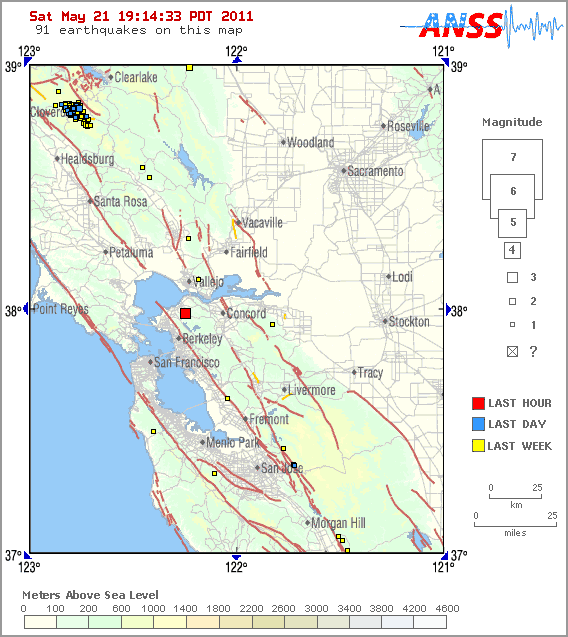
U.S. Geological Survey locator map of May 21, 2011, earthquake epicenter.

Sponsored

lower waypoint
next waypoint
Alameda County District Attorney Challenges Recall Signature CountCalifornia Homeowners Say Oakland Lender Scammed Them Out of $3M in Home ImprovementsSFSU Pro-Palestinian Encampment Established as Students Rally for DivestmentBillionaire-Backed Bid for New Solano County City Is Closer to November BallotWhat’s Next for Pro-Palestinian Campus ProtestsInside Mexico's Clandestine Drug Treatment CentersThe Politics and Policy Around Newsom’s Vatican Climate Summit TripCalifornia’s 2023 Snow Deluge Was a Freak Event, Study SaysFAFSA 2024: The May 2 Deadline for California Students is Almost HereCity Lights Chief Book Buyer Paul Yamazaki on a Half Century Spent “Reading the Room”