A new online tool launched this week aims to enlist citizens to help catalog San Francisco’s trees. The Urban Forest Map relies on the public, or “citizen scientists,” to observe their yards and neighborhoods and to add information to an online database that tracks tree location, species, size, and health, throughout San Francisco.
The project’s creator, Amber Bieg, said that 17 different organizations and agencies in the city manage and track trees, but until now, they had no organized way to share information. “This map provides the ability to aggregate data in a new way,” said Bieg. “And it’s an affordable way to do an inventory because it uses citizen participation.”
Bieg developed the program with funding from the California Department of Forestry and Fire Prevention (CAL FIRE). Created in cooperation with Friends of the Urban Forest and the City and County of San Francisco, the Urban Forest Map is designed to serve as a publicly accessible, centralized database that will help urban foresters and city planners better manage trees in specific areas, track and combat tree pests and diseases, and plan future tree plantings.
Creators also hope that climatologists will use to the tool to better understand the effects of urban forests on climate, and that students will get involved and use the map to learn about the role trees play in the urban ecosystem. “If you can’t count it, you can’t manage it,” said CAL FIRE urban forester John Melvin. “If the state is going to adapt to climate change, we’re going to have to expand and better manage our urban forests, and that starts with knowing what we have.”
Urban trees can help cities adapt to climate change by providing shade cover and by both mitigating and purifying storm water runoff, Melvin said. Studies have shown that a robust tree canopy can reduce the “urban heat island” effect by several degrees.
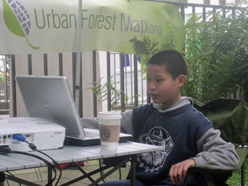
To underscore how easy the tool is to use, on Wednesday morning San Francisco 5th-grader Benton Liang demonstrated how to use to the software for a small crowd gathered in a small park at the foot of the Transamerica Building. In addition to providing an inventory, Bieg said, the map is also an educational tool. The Urban Tree Key is a related interactive tool that helps citizen scientists identify common Northern California urban trees. The map’s software also allows users to calculate the benefits, such as energy savings and air quality, that a specific tree or category of trees provide using data from the Center for Urban Forests Research, said Bieg.
To learn more about the Urban Forest Map, watch a video from 2007 that KQED’s Quest made about the project.
