The climate pattern usually causes wetter weather in California

If you thought the first six months of the year were chock full of weird weather events, just wait — according to climate scientists there is an increasing likelihood that El Niño conditions will soon develop in the tropical Pacific Ocean. El Niño events, which are characterized by an area of unusually warm sea surface temperatures in the tropical Pacific Ocean, can have a huge influence on global weather patterns. Its effects on the U.S. tend to peak during the winter.
The U.S. has already had a record warm January-to-June period, and has already had two extremely rare heat waves this year, one in March and the other in mid-June to early July. Entering mid-summer, drought conditions are covering 56 percent of the lower 48 states, a record drought extent in the 21st century.
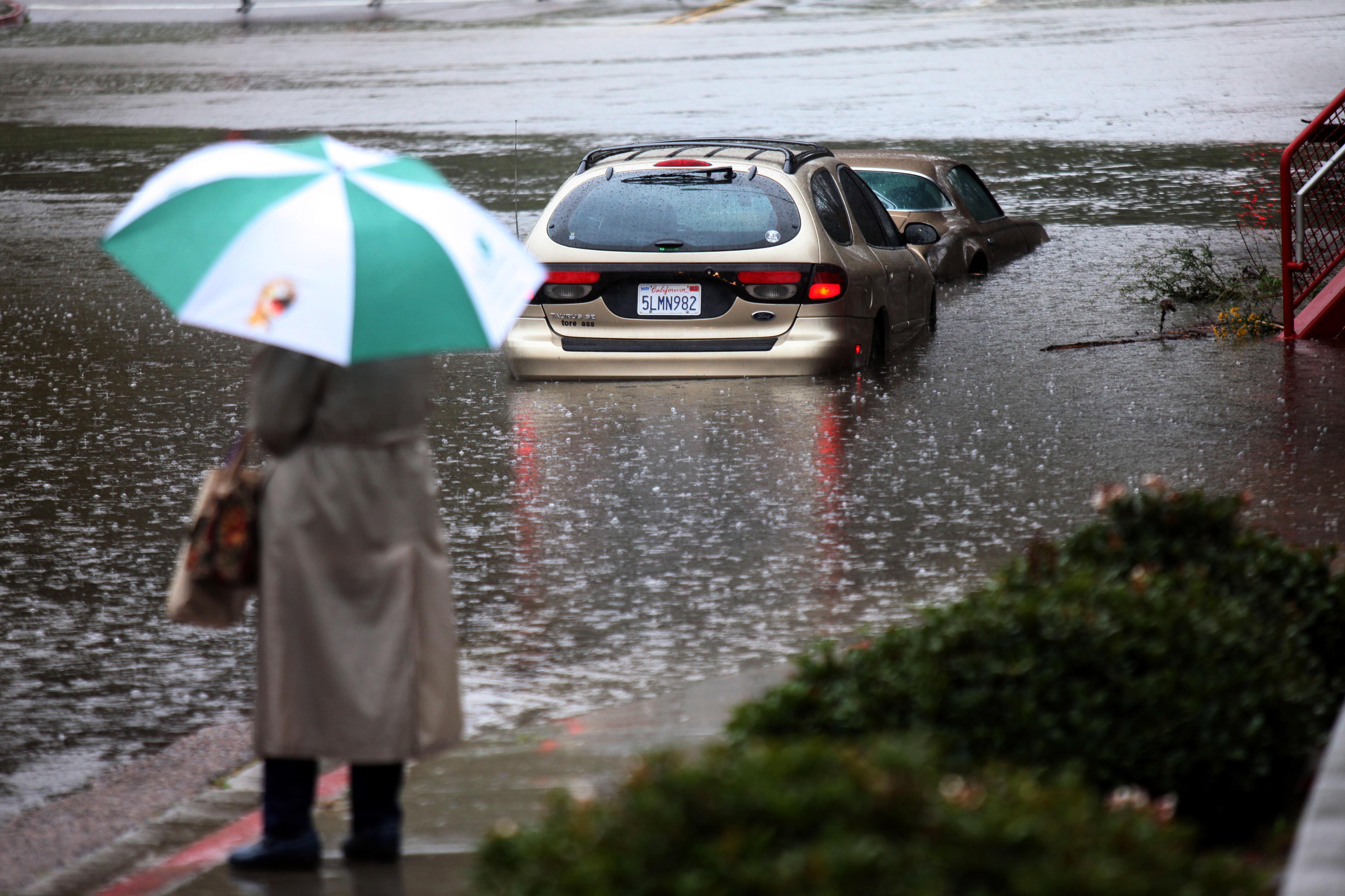
Depending where you’re located, the prospect of a new El Niño event may be good news. The drought-parched Texas Panhandle, for example, tends to be wetter during El Niño years. It could also be decidedly unwelcome news — just ask residents of California who dealt with El Niño-related flooding in 2010.
El Niño is a natural source of climate variability, and typically occurs every three to seven years. The question of whether manmade global warming will influence El Niño cycles is an area of active research. One recent study does suggest, though, that global warming could intensify the effects of an El Niño episode, even if it doesn’t influence its occurrence.

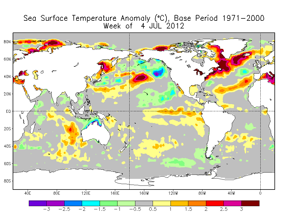
Citing factors such as warming ocean temperatures in the tropical Pacific, the Climate Prediction Center, which is part of the U.S. National Oceanic and Atmospheric Administration (NOAA), said on July 5 that there is a better than 50 percent chance that El Niño conditions will develop sometime between July and September.
Because of El Niño’s effects on seasonal climate conditions, farmers and ranchers, ski area operators, water planners, hurricane forecasters, and many more closely monitor such El Niño forecasts.
Tony Barnston, chief forecaster for the International Research Institute for Climate and Society, which works with the Climate Prediction Center, said an El Niño event could help relieve the ongoing drought conditions in some areas, but potentially worsen the drought for others.
“The southern tier of U.S. states tends to have above-normal precipitation during winter when there is an El Niño. So this would be helpful for the droughts currently lingering in Texas/New Mexico, and Georgia/Alabama,” he said in an email conversation. “It would not help the ones in Kentucky/Indiana though, and could cause a new one in the northern Rockies.”
El Niño events can also help boost global average surface temperatures. A strong El Niño event led to the record warm year of 1998, and some climate scientists, including NASA’s James Hansen, have pointed out that a new El Niño event would likely lead to another record warm year given the combination of El Niño and manmade global warming.

A strong, two-year La Niña event, which was characterized by cooler-than-average sea surface temperatures in the tropical Pacific, dissipated in April of this year, and it held down global average temperatures somewhat.
This El Niño event, if it does occur, is more likely to be on the weak-to-moderate end of the spectrum, according to Barnston.
One of the key indicators that El Niño conditions are developing is a growing area of warmer-than-average equatorial Pacific sea surface temperatures, and an increase in the oceanic heat content as well. “The observations . . . reflect a likely progression towards El Niño,” the Climate Prediction Center said.
Forecasters use computer models to help anticipate El Niño and La Niña events. Right now, most of the simulations of air and sea conditions show a developing El Niño.
According to Barnston, who is a veteran researcher and forecaster of El Niño events, there are many unknowns that forecasters are currently facing. “We don’t know, first, whether there will be an El Niño or not. Currently we think there is about a 60-70 percent chance for one, and a 30-40 percent [chance] of not having one,” he said. “If we do get one, we don’t know how strong it would be. We doubt it will be a giant one like 1997-98 because those usually develop by May or even earlier. But it could be moderate or weak. Most of us think it is likely to be in either of those two categories, and think that it would last from about August through January.”
The development of an El Niño or La Niña event depends on feedbacks between the ocean and atmosphere, and Barnston said that currently the prevailing weather pattern in the tropical Pacific is not particularly conducive to El Niño formation, despite the warming sea surface temperatures, but this could change. “We’re in a transition stage,” he said.
“The development of El Niño depends greatly on what happens in the coming two months. If we do not get at least some development by the end of August, then the chances of getting development later become much lower.”
A version of this post also appears at Climate Central, Climate Watch’s content partner.
