upper waypoint

Bay Area Rain on Tap Through Much of Next Week

Save ArticleSave Article
Failed to save article

Please try again

A person with a green umbrella crosses a rain-soaked street.
A storm moves through San Francisco in the afternoon of March 14, 2023, bringing high wind and rain. (Beth LaBerge/KQED)

Updated 2:15 p.m. Sunday

The National Weather Service said two low-pressure systems are expected to bring one to five inches of light to moderate rainfall to the Bay Area between Sunday and Thursday. The main rain band will move inland early Monday, bringing moderate rain with gusty southwest winds.

“Our rainfall rates aren’t looking strong enough for us to be worried about widespread flooding,” said Brayden Murdock, a meteorologist with the weather service.

Murdock said the North Bay and Big Sur are expected to get the most rain. The Bay Area will start to dry up after Thursday as the storm moves south toward Los Angeles and San Diego.

Sponsored

Updated 12:40 p.m. Friday

The National Weather Service said a low-pressure system moving over the East Pacific could bring rainfall across the Bay Area starting Sunday — followed by snow in Tahoe next week.

The weather service’s latest forecast issued Friday morning indicated a 20% to 30% chance of thunderstorms late Sunday into Monday.

“This could wind up also being a windy setup,” said Brayden Murdock, a meteorologist with the weather service. “This might be the time to secure some of those holiday decorations as well as trash cans, trampolines, anything that can blow away.”

Murdock said the agency knows rain is coming but is still determining where the largest amounts of rain will fall. “We are looking at great chances for rain going into the weekend going into next week,” he said.

An atmospheric river boost

Scripps Center for Western Weather and Water Extremes at UC San Diego forecasts that the storm will be boosted by atmospheric river conditions beginning on Sunday.

Southern California could get the brunt of the storm, depending on how slow or fast the storm moves, Murdock said. The forecast indicates it could park over that region, dumping rain over that area.

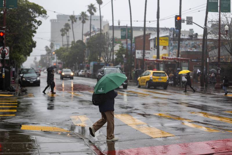
In the Bay Area, the rain could last several days and drop multiple inches of rain.

“If the system continues to slow down, then it’s going to be fine-tuning on top of the fine-tuning,” Murdock said. “It’s one of those setups where we’ll have to keep an eye on it.”

A similar weather event that passed over the region last month promised strong rainfall across the area but weakened as it approached. Murdock said like the storm last month, this storm could lose steam as it barrels toward the Bay Area.

“[If there] is a very steep trough, we could actually wind up getting that low cut off, and then it just loses momentum,” he said.

Snowfall in the Sierra

Forecasters don’t expect heavy snow in the Sierra until Monday.

The weather service in Sacramento predicts periods of rain, mountain snow and gusty wind, with several feet of snow possible over higher elevations.

“This storm will likely lead to things like chain controls and transportation problems across Donner Pass,” said Chad Hecht, a meteorologist with the Scripps weather lab. “With that being said, it is kind of on the weaker end [of atmospheric rivers], and I think the main takeaway here is that it’s a longer-duration event. It’s going to snow for a longer period.”

Hecht said climate models show a potentially wet pattern for the rest of the month.

“There’s definitely a signal out in the longer range forecast for a wet pattern for California,” he said. “Sometimes, these long lead times for those signals can go away. This is a piece of information that you can use for situational awareness that the potential for an active pattern is there.”

UCLA climate scientist Daniel Swain wrote on X, formerly known as Twitter, that a wet pattern across the entire state “will likely” continue for the next two weeks.

A factor this year is the potential effects of a strong or super El Niño, which historically can mean a propensity for a wet winter. Although not all El Niño years mean storms bombard California.

“Sometimes we get a really strong storm, and then nothing after that,” Hecht said. “In the past ten years, we’ve seen several examples that contradict what [climate models] suggest is going to happen across the western United States.”

KQED’s Kevin Stark and Natalia Navarro contributed to this story.

lower waypoint
next waypoint
Bay Area Cities Push to Legally Validate Polyamorous FamiliesCalifornia’s New 1600-Acre State Park Set to Open This SummerWhat Is the 'Green Flash' at Sunset — and How Can You See It?California's Plans for Slowing Climate Change Through Nature-Based SolutionsSame-Sex Couples Face Higher Climate Change Risks, New UCLA Study ShowsHoping for a 2024 'Super Bloom'? Where to See Wildflowers in the Bay AreaBlue Jellyfish-Like Creatures Ride California Waves: A Climate Change Indicator?Everything You Never Wanted to Know About Snail SexEver Wake Up Frozen in the Middle of the Night, With a Shadowy Figure in the Room?The Never-ending Battle Over Martins Beach Explained