In 1984, the American Geophysical Union published a guidebook of the Bay Area’s most striking rock formations designed by Clyde Wahrhaftig, a legendary UC Berkeley geologist.
Geology
Take a Google Earth Tour of the Bay Area’s Most Epic Rock Formations
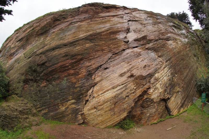
This smooth rock face at Corona Heights in San Francisco was polished by millions of years of geologic activity. (Callan Bentley/Northern Virginia Community College)
“A Streetcar to Subduction and Other Plate Tectonic Trips by Public Transport in San Francisco” became a cult classic among geologists and attendees of AGU’s fall conference held in San Francisco.
Today, I imagine a hard copy would attract the attention of a Luddite wandering the aisles of his local public library. But digital natives? Maybe not so much.
Eureka! Enter Bay Area rock tour 2.0!
Sponsored
To mark the original publication’s 35th anniversary, scientists have transformed the tour into a Google Earth digital experience, complete with photos and informational videos.
Now, using your phone and the Google Earth App, you can follow “Streetcar to Subduction” to blueschist and serpentinite rocks on Angel Island, Jurassic period chert at Corona Heights and the Hayward Fault in Central Park in Fremont, among other Bay Area geologic formations. True to the title, you can get to many of the locations on public transit.
Project lead Jamie Kirkpatrick, a geologist from McGill University, noted a couple of inspirations for updating Wahrhaftig’s tour.
“It’s the Bay Area and it’s beautiful and we like to go outside,” he said. “But also, the geology in this area is remarkable.”
Kirkpatrick appreciated the original guidebook, but he said that Wahrhaftig wrote using dense, scientific jargon. Also, the public transit route information and some of the science was out of date.
“We wanted to make a guidebook that people who live in the Bay Area could use,” Kirkpatrick said.
Don’t like the great outdoors? That’s fine. You can take the tour online without ever having to venture into the sun.
Find links to the individual tours here and helpful instructions for using the guide here.
Geologists Callan Bentley, Northern Virginia Community College; Kim Blisniuk, San Jose State University; Christie Rowe, McGill University; and John Wakabayashi, California State University, Fresno designed the virtual tour.