upper waypoint

SkyTEM Aquifer Mapping

Save ArticleSave Article
Failed to save article

Please try again

Fill up a glass of water to quench your thirst. Wonder where it comes from? Chances are it’s from underground water sources called aquifers, which provide fresh water for most people on Earth. Unlike highly visible rivers and streams or lakes and ponds, aquifers are beneath the surface, so finding them is tricky

Jim Goeke
University of Nebraska hydrogeologist Jim Goeke shows how a rocky outcrop is a model for understanding an aquifer.

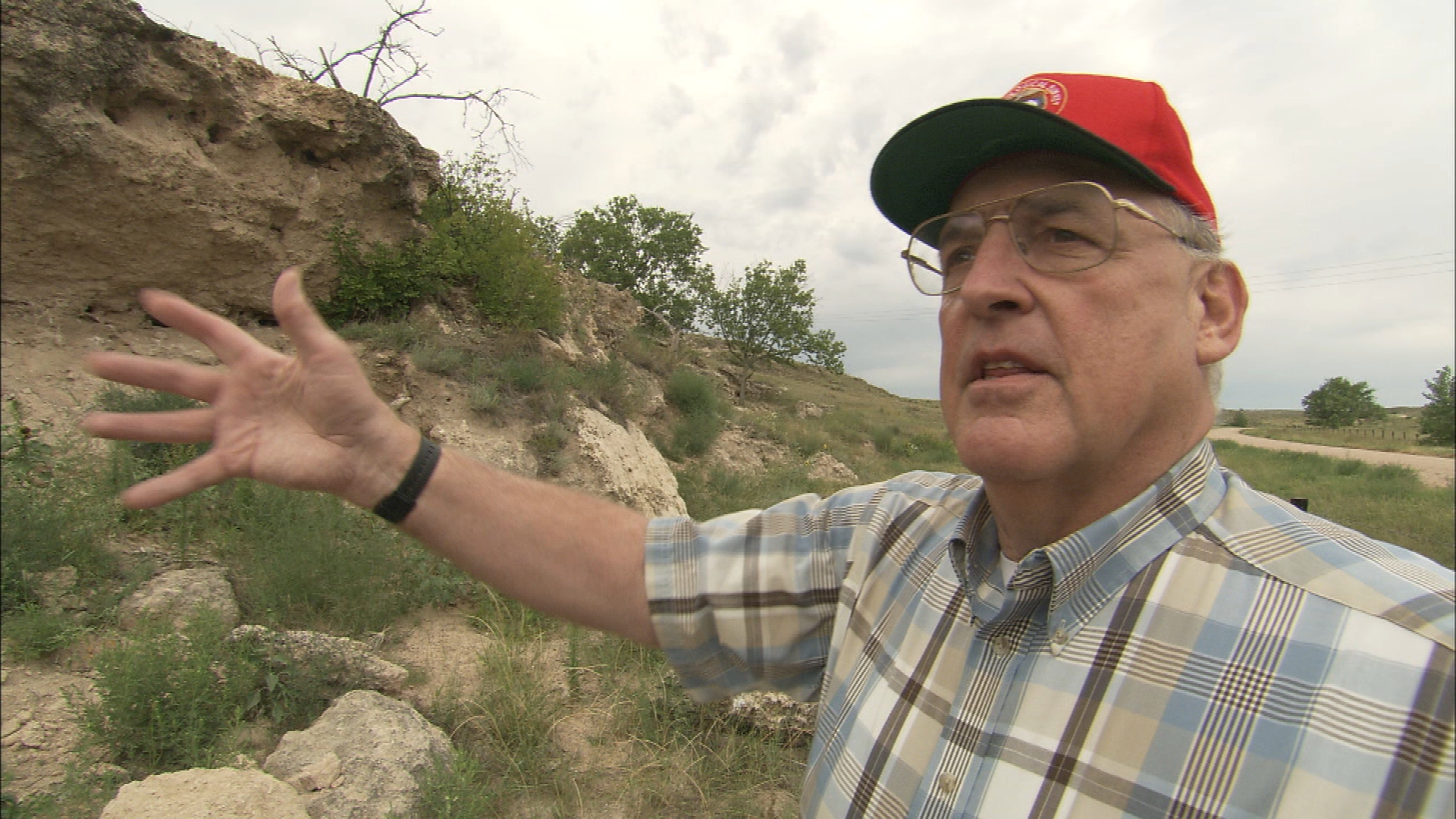
But water scientists, like University of Nebraska hydrogeologist Jim Goeke, know where to look for clues to groundwater deposits. Goeke took us to a rocky outcrop along a rural highway to see exposed layers of rock, sand, and gravel. “Aquifers are water-saturated layers of gravels and sands,” he said. “The open spaces between these grains store and transmit water. These outcrops give us an idea of what aquifers look like below the ground.”

Beneath the Great Plains is one of the world’s largest aquifer systems, stretching from the Dakotas to Texas. Other regions in the U.S. contain a patchwork of aquifers, so locating them is no easy task. And as more states grapple with prolonged drought, it’s become critical for leaders of natural resource districts to map and manage aquifers that provide water for people and agriculture.

Drilling core samples is how hydrogeologists map aquifers.

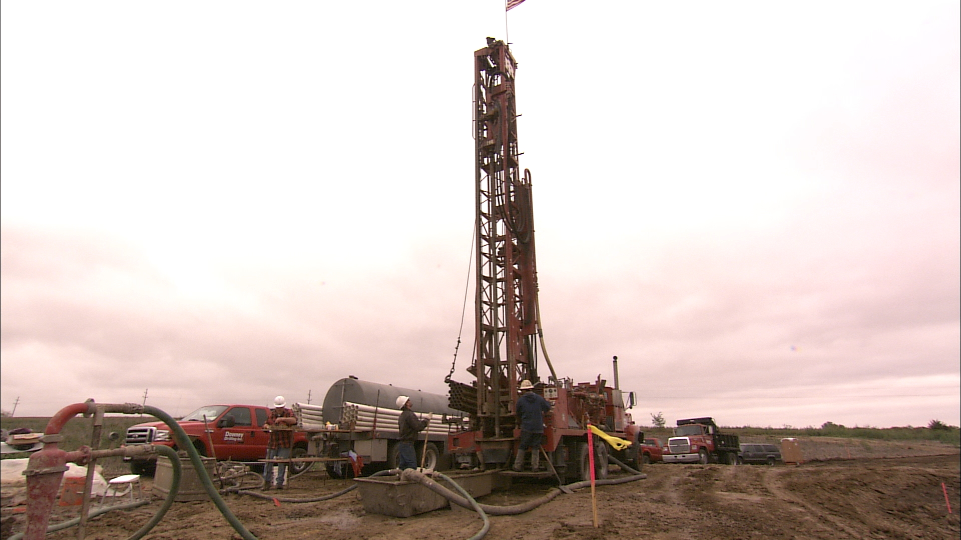
Traditionally, Jim Goeke and his colleagues have had only one practical option to find aquifers. They drill a series of test holes in search of samples of sediments that store and transmit water. “Depending on where you are, you can find sands and gravels and silts and clays,” explained Goeke.

Drill Core Samples
Hydrogeologist Jim Goeke examines drill core samples.

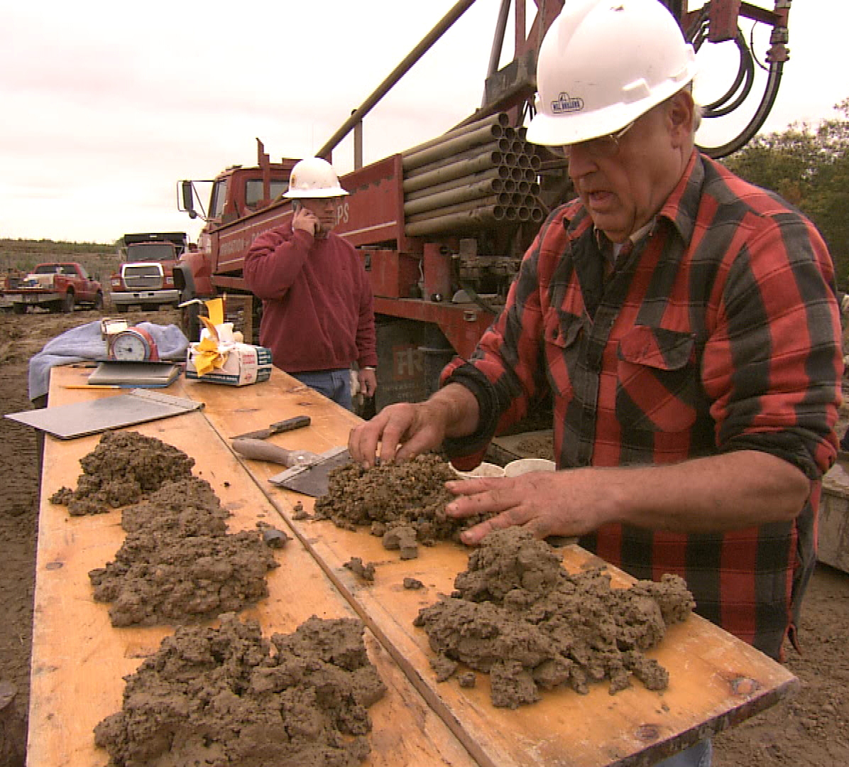
At each drill hole, geologists analyze the samples, layer by layer, to map the water-bearing sands and gravels that form aquifers. But drilling is costly and time consuming, so test holes are only drilled every three to six miles. And since they are so far apart, geologists can only estimate the shape of an aquifer.

Jim Cannia
Jim Cannia is a geologist for Exploration Resources International.

According to Jim Cannia, a geologist for Exploration Resources International, “Our method has been analyzing a series of drill holes and using our training and imagination to fill in the dots between sites to define aquifers.” So, getting results from drill surveys may take months or years to complete. That’s been the practice for 150 years.

Sponsored

Now Cannia is meeting with leaders of Nebraska’s Lower Platte South Natural Resources District to use a new option. Cannia’s company is pioneering a high-tech device to detect groundwater reserves that can map aquifers in a matter of days or weeks.

SkyTEM Rig
Technicians prepare the SkyTEM rig for aerial mapping.

The new tool is called SkyTEM. It’s an aerial geophysical survey system -- towed by helicopter -- that measures aquifers electronically. SkyTEM uses electromagnetics, a global positioning system, lasers, loggers, and a computer strapped to a giant hexagon-shaped frame. Constructed from nonconductive fiberglass and wood, the frame will not interfere with SkyTEM’s electronics as they probe the ground for electrically conductive layers. Ringing the bottom of the frame is a cable of wound copper wires that acts as a transmitter.

in flight, the SkyTEM rig electronically maps aquifers.
The SkyTEM rig electronically maps aquifers from 100 feet in the air.

As the helicopter flies 50 miles per hour, it pulls the SkyTEM rig 100 feet above the ground, traveling back and forth in parallel lines along a predetermined mapped grid. The target for this survey is a 150-square-mile area in southeast Nebraska’s Lower Platte South Natural Resources District.

Cannia explained that SkyTEM creates precise records by shooting rapid-fire electromagnetic waves, similar to radio signals, into the ground every 9 feet -- to a depth of 900 feet -- all the way to bedrock. “The rocks feel that radio signal and then get a little energy and send energy back out,” said Cannia. “It says, ‘I’m a sandstone’ or ‘I’m a sand and gravel body’ or ‘I’m clay and silt.’ And that’s what we’re mapping.”

SkyTEM
SkyTEM sends electromagnetic waves into the ground to map sands and gravels that make up aquifers. Graphic: Scott Beachler/NET Television.

SkyTEM measures electrical conductivity and electrical resistivity. The sand and gravel aquifer materials resist. “So, that’s what we want to see if you want to know where the aquifer is,” he added. But clays and silts are electrically conductive, like putty. Cannia explained, “Not much water gets through putty, so that tells us where the aquifer isn’t. Between those two we map that difference and we make a map of where everything is.”

Along each flight line, the SkyTEM signals are averaged together to produce a virtual borehole that displays in vivid colors. Blue and green mark silts and clays, while yellow and red reveal the sands and gravels that make up aquifers.

SkyTEM mapping produces colorful displays of aquifers.

SkyTEM images portray detailed 3-D maps of the area’s geology, showing the size and shape of aquifers, how much water they hold, and whether they're connected to other aquifers or surface water streams.

3-D SkyTEM aquifer map.

“When it’s all done,” said Cannia, “you’ll look at a picture sideways through that map and see what geologists always want to see. We want to know what’s real, knowing where we have aquifer material and where we don’t.”

What makes SkyTEM a good alternative to traditional aquifer mapping using drill holes? SkyTEM maps reduce the number of drill holes required to understand an aquifer. And to ensure SkyTEM images are accurate, geologists compare them to existing drill-hole sediment samples.

At a time of uncertain climate future, SkyTEM maps are an invaluable asset for natural resource districts, precisely identifying the location of aquifers and helping to manage groundwater use for the public.

The broadcast version of this story is titled "Mapping Hidden Waters."

lower waypoint
next waypoint