upper waypoint

Watching the Atmospheric Rivers Flow

Save ArticleSave Article
Failed to save article

Please try again

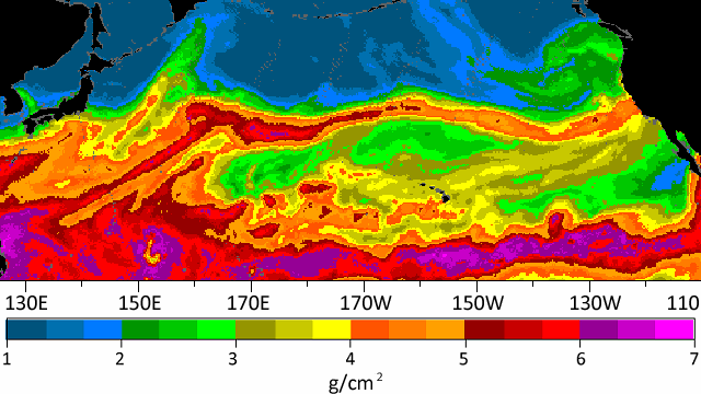
Atmospheric river of October 13, 2009. NOAA images

Atmospheric rivers are a 21st-century weather threat that first got their name in 1998, after satellites capable of measuring water vapor in the air began producing images like this one. It shows the chronically humid tropical ocean at the bottom, and long, thin streamers of water vapor threading away from the tropics. It was soon estimated that these streamers—atmospheric rivers or ARs—are responsible for essentially all of the moisture transported out of the tropics.

The basic connection between ARs and major precipitation events was obvious. In California, our 20th-century name for these is the Pineapple Express: a huge influx of warm, water-heavy air from the tropical Pacific that overfills the rivers and piles snow on the mountains. Smaller ARs may not cause major floods, but they can bump up river flows by 10 times in a day or two. They deliver to California about one-third of its total water. Clearly ARs are important research topics for both scientific and practical reasons. How do they interact with El Niño/La Niña cycles? How will climate change affect them? How can we better protect ourselves from them?

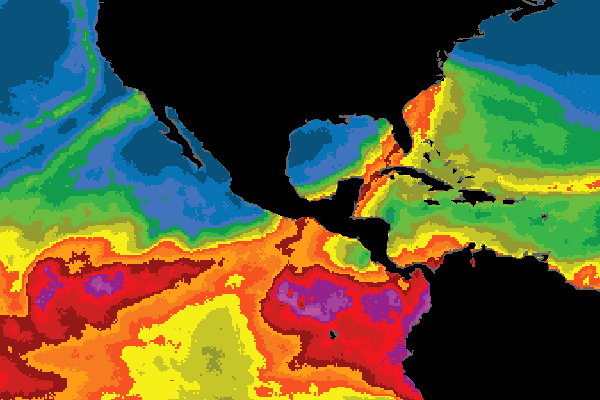
America has just finished going through Hurricane Sandy. Hurricanes are important events, but ARs affect both coasts. The National Oceanic and Atmospheric Administration's AR site points to the notorious "Snowmageddon" blizzard of February 2010 as an East Coast example, when a river of Pacific moisture crossed Central America and the Caribbean before drenching the Atlantic states.

Norway got a large AR in the late summer of 2005, and many others are sure to be found in the global weather records. But California seems to be the current champion, maybe because the data is better here. Between 1997 and 2006 there were 42 AR events touching California, of which seven caused major flooding of the type requiring evacuations and triggering large-scale power outages.
Sponsored

Even without knowing their cause, California has had epic floods during its history, and recently emergency planners have begun to take the "deep present" approach to them. What if the worst example we know, the great flood of 1862, were to recur today? That had the earmarks of an unusually large AR event or a rapid series of them. As the planning agencies contemplated that question, they prepared a scenario in 2010 with the Noachian name ARkStorm (for "AR thousand-year storm") clearly demonstrating that ARs are our other "Big One" beside earthquakes.

Since ARkStorm was completed, several agencies have carried its findings forward. In particular, a new Atmospheric River Observatory is nearing completion at Bodega Bay that will conduct crucial ground-based observations of ARs that pass over the Bay Area. The satellite water-vapor data is not enough, because everything else matters too: the elevation where the moisture sits, the winds at different levels, the temperature profile of the lower atmosphere and much more that meteorologists need for the best modeling. After that, the flood predicters add the model's results to their own knowledge of river levels and soil moisture.

What makes ARs so potent is that they bring in air saturated with tropical moisture, the closer to sea level the wetter. Such air will turn its water to rain almost instantly when lifted up by the Coast Range, and again when it hits the Sierra Nevada. The new AR Observatory at Bodega Bay, like others being built along the west coast, will interrogate the air with radar at various wavelengths, measure rainfall with standard gauges and drop-size distribution with disdrometers, and derive water-vapor content from GPS data (an unforeseen benefit of the universal navigation system). More instruments in the mountains near Cazadero will complement it. The promise is that we will be able to accurately forecast these 21st-century events, and their effects in our neighborhoods, a week or more in advance.

lower waypoint
next waypoint