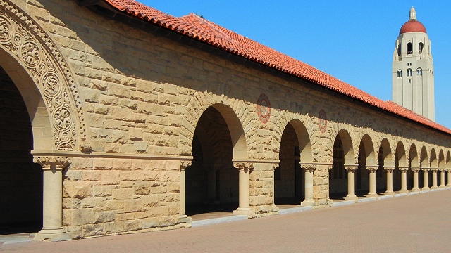
These days, crowds of matriculating freshmen are being led by docents around the iconic campus of Stanford University. Many prestigious schools feature stone buildings, but the warm sandstone of Stanford's historic core is special. The stone has a Bay Area source.
The Bay Area's quarries are good for crushed stone, but not dimension stone. Generally, the rock around here has been shaken and folded so thoroughly that it's hard work to find decent blocks without fractures or alteration. We have some marble and limestone, but it's suitable only for making cement. And we have some granite, but for usable stuff in commercial quantities builders look east to the Sierra Nevada or out of state. The exception is the golden sandstone formerly quarried in the Santa Teresa Hills, south of San Jose.
The Santa Teresa Hills are a little outlier of the Santa Cruz Mountains that almost plug the south end of the Santa Clara Valley. Route 85 passes north of them and the Almaden Expressway runs to their south. Here they are in Google Maps.

Their rocks are largely the typical Bay Area rocks that builders spurn—Franciscan melange and metavolcanic rocks of the Coast Range Ophiolite—but the spine of the western end of the hills is made of a much younger, well-sorted sandstone of Eocene age, about 35 million years old. It's labeled "Tls" in this excerpt from the San Jose Quadrangle geologic map. The same rock underlies the peak of Loma Prieta and the crest of the Sierra Azul, across the intervening New Almaden block.

You can visit the source by taking Camden Avenue east from the Almaden Expressway. Then turn left on Graystone Lane, where starting in the 1880s the Greystone Quarry shipped stone direct to Stanford from Leland Stanford's private rail spur. Just across Alamitos Creek is this old stone shed dating from around 1875, with an E Clampus Vitus sign telling its history. On the geologic map it's just under the "Tls" label.

The scars of the quarry itself, which closed in 1906, are long gone, but in many places along the hill you can spot the sandstone cropping out.


