upper waypoint

The Blue Rock of Antioch

Save ArticleSave Article
Failed to save article

Please try again

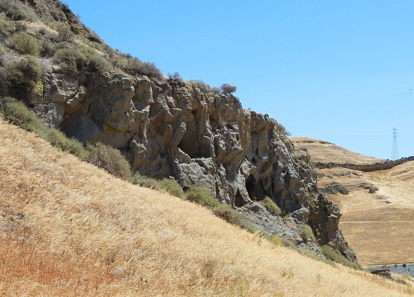
Neroly Sandstone crops out in the Los Medanos Hills. All photos by Andrew Alden

Last weekend I was part of a field trip through the northernmost part of the Diablo Range, the high Los Medanos Hills north of Mount Diablo that overlook Suisun Bay and western Delta. There is a lot going on there, geologically speaking, that was hard to completely absorb despite the best efforts of our guide, who has spent more than 40 years in these rocks. But I was impressed with the personality, for lack of a better word, of several rock units we saw that day. Let me show you one of them: the blue rock called the Neroly Sandstone.

One of our stops was near Bailey Road, an offbeat route through these hills known to locals as the one between Willow Pass and Kirker Pass, connecting east Concord and west Pittsburg. The state-of-the-art Keller Canyon Landfill is there, and we got a guided tour of its operations as well as its geologic setting. At our first stop we visited an outcrop of the Neroly Sandstone, which is the cliff-forming unit exposed in these hills.
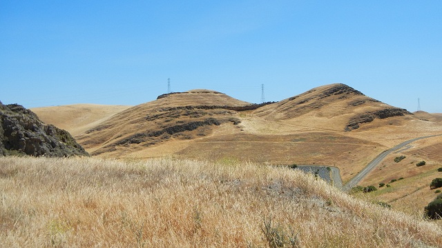
Neroly Sandstone crops out in the Los Medanos Hills. All photos by Andrew Alden

The Neroly got its name in 1930 from an old train stop east of here. In 1949 another geologist renamed it the Neroly Formation. By either name, it's lumped into the San Pablo Group along with the underlying Cierbo and Briones Formations. It's considered the equivalent of the similar Etchegoin Formation farther south near the Kettleman Hills. It has been assigned a Pliocene age, roughly 4 million years. As we approached the outcrop, some of us noted its bluish color but others couldn't see it.

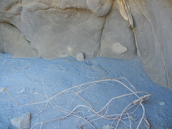
Getting still closer didn't help a lot. It seemed to be both brown and blue, and on a day with a bright, open sky shadows naturally have a bluish cast. But here we could see its nature: a thick sequence of coarse sandstone with thin, discontinuous bedding, the kind of thing laid down by rivers. Our guide explained that fossils of plant debris are commonly found in the Neroly. That made me prick up my eyes, although this particular outcrop was barren of fossils.

Sponsored

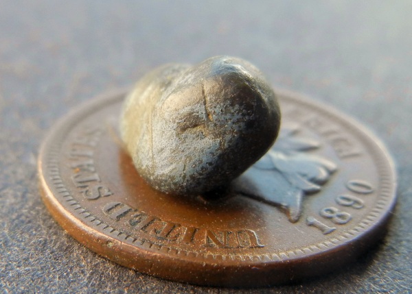
At this point I picked up a blue pebble and passed it around the group; later I popped it in my pocket. Here it is:

This specimen makes it clear that the sediment particles making up the rock are not themselves blue. Rather, each particle has a thin coating of blue material. This was identified in a 1957 paper as a clay mineral, a variety of montmorillonite, that formed by the alteration of the particles. Those particles, in turn, are volcanic rock erupted somewhere in today's Sierra Nevada. But the blue clay is not what holds the rock together. Instead it's just a bit of calcite. That tends to dissolve easily in surface conditions and explains what I found next, in a hollow eroded into the rock.

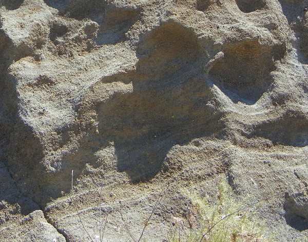
Wind and water have gently freed the clay-covered grains and removed the rest. A rock of blue grains was cemented by brownish material, explaining its ambiguous color.

The picture we have of the Neroly Sandstone is a huge, widespread blanket of volcanic sand and gravel spread west of the Sierra and rounded by vigorous rivers. At the same time, the gravel was left alone in tropical conditions enough to partially degrade into blue clay. How was it tilted up and exposed? Where does it go underground? What else is special about it? The answers are: compression across the Central Valley has pushed it up; it extends all the way across the Valley and matches up with the Mehrten Formation in the western Sierra foothills; and its porous nature makes it an important aquifer (water-bearing rock) in the region.

Driving home at the end of our trip, we passed the spiffy Bluerock Center in Antioch. It's not far from the Neroly Sandstone, and I'm sure that the rock was well known to Antioch's early inhabitants. The big stone specimen at its entrance was something else, though: probably a "black granite" ordered by the landscape designers from a catalog.

lower waypoint
next waypoint