upper waypoint

Side Trips from Interstate 5: Sutter Buttes

Save ArticleSave Article
Failed to save article

Please try again

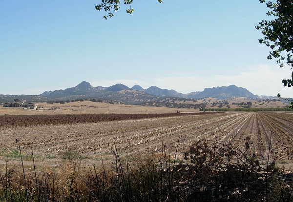
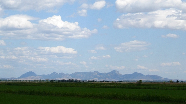
The Sutter Buttes are an isolated volcanic center surrounded by super-flat bottomland of the Sacramento Valley. All photos by Andrew Alden

The Sutter Buttes are an isolated volcanic center surrounded by super-flat bottomland of the Sacramento Valley. All photos by Andrew Alden

If it's a fine day and you have a couple of hours to spare on your drive north, why not see one of the curiosities of California and take a spin around the Sutter Buttes, also known as the world's smallest mountain range.

The Buttes are a compact clump of rocky crags placed smack in the middle of the flat Sacramento Valley. If you know where to look on a clear day, you can first spot them from I-505 as you drive north just north of Winters, some 40 miles off. They're like a mirage, glimpsed through the distant trees and silos, that soon vanishes as an imperceptible rise cuts them off. Otherwise their first appearance is a vision dead ahead as you exit the rounded, dreamlike Dunnigan Hills just before joining I-5. On many hazy days you may catch the barest outline of the Buttes' fairytale-steep peaks and wonder if you're seeing anything at all.

The Sutter Buttes are the remains of a young volcanic center that flourished here between about 1.5 and 1.3 million years ago, during the Pleistocene Epoch. On the geologic map below (derived from the California Geological Survey's interactive state geologic map) its bulls-eye shape is distinct.
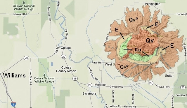
Rock units are as follows: Qv, lava plugs and domes; Qvp, volcanic flows; E and Ku, Eocene and Cretaceous sedimentary rocks.

A central set of lava plugs and domes (Qv) is surrounded by an apron of volcanic flows of lava and debris (Qvp). After the eruptions stopped, erosion uncovered the older sedimentary rocks (E and Ku) that were folded upward by the rising magma. These folded older rocks are prime sites for natural gas wells. In the 1920s the volcanologist Howel Williams, a native of Wales, gave names to these parts that were inspired by Medieval castles: Qv is the Castellated Core, Qvp is the Rampart and the soft old rocks between make up the Moat. See more detail of the geologic story, plus a look at the Buttes' interior, over on my About.com site. But this is enough background for today's side trip.

Your closest approach to the Buttes on I-5 is at Williams, and that's where you set out for this enchanting feature. Turn off the freeway and head east on state route 20. The road crosses the Central Valley at one of its flattest points. The little town of Colusa sits on the Sacramento River and has a nice park there. This is a worthy side trip—maybe a picnic stop—in itself.

Sponsored

From here there are several different ways to experience the Buttes, depending on your schedule. The shortest trip is a straight drive-by on route 20, after which you can take route 99 north to rejoin I-5 at Red Bluff. Longer versions could include a pass around the little-trafficked north side, a detour into the Buttes on Pass Road, and a complete circumnavigation with optional Pass Road leg. I'll start with the west side.

West Butte Road skirts the ranchlands of the Rampart and several valleys, suitable for orchards and field crops, that penetrate to the Moat. The land of the Buttes is almost entirely in private hands.

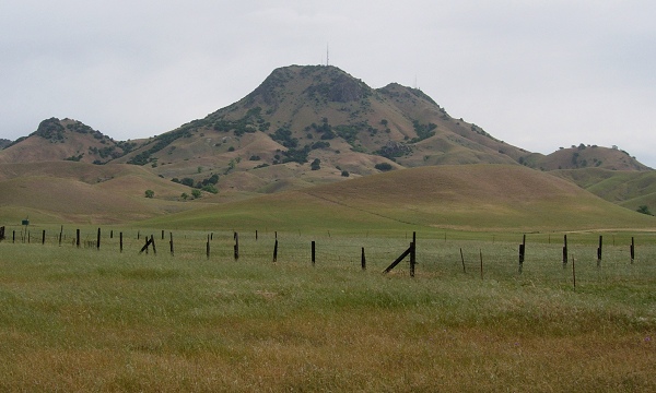
Rocks of the Rampart and Castellated Core appear distinct in this view from the north. The lightly travelled road gives many opportunities to stop and admire the landscape. The east side of the Buttes is on the outskirts of Yuba City but otherwise is very similar. There the lower Feather River runs down the valley on its way to join the Sacramento near Knights Landing.

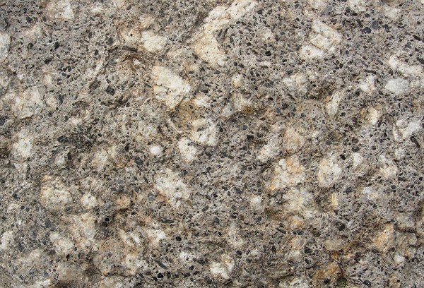
If you get a chance, pull over and inspect the roadside rocks. The Buttes have long been a ready source of stone for lining canals, bolstering levees and making roadbeds. The lava is a beautiful andesite porphyry that is unusually rich in crystals of hornblende and biotite (black) and feldspar (light). Other roadside rocks might include volcanic conglomerates and tuffs dating from the Buttes' fiery youth.

Pass Road takes you inside the Rampart and as close as possible to the Castellated Core. Here South Butte, highest point in the range, rears its head to 2117 feet.

The Maidu tribes thought highly of the Buttes; so do its current landowners. Access for hiking is limited but possible through the Middle Mountain Foundation. Perhaps this side trip will inspire a longer visit to California's nearest thing to Shangri-La.

lower waypoint
next waypoint