upper waypoint

Geological Outings Around the Bay: Fremont Peak

Save ArticleSave Article
Failed to save article

Please try again

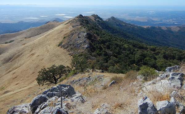
Fremont Peak is renowned for its views of Monterey Bay to the west and the Hollister Valley to the east. All photos by Andrew Alden.

Fremont Peak is renowned for its views of Monterey Bay to the west and the Hollister Valley to the east. All photos by Andrew Alden.

I often think of the Bay Area as a series of regions dominated by a particular mountain. San Francisco is under the sway of Mount Tamalpais, of course, and the East Bay is Mount Diablo territory. Farther south the skylines feature Black Mountain on the west and Mission Peak on the east, then Loma Prieta and Mount Hamilton respectively. And the area stretching from Gilroy to Monterey is the land of Fremont Peak. It makes a good focus for a day trip.

Let's have a look at the area in the online Geologic Map of the Monterey Quadrangle.
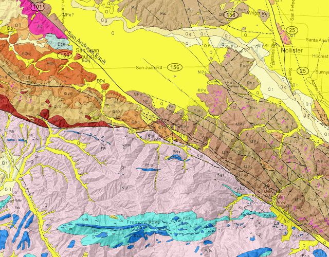
Map from California Department of Conservation

The San Andreas fault slashes across the area southwest of Hollister. To its east are young (Miocene and Pliocene, 7 to 4 million years old) sedimentary rocks that correlate with the huge young sequences in the Central Valley. To its west (on the north side) are older sedimentary rocks mostly dating from the Eocene and Oligocene epochs around 35 million years old. The southern part of the map area, where Fremont Peak lies, is granite and related rocks making up the Gabilan Range. You reach the peak through the town of San Juan Bautista, located directly under the "San Andreas fault" label.

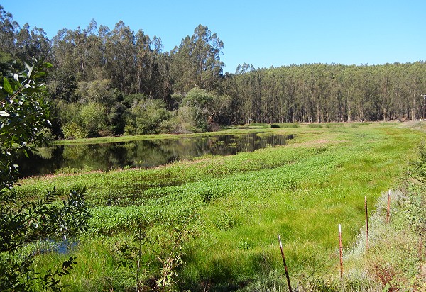
If you have the time to find Anzar Road, north of San Juan Bautista, pay a visit to Anzar Lake, one of the best-developed sag ponds on the San Andreas fault. These form where fault movement causes the ground to sink below the water table.

Sponsored

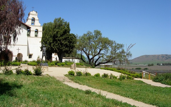
Anzar Road runs right along the fault trace pointing straight toward San Juan Bautista, where the old Spanish mission sits next to the fault overlooking the fertile soils that once formed the bottom of ancient Lake San Benito. The uplifted ground here made a desirable location, but the mission has suffered several large earthquakes during its history. The town is a good place to acquire lunch, visit the GeoZeum, and admire Fremont Peak from below.

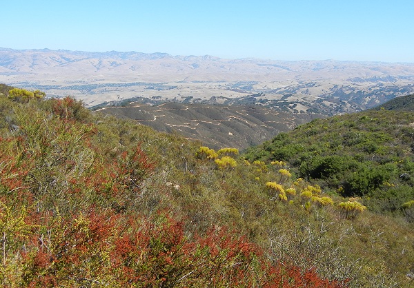
Fremont Peak, formerly known as Gabilan Peak, is the centerpiece of Fremont Peak State Park. The road up the mountain offers eastward views over Hollister Valley to the southern Diablo Range. The vegetation changes as you leave the sedimentary rocks and enter the granite zone. The granite of the Gabilan Range is part of the geologic province called Salinia. It's a segment of the Sierra Nevada that has been carried northward along the San Andreas fault. Other pieces of Salinia occur in the Santa Cruz Mountains, Point Reyes, and as far north as Bodega Head in Sonoma County.

The San Andreas fault runs in front of the chaparral-covered hill at center. Note the change in vegetation as the bedrock changes.

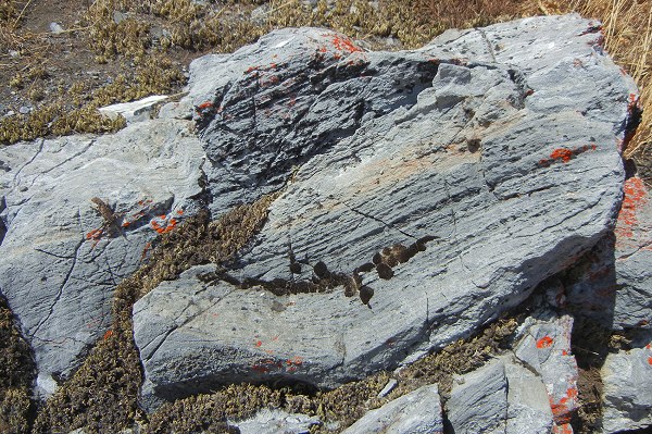
The peak itself is not made up of granite, but rather of the much older metamorphic rocks that lay on top when the granite was emplaced from below. The most distinctive of these rocks is marble. The rock has been so thoroughly squeezed that it contains no fossils from which to determine its age. On the map it's the blue zone labeled "PzMz" or Paleozoic-Mesozoic, the scientific version of "beats me."

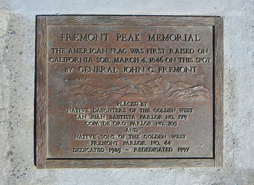
The peak itself bears a plaque commemorating the famous stunt pulled by Captain John C. Frémont to taunt the Mexican authorities in early 1846, raising the American flag within sight of the capital in Monterey and Mexican troops gathered to the east. He soon took the flag down, blaming the bad weather, but his point had been made: the United States was coming into the country. The peak itself is a tumble of big marble boulders, worth a close look even if the views are good.

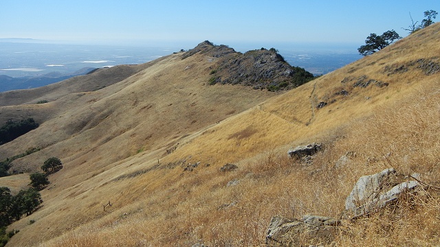
On a clear day the whole sweep of Monterey Bay is visible. The western spine of the mountain consists of marble and beautifully displays the difference that topography makes to plant communities. The cool, sheltered north face is forest while the south face is parched grasslands and wildflowers.

The rock is riddled with small barite mines, and visitors with black lights will get a nice show inside them. At night, the park allows stargazers to view the sky through a 30-inch telescope.

lower waypoint
next waypoint