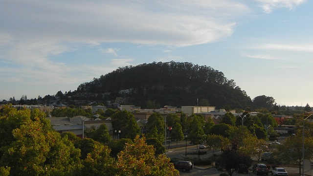

This is the classic view of Albany Hill from the El Cerrito BART station. With the sun behind it, you can see that much of the hill's apparent size is due to a high hairstyle of eucalyptus trees. Beneath them is an isolated body of Franciscan sandstone dating from late in the Cretaceous Period, about 70 to 83 million years old.
Many Bay Area landmarks had different names before the Gold Rush. Albany Hill was first named "Cerrito de San Antonio" by the Peralta family. Afterward it became El Cerrito, "little hill," and got its current name just a century ago when the city of Albany incorporated. During those years it served first as a rock quarry and the site of an explosives factory (when the eucalyptus forest was planted, as at Pinole Point, to muffle accidents) and later as a fine place to build homes and apartment buildings. Today much of it is preserved in Albany Hill Park in a benign stasis.
Albany Hill appears on the geologic map as a patch of unit Kfn, Franciscan rocks of the Novato Quarry terrane.

The line labeled "A" marks part of cross-section A–A' that conveniently starts right at Albany Hill.

To visit the rocks of Albany Hill, park along Taft Avenue, which runs up the east side of the hill. The street boasts an extensive roadcut where you can inspect and sample the rock. It's a hard, massive, medium-grained sandstone that has undergone some metamorphism. This has wiped out any original structural features that may have been there, such as bedding and erosion marks. This isn't the dramatic stuff of Pebble Beach.

Up at the end of Taft is a parking area for Albany Hill Park. Enjoy the woods and the views and watch for the occasional outcrops underfoot. In many of these, foot traffic exposes the sandstone's true tan color.

