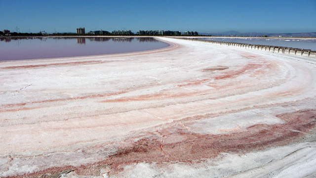
Cargill Salt owns these ponds as part of their salt-harvesting operations. Smith is with a developer that's working with Cargill on a different vision for these more than 1400 acres.
"Welcome to the Redwood City Saltworks site," he says. Saltworks is DMB's proposal for 8,000 to 12,000 new housing units. "Half of the site would be dedicated to open spaces uses including tidal marsh restoration and then the other half would be this integrated, transit-oriented development."
Smith says it's housing that's sorely needed in the Bay Area. "You have had the explosion of economic success of Silicon Valley. We should be ashamed of our inability or unwillingness to provide housing to support those workers and that economic activity."
David Lewis, Executive Director of Save the Bay, is on the other side of the issue. "This site is not a site for housing," he says.
"Salt ponds in Redwood City are actually one of the last unprotected areas that could be restored to tidal marsh for San Francisco Bay."
It seems like a pretty typical story: a developer wants prime land to build on and environmental groups want to see wildlife habitat restored. But there's a twist, as David Smith points to on one particular map.
Bay Waters Rising
"What we're looking at is a blue inundation zone and it depicts the projections for sea level rise for the region around Redwood City," Smith says, pointing to map showing the low-lying parts of the bay's shoreline at risk from sea level rise – which includes the land we're standing on.
Smith says their plan calls for a three mile levee to protect the development from the bay. Projections from state scientists show sea level could rise by nearly six feet by the end of the century.
"We'd like to ignore it. But if we ignore it, we're ignoring it at our own economic peril," says Will Travis, Executive Director of the Bay Conservation and Development Commission. BCDC is the state agency with jurisdiction over the bay.
"We're building things now that will be around for a hundred years. And we should, we believe, think about how those cities, how those communities will remain viable and sustainable," he says.
BCDC is writing new regulations for development along the shore, which they'll use in future permitting decisions. They've been guided by a state plan from the Schwarzenegger administration called the California Climate Adaptation Strategy. It discourages building in low-lying areas and encourages wetland restoration.
"Wetlands are wonderful for dealing with climate change. Wetlands soak up flood water. So the wider the wetland in the front, the lower the levee can be in the back," says Travis.
Battle Over Shoreline Rules
But when BCDC released the first draft of its new development policy two years ago, the agency faced a wave of protest, especially from folks who see bay front property as prime real estate.
"It tried to do too much too fast," says Jim Wunderman, president of the Bay Area Council, a group representing business interests.
"We should be absolutely concerned about sea level rise, but we shouldn't allow the concern about it to say let's just stop doing everything," he says.
A number of bay-front cities had the same complaint. Public meetings got ugly. "People said things that they probably weren't proud of when the meeting was over and I know we've had epithets hurled at us," says Wunderman.
So BCDC backed off a little, saying that new development would be considered on a case by case basis. David Lewis of Save the Bay says those changes concern him, because the policy is leading the way for others.
"Most small cities don't have the resources to change the way they plan and permit developments with a big change like sea level rise. I think BCDC's at the forefront and it should be brave about doing the right thing," says Lewis.
Will Travis of BCDC says the changes were necessary, so the plan works for the dozens of cities it involves. "We want to achieve environmental protection. We have to, but not at the expense of regional prosperity. So we're trying to achieve that balance."
The challenge, Travis says, is making a global issue like climate change part of regional planning.
"A society likes dealing with climate change at the abstract. It's when you actually get down to doing something about it that people have concerns."
In October, BCDC expects to finalize the sea level rise policy that will govern development along San Francisco Bay for years to come.
Additional Links