upper waypoint

Mount Diablo Views

Save ArticleSave Article
Failed to save article

Please try again

mount diablo
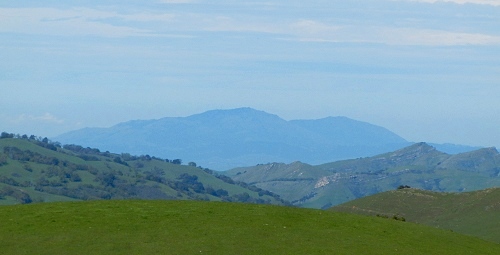
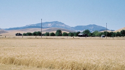
Mount Diablo is seen with its foothills from Wildcat Canyon Road near Inspiration Point in the Berkeley Hills. Photo courtesy Seán O'Hara of Flickr under Creative commons license. Photos by Andrew Alden unless otherwise indicated.

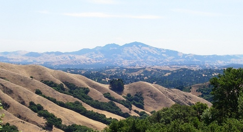
Mount Diablo, in the heart of the East Bay, is an interesting mountain in many ways. It has fossils. It has a lot of serpentinite in it, with the accompanying serpentine plant community. It's been mined for mercury and other metals. It's an exceptional structure even in a region of crazy-complicated tectonic structures. But I expect to get into the geological details some other time. Because first of all, Mount Diablo is just there.

Mount Diablo was always a landmark, so widely visible around the Bay and central California that in 1851 its peak was named the base line for land divisions. Around here and across the majority of California and all of Nevada, every township and section is numbered in relation to the north-south Mt. Diablo Meridian and the east-west Mt. Diablo Base Line. (Full details are given by the Mount Diablo Surveyors Historical Society.)

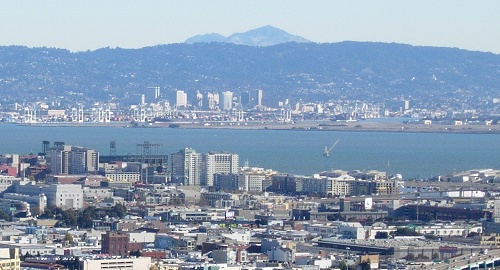
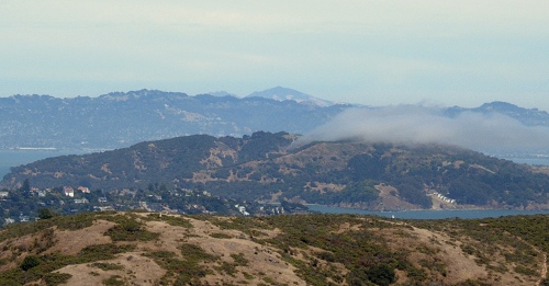
Today few of us have any awareness of land division, and we can simply enjoy the peak's prominence as we drive Bay Area roads or hike the hills. Around the Bay proper, Mount Diablo peeks over the Berkeley Hills as seen from Corona Heights in San Francisco . . .

Sponsored

mount diablo san francisco

. . . or from the hills above Marin City, where the "devil's mountain" overlooks Angel Island.

angel island

To see the peak's full extent we need to cross the hills of the East Bay, or at least climb them. Here the mountain is seen from the Los Buellis Hills, east of San Jose, looking up the valley formed by the Calaveras fault.

mount diablo san jose

Once over the hills, your every vista centers around Diablo whether it's the view from Oakland . . .

mount diablo siesta valley

. . . or from the Tassajara Valley . . .

tassajara valley

. . . or from the Delta:

delta
Photo courtesy Mark Johnson of Flickr under Creative Commons license

On Interstate 5, Mount Diablo can be spotted from the Dunnigan Hills in the north to near Patterson in the south. From state route 99 it's visible from a much longer stretch, but only if the conditions are right. In fact, instead of driving everywhere to determine Mount Diablo's viewshed, it's more efficient to visit the peak itself on a perfect day and look outward. There's a handy sign pointing out what's possible on a perfect day.

mount diablo sign
Photo courtesy George Kelly of Flickr under Creative Commons license

I've been up there on a perfect day, and while it's not geometrically possible, atmospheric refraction has allowed me to spot Mount Shasta. An example of a typical excellent (not perfect) day shows Pyramid Peak in the central Sierra Nevada.

sierra nevada
Photo courtesy advencap of Flickr under Creative Commons license

Such days were once more common. A. J. McCall, standing at the Sierra's crest on September 7, 1849, recorded "a picture of wonderful grandeur and magnificence":

"Below were a succession of innumerable pine-covered mountain peaks, growing less and less until they disappeared in a broad, yellow valley sweeping north and south until lost to view, and beyond another range of mountains. This was the far-famed Sacramento Valley, nearly a hundred miles distant. The purity of the atmosphere rendered vision almost illimitable, showing every line and shadow distinctly." (source)

Today the activities of ten million modern Californians make such purity almost unattainable—especially around Labor Day.

There's a common belief that when pioneer scout Kit Carson guided the Fremont Expedition over the Sierra in the winter of 1844 (at today's Carson Pass), he recognized his position by spotting Mount Diablo: "There is the little mountain—it is 15 years since I saw it; but I am just as sure as if I had seen it yesterday." But Bob Graham and Peter Lathrop argue convincingly that it was not Diablo, but the whole Coast Range that Carson meant. That's too bad; it was a good story.

37.8817 -121.9146

lower waypoint
next waypoint