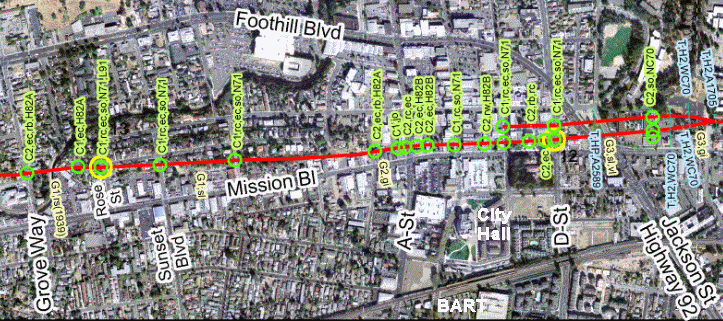
The BART station is at the bottom between A and D Streets. If you can, walk through the new City Hall on your way to Mission Boulevard; it's highly engineered for earthquake resistance, and the apron of stone around it hides a base-isolation system that lets the building shimmy like a surfer to ease the stress on it from a magnitude-7 event.
On Mission it's simply a matter of walking in either direction and going up each side street. The annotations have a simple code: C1 and C2 denote excellent and good creep evidence, respectively. Here are examples of the codes that follow them. First is "ec," for echelon cracks, like this set from Oakland's Lake Temescal where the fault has its own exhibit.
Before we go any farther I should point out that Hayward is not proud of its fault. Many homes and properties were built upon the fault trace before creep was first recognized in 1956. It's best not to stand and point. Geology teachers tell their classes the same thing.
The code "rc" stands for right-offset curb. These are easy to spot. I photographed this example a few years ago; since then the construction site has become a structure, but the curb still takes its rightward jog. The Hayward fault is classified as right-lateral, meaning that when you look across it, the other side moves to the right.
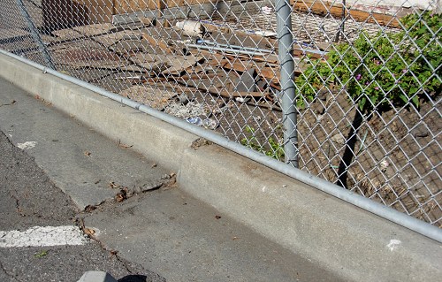
The curb on Sunset Street, near Prospect Street, is a clearer example.
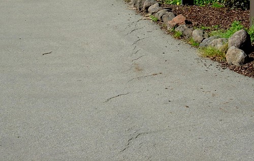
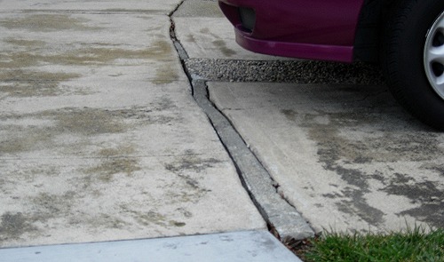
The codes "rb" and "rw" mean offset buildings and walls, respectively. You'll see a lot of damaged brick buildings, or recent repairs, in line with the bent curbs. The code "jo" means open joints or cracks in concrete. This example shows a steadily opening gap that has been patched.
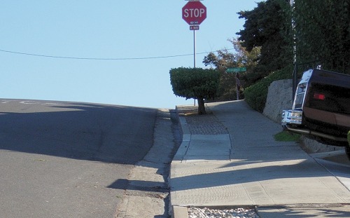
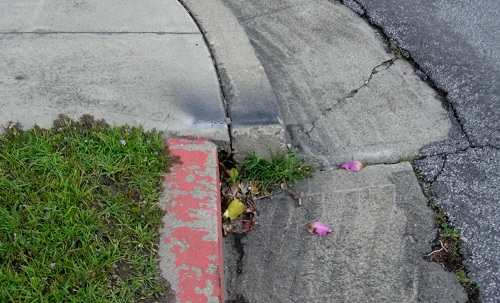
Localities marked "so" have had their offsets surveyed. The most commonly visited site is the corner of Rose and Prospect Streets, the yellow circle on the map. The corner curb has had a constant stream of visitors since it was built in 1971. This is how it looked in 2001.
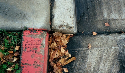
Photo courtesy misspudding of Flickr under Creative Common license
You can see from my photo taken in 2007 that it has moved further since then. The street here has a good set of echelon cracks too.
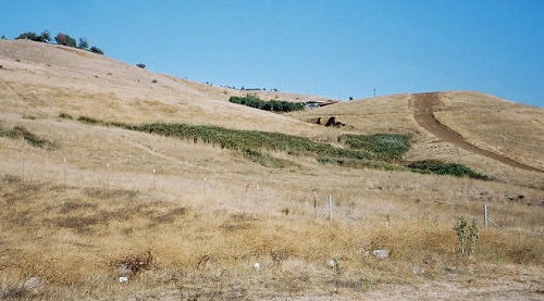
Prospect Street got its name because it runs along a low ridge with a nice view west. The ridge is a pressure ridge, thrown up during thousands of years of creep and earthquakes. That's one natural sign of fault activity. Another is offset streams, which are just like offset curbs only much larger. You'll see one on the map where a stream flows down from the top (east), turns sharply to its right, then jogs leftward on the other side of the fault. It's marked "G1, rs" meaning excellent geomorphic evidence consisting of a right-offset stream.
Another natural fault sign appears about 2 miles south on Mission at Holy Sepulchre Cemetery, where you can look up on the hillside just to the south and see another natural sign of the fault: a line of springs. It really stands out in the dry season.
This is just a beginning of what geologists learn to see, but you can follow in their footsteps as far as you care by visiting the USGS's Northern California earthquake home.
37.67981 -122.09122

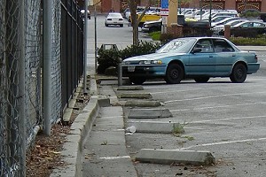 Suburbia is warped in downtown Hayward, where fault creep is steadily distorting curbs, walls and pavement. All photos by Andrew Alden except where noted.