
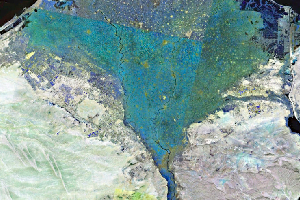
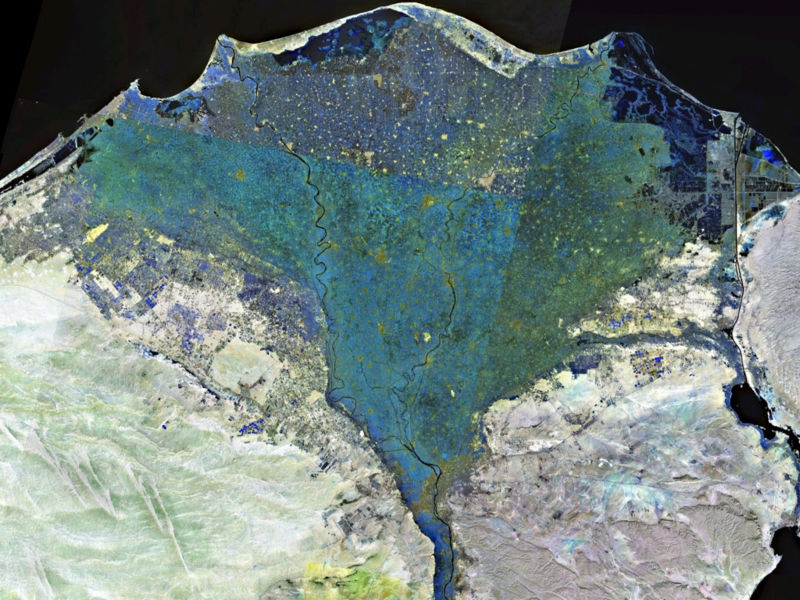
The Sacramento and San Joaquin Rivers meet in the area between the city of Lodi and the Carquinez Strait to form what we simply refer to as ‘The Delta’ in central and northern California. The term ‘delta’ is derived from the triangle-shaped Greek letter of the same name and was originally applied to where the Nile River meets the Mediterranean Sea. The triangular shape forms as the single Nile River channel splits into numerous smaller river channels, which then split again, and so on, spreading out over a vast low-lying area.
 Click here for a larger version of the Nile Delta.
The Sacramento-San Joaquin Delta has this classic, triangular shape but with a major caveat — it’s inverted. That is, instead of the delta splitting into numerous channels in a downstream direction, it is characterized by numerous channels coming together in a downstream direction. The geologic history of the greater Bay Area helps explain this rather unique delta geometry. Unlike the Nile, Amazon, Mississippi, and other major river systems, the location where the Sacramento-San Joaquin rivers meet sea level is: (1) well inland of the coast and (2) strongly controlled by the topography of the region.
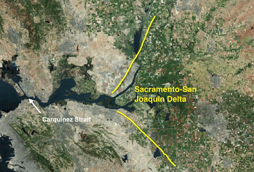
The Sacramento-San Joaquin Delta is known as a bay-head delta, which is when a delta forms at the head of a large estuary like the San Francisco Bay. When sea level was much lower during the last ice age the river met the sea at the position of the Farallon Islands. As sea level rose and the valleys that are now the Bay flooded, the river mouth moved inland to its current position. The complex topography of the Bay Area — a result of active faulting associated with the San Andreas, Hayward, and other faults — has forced the channels in the delta to come together at Carquinez Strait.