upper waypoint

Reporter's Notes: Dialing in on Traffic

Save ArticleSave Article
Failed to save article

Please try again

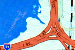
The pilot project at UC Berkeley called Mobile Millennium uses cell phones as data points to show traffic patterns in real time.

To become an early adopter of the technology, you must have an unlimited data plan on a mobile phone with a GPS system. If you have that, you can sign up here.

Project leader Alex Bayen says that it's not just a breakthrough in how we can gauge traffic, but also a scientific breakthrough – that is, it was a challenge to take random data points, some in motion, some not, and to turn them into usable traffic information. This is how Alex Bayen put it.

[jwplayer config="QUEST Audio Player" skin="http://ww2.kqed.org/quest/wp-content/themes/quest/glow.zip" file="http://www.kqed.org/.stream/anon/quest/radio3-11_DialinginTraffic_blogextra1.mp3" ]

Sponsored

And he adds that, as cell phones get more memory and more devices on them, they will become more central in our lives.

[jwplayer config="QUEST Audio Player" skin="http://ww2.kqed.org/quest/wp-content/themes/quest/glow.zip" file="http://www.kqed.org/.stream/anon/quest/radio3-11_DialinginTraffic_blogextra2.mp3" ]

The science of place-based reporting is a burgeoning field. A program at UCLA, for example, uses cell phone information to create a personal environmental risk assessment and a UC Berkeley study monitors currents in the Sacramento River.

Listen to the Dialing in on Traffic radio report online.

37.8721 -122.258

lower waypoint
next waypoint