upper waypoint

Track a Yosemite Black Bear Online? Yes, Now You Can.

Save ArticleSave Article
Failed to save article

Please try again

Yosemite National Park has worked for almost 20 years to curb human contact with bears in the park. (Ezra David Romero/Valley Public Radio)

Rangers at Yosemite National Park on Monday unveiled a unique tool aimed at reducing interactions between its population of black bears and people: a website where fans of the animals can follow their every step -- from a distance.

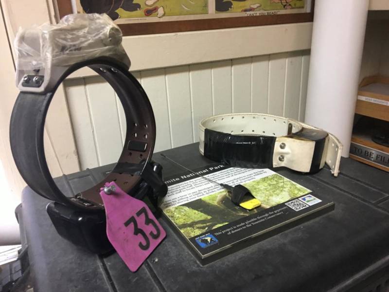
That’s possible because select bears are fitted with GPS collars showing where the animals are heading. The tracking tool pings the bears' steps from satellites, which can be followed on an interactive map on a new website, keepbearswild.org.

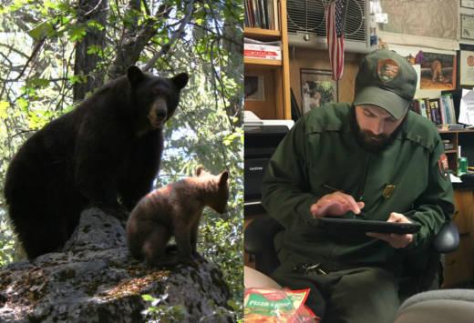
"I think people are going to be blown away," said Ryan Leahy, a wildlife biologist at Yosemite National Park who leads the project. "It's our responsibility to keep bears wild."

Rangers have already been using the data collected from the GPS tracking.
Rangers have already been using the data collected from the GPS tracking. (Ezra David Romero/Valley Public Radio)

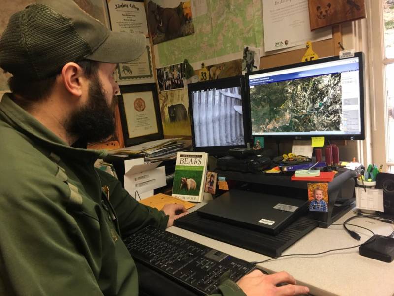
Park staff had already been using up to 20 collars on the bears, coming up with some surprising findings: They learned that the animals begin mating in May, more than a month earlier than previously thought, rangers said. And, the devices revealed that the bears travel more than 30 miles in a day or two, moving with ease up 5,000-foot canyon walls, Leahy said.

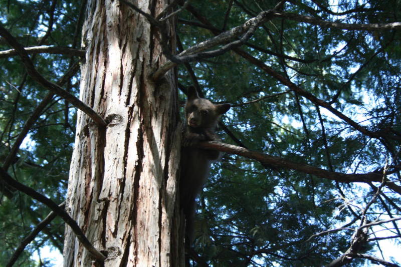
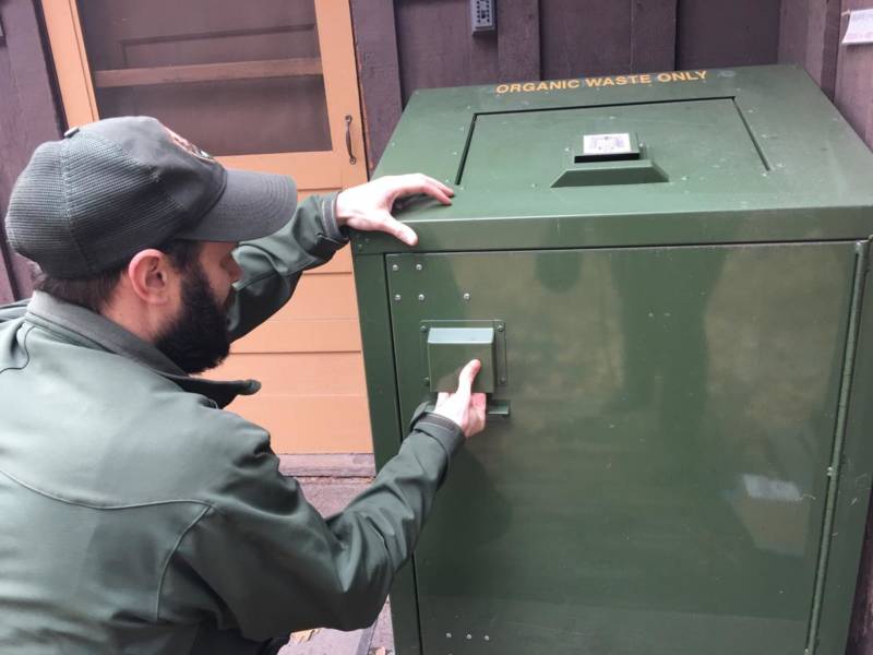
The goal of the website is to draw in the public so they know to slow down while driving and properly store food when they visit the park's towering granite cliffs, charging waterfalls and abundant wildlife, including up to 500 black bears.

A screengrab of the interactive map on keepbearswild.org is shown on April 3, 2017. Yosemite National Park debuted the service to help educate the public about black bears and threats to the animals.
A screen grab of the interactive map on keepbearswild.org is shown on April 3, 2017. Yosemite National Park debuted the service to help educate the public about black bears and threats to the animals. (keepbearswild.org)

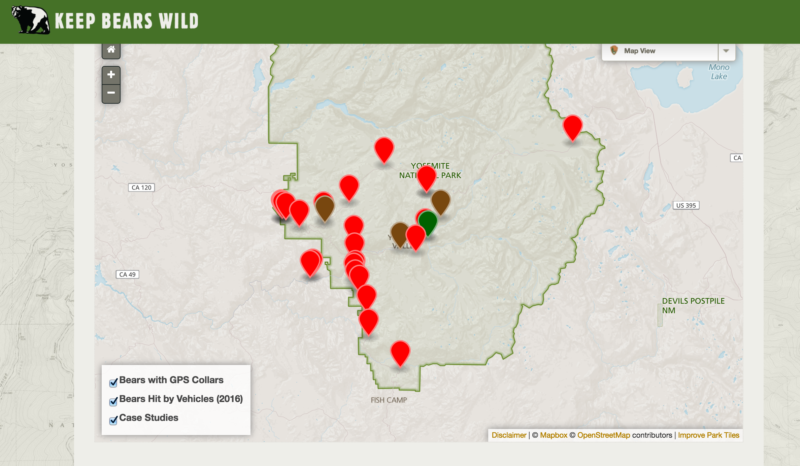
Too often, black bears — many of which are actually brown in Yosemite — are hit and killed by drivers on Yosemite's winding roads. The website shows where 28 bears were struck by cars last year, many fatally.

Sponsored

“You’re talking about 10 percent of our bears potentially being hit by vehicles each year,” said Leahy. “Just slowing down a little bit will give you that stopping distance required to prevent a collision.”

Bears are tracked using telemetry collars as well as GPS collars in Yosemite National Park.
Bears are tracked using telemetry collars as well as GPS collars in Yosemite National Park. (Ezra David Romero/Valley Public Radio)

While the new website is designed to give the public extra insight into bears' lives without interfering with them, training visitors to think this way hasn’t always been easy, said National Park Service (NPS) spokesman Scott Gediman.

In 1998, there were nearly 1,600 bear encounters where people were injured or property was damaged. Today, there are fewer than 100 such encounters each year, thanks to the Keep Bears Wild program launched almost two decades ago.

Gediman said there were so many encounters with bears because, in the park's early history, rangers managed bears very differently from today. There used to be bear feeding areas and dumps in the park where people watched bears devour piles of trash and food.

“Bleachers were even set up,” said Leahy. “Meanwhile, during this whole thing, bear conflict was starting to occur outside of these feeding shows. You’re starting to have habituating bears, bears that have lost their natural fear.”

A bear cub in Yosemite National Park.
A bear cub in Yosemite National Park. (National Park Service)

All of that human interaction taught bears to gorge on chips and trash. In turn, the adults taught their cubs to do the same. Decades later, bears still crave human food, said Leahy.

Managing the park’s current population has improved, partially thanks to technology — from the simple bear box, where you can store food, to radio telemetry collars and tags, which alert park staff when a bear is nearby.

Bear tech: From bear boxes to GPS collars.
Bear tech: From bear boxes to GPS collars. (Ezra David Romero/Valley Public Radio)

Fast forward to the GPS collars and the pilot project, which Leahy’s team has been working on for the last year to track the bears in real time on an iPad or a computer, using frequencies from the GPS-collared animals.

“Yeah, it looks like all the bears have gone into their dens,” Leahy recently said, looking at a screen showing locations of the animals. “Apparently, that last storm pushed them in.”

With the new website and map, a bear's location is delayed so people aren't tempted to track it down in real time, rangers said.

“What we want to do with this website – in a positive way before they get here – is engage people, ‘Hey, here is the real story about black bears in Yosemite National Park,’ ” Leahy said.

The Associated Press contributed to this story.

lower waypoint
next waypoint
California Preschools Wrestle to Comply With State’s Tightened Suspension RulesSan Francisco’s New Parking Rules Set to Displace RV Community Near SF StateA New Bay Area Clásico? SF's El Farolito and Oakland Roots Set to Battle in HaywardWhy Nearly 50 California Hospitals Were Forced to End Maternity Ward ServicesStunning Archival Photos of the 1906 Earthquake and FireWhat the 99 Cents Only Stores Closure Means to CaliforniansDemocrats Again Vote Down California Ban on Unhoused EncampmentsFederal Bureau of Prisons Challenges Judge’s Order Delaying Inmate Transfers from FCI DublinCalifornia Legislators Take Aim at Construction Fees to Boost HousingFirst Trump Criminal Trial Underway in New York