upper waypoint

3 Visualizations of Tuesday's Storm as It Happens

Save ArticleSave Article
Failed to save article

Please try again

Originally posted Jan. 7, 2017

I

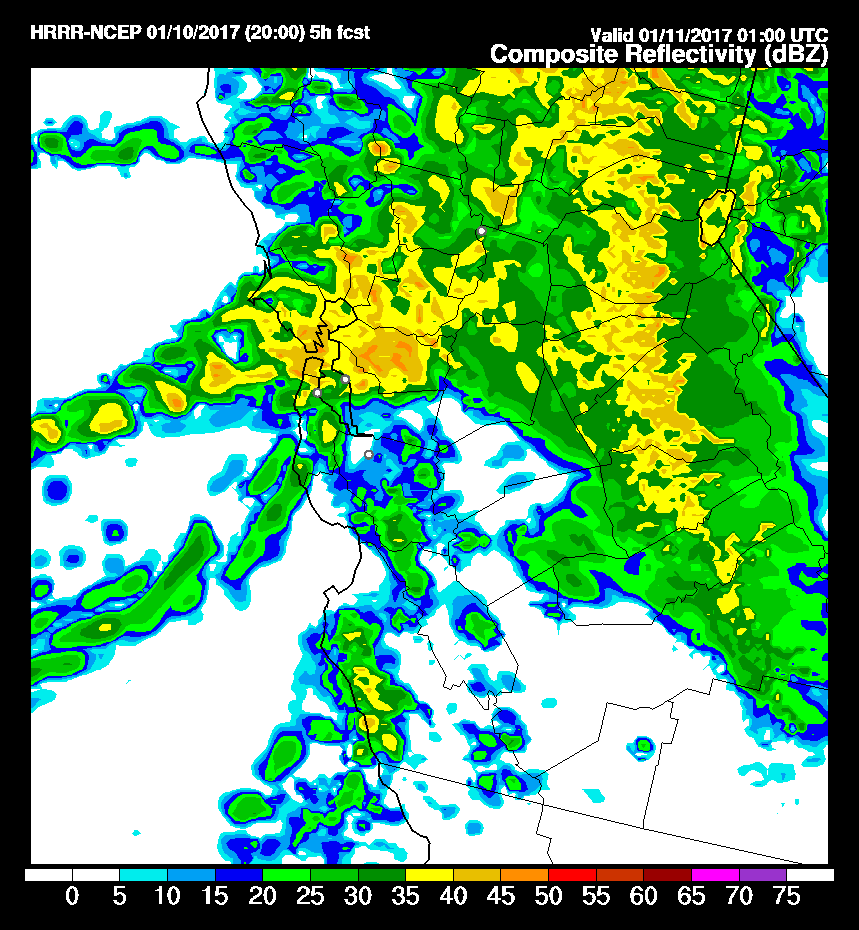
f you're obsessively following the latest rainy wallop hitting the Bay Are, here are three views that will show you the action as rendered in one case by Doppler radar and in the others by a combination of weather models, supercomputers and digital visualization geniuses.

1. San Francisco Bay Area Doppler radar, via Weather Underground: This is old hat if you're a weather watcher. For online news producers, this rendering of our regional weather radar is great because it's easy to embed and it updates every time you refresh the page.
[http_redir]


2. Earth: This is a visualization of precipitation for the next three hours based on output from the National Centers for Environmental Prediction Global Forecasting System (GFS, for short). You can find a little background on the visualization here: California's Storm: The Coolest View You Will See Today. A user tip: Experiment with the visualization. Click on the label that says "Earth" in the bottom left-hand corner, and you'll open up a menu that will give you a choice of a variety of different views -- of surface winds, for instance, or for winds at the 850-millibar level (about 5,000 feet above sea level).
[http_redir]

Sponsored


3. NCEP High-Resolution Rapid Refresh-Simulated Radar Reflectivity: Yes, this is somewhat geeky, and it's not super easy to use. But it is very cool: This is the simulated radar output for our region produced by the newish HRRR model. It's called "rapid refresh" because it's updated every hour (instead of every six, as is typical for the principal forecast models). Also unlike those models, it's an attempt to estimate weather conditions every hour for the 18 hours after each model run is completed. In effect, it's an attempt to look into the immediate future.

The image below is from HRRR's noon Tuesday run, which is the model's forecast for the 18 hours running through 6 p.m.. The image below is a rendering of what the composite radar picture may look like at 3 a.m. Sunday. That yellow and orange and red stretching from across the coast to San Francisco, the East Bay and beyond? That's a forecast for sustained heavy rain at that hour. (Note that the images are labeled in UTC, or Coordinated Universal Time, the current equivalent of Greenwich Mean Time. That's eight hours ahead of Pacific Standard Time, so 11:00 UTC is 3 a.m. PST.)

A simulated radar image from the High-Resolution Rapid Refresh weather model, depicting forecast conditions for 5 p.m. Tuesday, Jan. 10, 2017.
A simulated radar image from the High-Resolution Rapid Refresh weather model, depicting forecast conditions for 5 p.m. Tuesday, Jan. 10, 2017. (NOAA)

Here's the link to images for the first 14 hours of the noon Tuesday run. And here's the link to the page where you can find the current model run for Central California.

lower waypoint
next waypoint
Alameda: The Island That Almost Wasn’tFresno's Chinatown Neighborhood To See Big Changes From High Speed RailJust Days Left to Apply for California Program That Helps Pay for Your First HouseIn Fresno’s Chinatown, High-Speed Rail Sparks Hope and Debate Within ResidentsRainn Wilson from ‘The Office’ on Why We Need a Spiritual RevolutionCalifornia Law Letting Property Owners Split Lots to Build New Homes Is 'Unconstitutional,' Judge RulesWill Less Homework Stress Make California Students Happier?Silicon Valley House Seat Race Gets a RecountWorried About Data Brokers in California? Here’s How to Protect Yourself OnlineCalifornia Lawmakers Advance Proposal to Offer Unemployment Insurance to Striking Workers