upper waypoint

Autumn Rains Resume, With More on the Way

Save ArticleSave Article
Failed to save article

Please try again

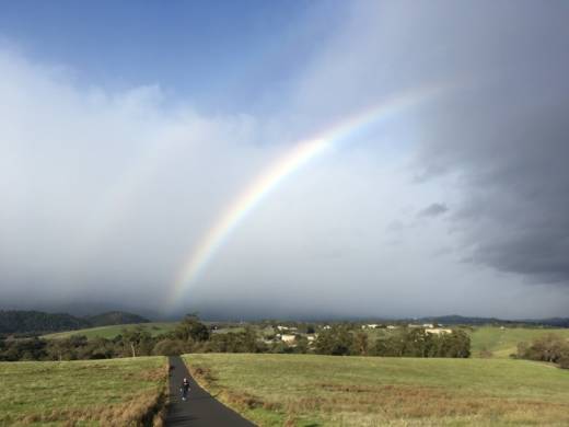
A rainbow spotted on the Stanford campus on a morning before a big storm. (Rachael Myrow/KQED)

After a very rainy October and a very dry first half of November, it's wet again throughout the Bay Area and the northern half of California. And the timing of a series of storms moving in from the Pacific could well impact holiday travel.

Much of the nine-county region got a pretty good soaking over the weekend -- ranging from 6.27 inches in the relentlessly drippy non-town of Venado, in the hills west of Healdsburg in northern Sonoma County, to 3.67 inches at Ben Lomond in the Santa Cruz Mountains, to about an inch in San Francisco, Oakland and Berkeley. Lowland locations in the South Bay got less -- generally a half-inch or less.

But that rain is past, prologue to several cold storms ready to sweep into the region. The summary:

Tuesday-Thursday: Forecasters expect rain to arrive in northern Sonoma County early this evening and get to the Golden Gate before midnight. The National Weather Service San Francisco Bay Area forecast office says rainfall will range from three-quarters of an inch in the North Bay hills to a tenth of an inch or less in inland Santa Clara County before the storm moves on by midday Wednesday.

The system is also expected to bring 3 to 6 inches of snow to the Sierra Nevada, with more over higher terrain. If you're driving, you can expect messy conditions late Tuesday through midday Wednesday along Interstate 80 and U.S. 50, the main routes to the mountain resorts and Lake Tahoe. The good news: The weather will clear up and stay dry through late Thanksgiving evening.
Sponsored

Friday-Sunday: Models suggest the second in the series of storms, the strongest of this week's disturbances, will bring rain to the region's northern reaches Friday morning, move slowly into the central Bay Area by Friday afternoon and dissipate into showery weather Saturday morning. Again, this storm will bring the heaviest rain to areas north of the Golden Gate, with 1 inch-plus totals in the North Bay hills and totals in the quarter-inch to half-inch range around the bay. Storm 2 is forecast to drop as much as a foot of snow at Donner Summit (I-80) and Echo Summit (U.S. 50).

A third, weaker storm is forecast to move in late Saturday through Sunday morning, dropping another quarter-inch or so of rain in most Bay Area locations and as much as 6 inches of snow in the Sierra. After that, models are suggesting what could be a break from stormy weather lasting well into next month.

lower waypoint
next waypoint
Cecil Williams, Legendary Pastor of Glide Church, Dies at 94State Prisons Offset New Inmate Wage Hikes by Cutting Hours for Some WorkersAllegations of Prosecutorial Bias Spark Review of Death Penalty Convictions in Alameda CountyWhy Renaming Oakland's Airport Is a Big DealNurses Warn Patient Safety at Risk as AI Use Spreads in Health CareSF Democratic Party’s Support of Unlimited Housing Could Pressure Mayoral Candidates‘Sweeps Kill’: Bay Area Homeless Advocates Weigh in on Pivotal US Supreme Court CaseSupreme Court Hears Oral Arguments in Major Homelessness CaseBay Area Indians Brace for India’s Pivotal 2024 Election: Here’s What to KnowCalifornia’s Future Educators Divided on How to Teach Reading