upper waypoint

Plan Moves Ahead to Ease Congestion and Allow Bikes on Richmond-San Rafael Bridge

Save ArticleSave Article
Failed to save article

Please try again

A bicycle and pedestrian path will be built on the upper deck of the Richmond-San Rafael Bridge. (Don McCollough/Flickr )

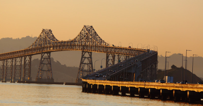
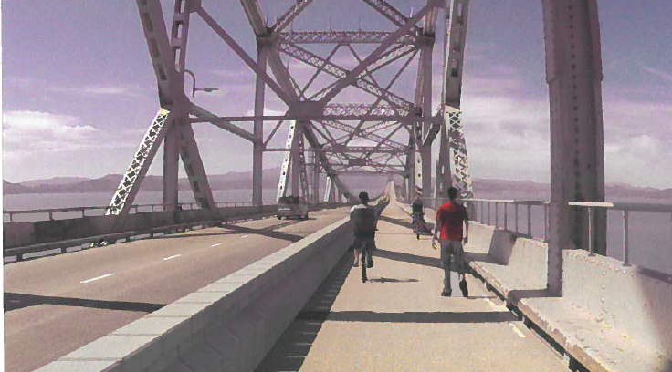
By 2017, if all goes according to plan, people will be able to bike and walk across the upper deck of the 5.5-mile Richmond-San Rafael Bridge, an idea that bike advocates have been pushing for nearly 40 years.

"It's exciting to finally see this project moving forward," says Renee Rivera, executive director of Bike East Bay. "There will be so many new opportunities that open up by having bicycle and pedestrian access to the bridge."

A Bay Area Toll Authority committee Wednesday approved $4.6 million for a contractor, HNTB Corp., to draw up a final design, which includes converting a shoulder into a third vehicle lane on the lower deck to ease congestion and delays for eastbound drivers.

The new path will fill a major gap in the Bay Trail, a 330-mile network of bicycle and pedestrian paths that will some day grow to 500 miles, and wrap around the entire bay, across all eight bridges.

Five bridges are currently accessible by bike and foot, although the Bay Bridge path currently stops before Yerba Buena Island. Officials at the Metropolitan Transportation Commission are studying building a path across the western span to San Francisco, but say it's still many years away.

A rendering of the proposed biking and walking path on the Richmond-San Rafael Bridge.
A rendering of the proposed biking and walking path on the Richmond-San Rafael Bridge. (Courtesy MTC.) (Courtesy of the Metropolitan Transportation Commission )

Rivera says bike advocates first proposed the Richmond-San Rafael Bridge path in 1978, when state officials stopped using pipes in the shoulder to carry water across during a drought. Resistance from Caltrans kept it from moving forward until a year ago, when the agency adopted new road guidelines.

Sponsored

The new path, Rivera says, is among the first projects being rolled out under those guidelines, which incorporate innovative bicyclist and pedestrian designs. She calls the path a "test case."

"Is Caltrans truly ready to start considering all users? In the case of this project, all the conversations and support so far indicates strong support from Caltrans," Rivera says.

The project, including the path and third vehicle lane, is considered a four-year pilot and would cost an estimated $74 million, money that MTC officials already have set aside. The eastbound vehicle lane would run from Sir Francis Drake Boulevard to Marine Street.

The commute for drivers has worsened, in part, because of the lack of affordable housing in Marin, Rivera explains. Many people who work in Marin live in western Contra Costa County, where rents are cheaper.

"If there was more affordable housing in Marin, we wouldn't be necessarily seeing all this congestion," Rivera says.

In addition to the bridge path, transportation officials plan to build a biking and walking trail connecting the bridge and Richmond to Point Molate.

The final design must still be approved by Caltrans.  MTC officials say they are trying to speed up the 2018 completion date for the traffic lane.

lower waypoint
next waypoint
Stunning Archival Photos of the 1906 Earthquake and FireWhy Nearly 50 California Hospitals Were Forced to End Maternity Ward ServicesDemocrats Again Vote Down California Ban on Unhoused EncampmentsFirst Trump Criminal Trial Underway in New YorkFederal Bureau of Prisons Challenges Judge’s Order Delaying Inmate Transfers from FCI DublinJail Deaths Prompt Calls To Separate Coroner And Sheriff's Departments In Riverside CountyThe Beauty in Finding ‘Other People’s Words’ in Your OwnRichmond Passes 45-Day Retail Moratorium on Tobacco to Deal With 'Excessive Smoke Shops'Despite Progress, Black Californians Still Face Major Challenges In Closing Equality GapSF’s Equity Program Fails to Address Racial Disparities in Cannabis Industry