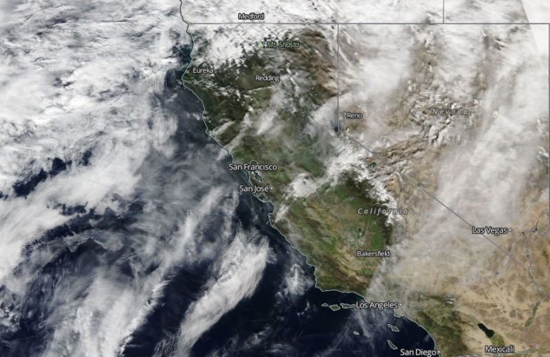
A ridge of high pressure that has kept the region dry, warm and occasionally smoggy over the past six weeks is giving way to a front that will tap into a heavy plume of moisture from the subtropics. After coming ashore late Thursday, the storm is forecast to move slowly south through the Bay Area on Friday, bringing periods of heavy rain to the entire region. Rain is expected to slacken Saturday, with a brief break in the weather before another wet storm arrives Sunday.
The NWS says the highlands of western Sonoma County will see the highest rain totals, with some ridgetop locales in the Russian River watershed getting 10 inches of rain or more from the storms.
Most of Marin and Napa counties and the Santa Cruz Mountains can expect 3 to 6 inches of rain. Bayside and valley locations will get between 1 and 3 inches, forecasters say.
What impact will the storms have on the drought?
In the larger picture -- we're in our fourth year of an acute shortage of rain and snow -- not much, perhaps. But the weather systems are expected to dump copious volumes of precipitation in the Sacramento River and Feather River watersheds, which should boost storage in the state's two biggest reservoirs, Shasta Lake and Lake Oroville. Shasta is currently at 65 percent and Oroville at 62 percent of average for this time of year.
Original post: Can you remember, without thinking about it too hard, the last time you saw rain here in the Bay Area?
For me, it was Christmas Eve, when it rained just hard enough and long enough to get water running in the Berkeley gutters. Then the sun came out, and it's been shining ever since. As most of us have heard by now, San Francisco just finished its first rainless January since record keeping started in the winter of 1849-50.
Bay Area meteorologist Jan Null notes that the dry opening month of 2015 continues the trend of recent droughty winters:
In San Francisco, where records go back the longest to 1850, it broke the record of 0.06" set all the way back in 2014! And it is noteworthy that in 2013, January had just 0.49", the 5th driest on record. This makes the average for the past 10 years just 3.03", compared to the 30-year normal of 4.50".
But why dwell on the past? The National Weather Service is now saying, with what sounds like a high degree of confidence, that we can expect rain by the end of the week. Forecasters say that the persistent ridge of high pressure -- you may know it as the ridiculously resilient ridge -- will be shoved aside, opening the way for a rich plume of moist air to flow to the coast from the subtropical Pacific. That setup, known variously as a Pineapple Express or atmospheric river, will create conditions ripe for a good shot of rain.
The weather service says the hills and mountains in Sonoma County's Russian River watershed could see 5 inches from the storm, starting Thursday night. Rain is expected to spread across the entire Bay Area by Friday morning. Rain totals will be highest just north of the Golden Gate and in the Santa Cruz Mountains, which could get 2 to 3 inches of rain. Most of the central Bay Area could get 1 to 2 inches, with the South Bay and eastern valleys getting maybe half an inch.
And Friday won't be the end of the wet weather, the weather service says: A chance of rain will continue Saturday, with another weather system arriving Sunday.
Daniel Swain, proprietor of the California Weather Blog and coiner of that "ridiculous ridge" lingo, observes that the incoming weather is the latest episode in what he calls some serious "weather whiplash" over the past several months. Here's how he summarizes the upcoming storm scenario:
As seems to have become the theme over the past few years, an intense precipitation event now appears likely to immediately follow an extraordinary dry spell across Northern California. Confidence has been growing in recent days that another extremely moist plume of subtropical moisture will take aim at NorCal during the first week in February, bringing heavy to excessive precipitation to at least the far northern part of the state.
Recent numerical model runs have been starting to shift this atmospheric river further south along the California coast, meaning that places at least as far south as the Bay Area are likely to see significant precipitation over the next 7-10 days. While there’s still quite a bit of uncertainty regarding the details of this upcoming pattern change, it’s fair to say that someone along the West Coast is going to get a serious soaking, and the focus may well be the northern 1/3 of California. Simulated rain totals for a ~7 day precip event have been very impressive for the North Coast, actually exceeding 20-25 inches of liquid in a couple of recent GFS [Global Forecast System] runs (which is about as high as I can recall having seen in a global model, though it’s possible this could be at least partly due to the recent increase in GFS horizontal resolution). Atmospheric rivers are certainly capable of delivering that kind of precipitation intensity in NorCal, but the question more than a few days out is always where exactly the associated moisture plume will come ashore–and whether it will stall out over a particular region for an extended period of time, raising flooding concerns. At this point, it’s still too early to discern the details, but given the impressively juicy airmass that next week’s storms are likely to tap into I would not be surprised if at least some portion of NorCal was dealing with some significant flood concerns within 7-10 days.
There is a dark lining in those rain-laden clouds blowing our way, though.