Ya gotta love an alert from the National Weather Service that includes the phrase, "The sun, moon and the earth are in proper alignment. ..."
It has nothing to do with astrology, of course. The NWS is warning that the gravitational force created by the configuration of these celestial orbs is going to result in king tides, starting this morning and lasting through Wednesday.
In the Bay Area, these extremely high tides begin today at 10:14 a.m. in San Francisco, reaching roughly 7¼ feet. In Redwood City, the waves will hit about 9 1/3 feet at 10:56 a.m. Other locations include Richmond, Petaluma and El Granada. Check out the map below to see locations throughout California.
Here's a schedule of dates and locations from the California King Tides Project. And here's a map that includes locations for the next three days and for the three-day king tide period of Feb 17-19.
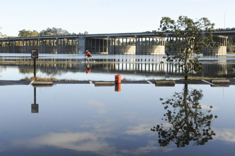
The tides could result in what the NWS is calling minor flooding of low-lying areas along the coast and bay fronts. "Coastal locations that are typically dry during high tide, such as parking lots and coastal trails, may become submerged," the NWS says. Even during low tide, be on alert for strong rip currents at the beach and breaking waves near harbor entrances.
Precautions, from the NWS:
- Do not leave your vehicle in low-lying parking lots near the coast or bay front.
- Do not travel through flooded roadways.
- If visiting the coast, avoid narrow beaches and coves where your entry and/or exit could be blocked by rising waters
Here's a 2011 video of king tide waves slopping over into the San Francisco streets just south of the Ferry Building. The boat ride was sponsored by San Francisco Baykeeper, an environmental group that wanted to draw attention to the potential effects of global warming on sea level.
“We think this is indicative of what a normal high tide will be as we start to see the effects of sea-level rise in the coming decades,” said a member of the organization at the time.