upper waypoint

Drought Photos: See Lake Oroville Fall Near Historic Low Over 20 Months

Save ArticleSave Article
Failed to save article

Please try again

At the beginning of this year, Gov. Jerry Brown declared a drought emergency throughout California.

Since then, during the third-driest water year on record, towns have started to run out of water, agencies have enacted mandatory conservation and "drought bears" have even wandered into urban neighborhoods in search of food.

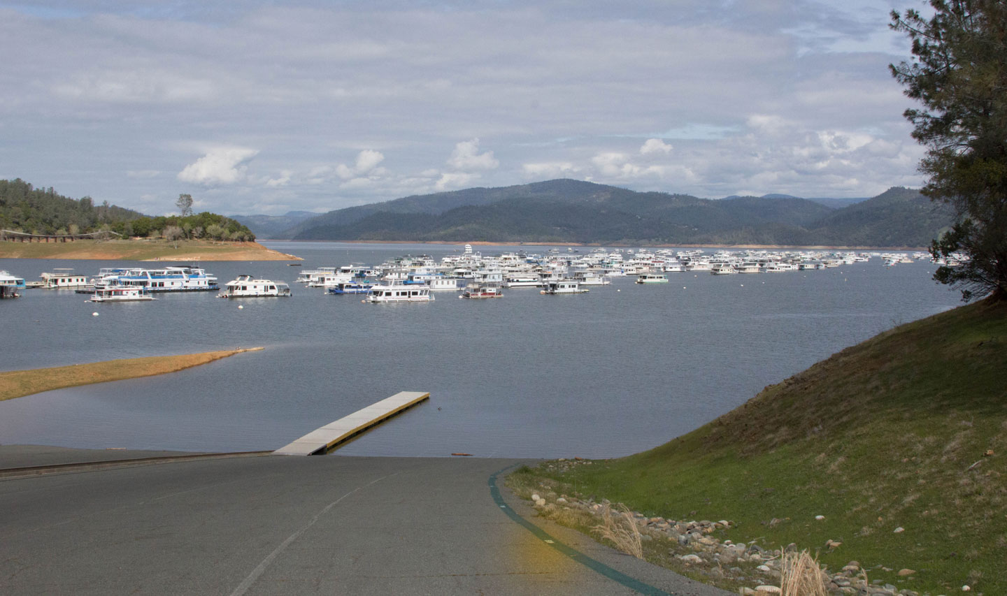
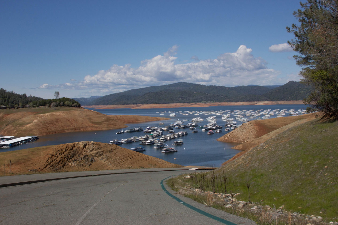
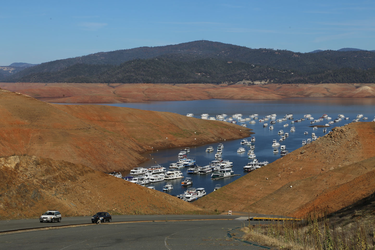
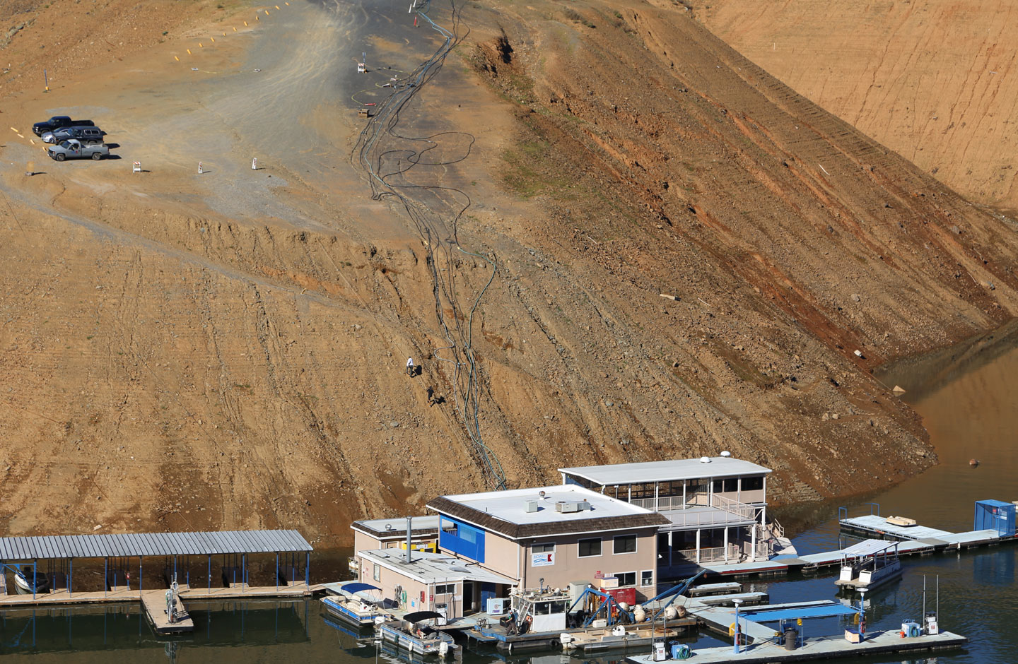
During this time, Lake Oroville, east of Chico in Butte County, has become a sort of drought poster child. It's the second-largest California reservoir after Lake Shasta, and the main reservoir for the State Water Project. Currently, the lake is only 5 feet higher than the record low recorded on Sept. 7, 1977 of 645 feet above sea level.

KQED staff have visited the reservoir several times during the last 20 months. About 16 months ago, Lake Oroville was almost at 90 percent of capacity and the Department of Water Resources was freely releasing supplies. This year, managers cut deliveries to virtually nothing, conserving as much of the reservoir supplies as possible.

In the three photos below, taken in March 2013 and April and November of this year, you can see just how low the lake's water level has dwindled to:

Sponsored

March 27, 2013: Water surface elevation 860 feet above sea level; reservoir at 83 percent of capacity.

orovillemarch2013
(Dan Brekke/KQED)

April 5, 2014: Water surface elevation 759 feet above sea level; reservoir at 50 percent of capacity.

(Dan Brekke/KQED)
(Dan Brekke/KQED)

November 8, 2014: Water surface elevation 652 feet above sea level; resevoir at 26 percent of capacity.

(Lisa Pickoff-White/KQED)

Currently the water levels are so low that people need to rappel down to their boats at Bidwell Marina. You can see the end of the normal dock above the parked cars.

The lake will continue to drop until it rains. Officials worry that if water levels fall to 604 feet they may be unable to produce power from the lake.

lower waypoint
next waypoint
California Legislature Halts 'Science of Reading' Mandate, Prompting Calls for Thorough ReviewProtesters Shut Down I-880 Freeway in Oakland as Part of 'Economic Blockade' for GazaRecall of Alameda County District Attorney Pamela Price Qualifies for a VoteCalifornia Preschools Wrestle to Comply With State’s Tightened Suspension RulesHalf Moon Bay Prepares to Break Ground on Farmworker HousingSilicon Valley Readies for Low-Simitian House Race Recount — but How Does It Work?Forced Sterilization Survivors Undertake Own Healing After Feeling 'Silenced Again' by StateHow Aaron Peskin Shakes Up S.F.’s Mayoral RaceFeds Abruptly Close East Bay Women’s Prison Following Sexual Abuse Scandalsare u addicted to ur phone