upper waypoint

News Pix: Lightning Strikes Berkeley, Gay Cowboys, and the Aftermath of the Rim Fire

Save ArticleSave Article
Failed to save article

Please try again

13567278745_520540aaf9_b
On Monday, lightning struck a redwood tree in Berkeley. Another bolt hit an Alaska Airlines flight operated by Horizon at Oakland International Airport. And in Sausalito, lightning hit another redwood tree, shattering windows at two homes. (Dan Brekke/KQED)

2014-03-29 13.29.07
A fire ravaged the historic lodge at Wilbur Hot Springs on Saturday. No one was injured, but the fire did significant damage to the popular retreat in Colusa County. The fire appeared to have started in the kitchen and spread to the second floor of the wooden 1863 structure. Owners Richard and Jolee Wilbur said in a note online that they are hoping to reopen for day-use visits and camping soon. (Zan Rubin/KQED)

rodeo
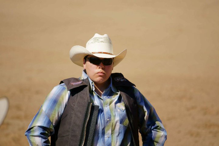
Deanna Trujillo-James is one of hundreds of competitors in gay rodeos across the country. In the small towns in the Bay Area where they sometimes compete — like the mountain town of La Honda in San Mateo County — cowboys like Trujillo-James get a lot of attention. "When we show up, people shout, 'Gay cowboys are here!' We bring in a lot of business to these small communities," she said. (Photo courtesy of Deanna Trujillo-James/Peninsula Press)

google2
Opponents of San Francisco’s tech shuttles lost an environmental appeal at the Board of Supervisors on Tuesday. Earlier that day, protesters delayed a Google bus in the Mission. (Zach Mack/KQED)


The Rim Fire burned more than a quarter-million acres last summer, including about 77,000 acres inside Yosemite National Park, leaving a stark and denuded landscape of dead trees.

Sponsored

Park closures during and after the fire crippled businesses that cater to visitors from around the world. The photo above shows the same location in the Stanislaus National Forest before the fire, and about two weeks after it. Fire scientist Scott Stephens of the University of California, Berkeley, was measuring plots and taking a timber inventory with graduate students when the fire forced them to evacuate. Stephens said when he returned to the area in late September, he had to locate it using GPS, as it had changed so much he couldn’t recognize it.

lower waypoint
next waypoint
Why California Environmentalists Are Divided Over Plan to Change Power Utility RatesWhy Renaming Oakland's Airport Is a Big DealAllegations of Prosecutorial Bias Spark Review of Death Penalty Convictions in Alameda CountyCecil Williams, Legendary Pastor of Glide Church, Dies at 94SF Democratic Party’s Support of Unlimited Housing Could Pressure Mayoral CandidatesNurses Warn Patient Safety at Risk as AI Use Spreads in Health CareBay Area Indians Brace for India’s Pivotal 2024 Election: Here’s What to Know‘Sweeps Kill’: Bay Area Homeless Advocates Weigh in on Pivotal US Supreme Court CaseCalifornia’s Future Educators Divided on How to Teach ReadingWhen Rivers Caught Fire: A Brief History of Earth Day