upper waypoint

6.8 Quake Shakes Northern California Coast; No Tsunami Threat

Save ArticleSave Article
Failed to save article

Please try again

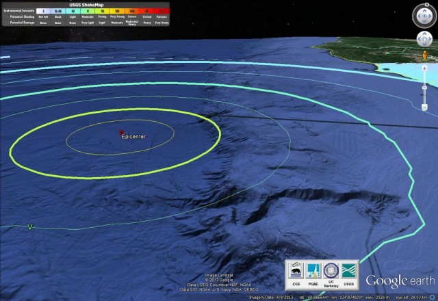
NOAA depiction of the epicenter of Sunday night's earthquake off the Humboldt County coast.

11:45 a.m. Monday Update: The U.S. Geological Survey has revised its assessment of last night's quake off the Humboldt County coast, now rating it as a magnitude-6.8 event. About 26 aftershocks have been recorded since the quake, which hit at 10:18 p.m. last night.
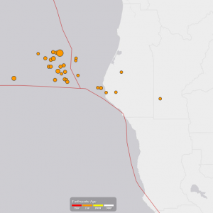
U.S. Geological Survey map showing location of Sunday night earthquake and aftershocks.

Original post, 12:10 a.m. Monday: The U.S. Geological Survey says a magnitude-6.9 earthquake struck at 10:18 p.m. Sunday night off the Humboldt County coast, about 250 miles northwest of San Francisco.

The Associated Press and Los Angeles Times both quote local officials as saying there were no early reports of damage or injuries. The California Office of Emergency Services reported, via Twitter, that as of 11:30 p.m. it had no reports of trouble from the coast.

The West Coast and Alaska Tsunami Warning Center said there is no danger of a tsunami from the quake.

The quake was centered about 40 miles west of Eureka, the largest town in Humboldt County, and was about 7.5 miles under the seafloor. The initial quake was followed by 10 aftershocks by midnight Sunday, the largest a magnitude-4.6 shake recorded at 10:51 p.m. The USGS "Did You Feel It?" public report page included a smattering of reports from as far away as the Bay Area, the northern Sierra Nevada and the Willamette Valley in Oregon. More than 2,000 reports came from communities around Humboldt Bay.

Sponsored

The offshore region is the site of the Mendocino Triple Junction, where the Gorda, Pacific and North American tectonic plates meet just north of the terminus of the San Andreas Fault.

In April 1992, a 7.2-magnitude quake, followed by 6.5 and 6.7 shocks, violently shook the coast 30 miles southwest of Eureka, causing more than 100 injuries and severe damage in several towns, including Ferndale and Petrolia.

In November 1980, a 7.2-magnitude quake centered just off the coast caused widespread damage around Eureka, including the partial collapse of a freeway overpass south of Eureka.

lower waypoint
next waypoint
Cecil Williams, Legendary Pastor of Glide Church, Dies at 94State Prisons Offset New Inmate Wage Hikes by Cutting Hours for Some WorkersAllegations of Prosecutorial Bias Spark Review of Death Penalty Convictions in Alameda CountyWhy Renaming Oakland's Airport Is a Big DealNurses Warn Patient Safety at Risk as AI Use Spreads in Health CareSF Democratic Party’s Support of Unlimited Housing Could Pressure Mayoral Candidates‘Sweeps Kill’: Bay Area Homeless Advocates Weigh in on Pivotal US Supreme Court CaseSupreme Court Hears Oral Arguments in Major Homelessness CaseBay Area Indians Brace for India’s Pivotal 2024 Election: Here’s What to KnowCalifornia’s Future Educators Divided on How to Teach Reading