upper waypoint

Marin County Reservoirs in the Drought of 2014 -- A Video Essay

Save ArticleSave Article
Failed to save article

Please try again

A small trickle of water flows from a pipe into the mostly dry spillway below Kent Lake (Mark Andrew Boyer / KQED)
A small trickle of water flows from a pipe into the mostly dry spillway below Kent Lake. (Mark Andrew Boyer/KQED)

As we said earlier this week, California's drought has entered the "what drought?" phase. After a few weeks of rain, much of the Bay Area looks like it might during any other winter, never mind that we just came through the driest 13 months since people began keeping precipitation records in this part of the world. The crisis everyone says we're in — to some extent it just doesn't look or feel real.

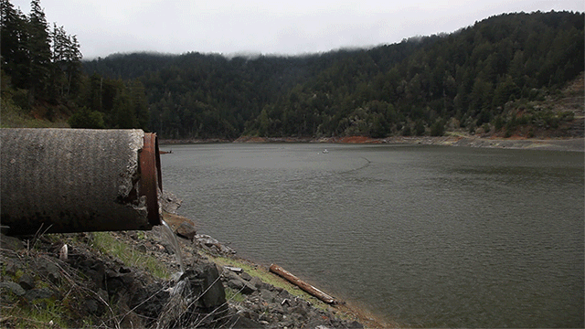
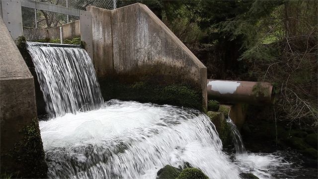
Take the Marin Municipal Water District as an example. At the beginning of February, its seven reservoirs were, collectively, just half-full. In the last five weeks, about two feet of rain has fallen at the district's Lake Lagunitas. Reservoir levels have risen to 74 percent of capacity. The district now says it believes it can make it through to next winter without mandatory rationing. And with reservoirs still well below average and the end of the rainy season approaching, the district cautions customers they're not out of the drought "danger zone" yet.

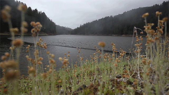
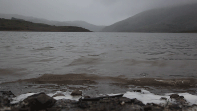
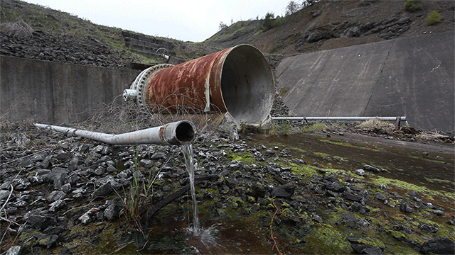
KQED News photographer Mark Andrew Boyer visited two of the district's biggest reservoirs, Kent Lake and Nicasio Reservoir, this week and brought back these brief video portraits of conditions there.

Plants blow in the wind above Kent Lake (Mark Andrew Boyer / KQED)
Plants blow in the wind above Kent Lake. (Mark Andrew Boyer/KQED)
Water trickles from a pipe leading to Kent Lake (Mark Andrew Boyer / KQED)
Water trickles from a pipe leading to Kent Lake. (Mark Andrew Boyer/KQED)
A steady cascade of water is released below Peters Dam (Mark Andrew Boyer / KQED)
A steady cascade of water is released below Peters Dam. (Mark Andrew Boyer/KQED)
Rain clouds collect over Nicasio Reservoir (Mark Andrew Boyer / KQED)
Rain clouds collect over Nicasio Reservoir. (Mark Andrew Boyer/KQED)
Water laps on the northwest shore of Nicasio Reservoir (Mark Andrew Boyer / KQED)
Water laps on the northwest shore of Nicasio Reservoir. (Mark Andrew Boyer/KQED)

Sponsored

lower waypoint
next waypoint
Stunning Archival Photos of the 1906 Earthquake and FireCould Protesters Who Shut Down Golden Gate Bridge Be Charged With False Imprisonment?Why Nearly 50 California Hospitals Were Forced to End Maternity Ward ServicesSan Francisco Sues Oakland Over Plan to Change Airport NameFederal Bureau of Prisons Challenges Judge’s Order Delaying Inmate Transfers from FCI DublinDemocrats Again Vote Down California Ban on Unhoused EncampmentsFirst Trump Criminal Trial Underway in New YorkAlameda County DA Charges 3 Police Officers With Manslaughter in Death of Mario GonzalezDeath Doula Alua Arthur on How and Why to Prepare for the EndDespite Progress, Black Californians Still Face Major Challenges In Closing Equality Gap