What lessons can be learned from this summer’s historic Rim Fire, which burned for weeks in and to the west of Yosemite National Park? As Lauren Sommer of KQED Science reported recently, scientists are looking at more than 400 square miles of charred Sierra Nevada forest to find out.
The immediate reality of the fire’s aftermath is stark. Researchers at the UC Davis Center for Watershed Sciences have been exploring what they call “the apocalyptic terrain” left behind by the fire, the third-largest fire in the state since modern record-keeping began in the 1930s. Here’s an audio slideshow that recounts a recent hike into the burn zone.
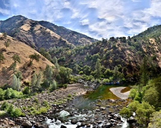
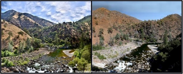
This week, the center published beautiful before-and-after views of one part of the Rim Fire landscape: the place where the Clavey River joins the Tuolumne. The center’s version — here it is again — includes a nifty slider so you can seamlessly compare every aspect of the scene. Alas, the slider version is not embeddable, and your blogger lacks the coding chops to put it together here. But check out the center’s site. The separate before and after shots are below.
Before: