upper waypoint

First Major N. Calif. Storm Sequence of the Season Looks Like a Gully Washer

Save ArticleSave Article
Failed to save article

Please try again

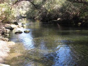
Putah Creek in Yolo County. Forecasters advise keeping an eye on streams for potential flooding. (Photo: Craig Miller)

All aboard the Pineapple Express!

Forecasters are telling us to prepare for high winds and heavy rainfall over the next several days. A line of Pacific storms is set to sweep through Northern California starting tonight. By the time it moves through on Sunday, it could go down as a major weather event.

There might not be much in this for skiers--or the Sierra snowpack, which ended last season on the thin side.

“Snow won't be a major concern,” says Johnnie Powell, a forecaster for the National Weather Service in Sacramento. “Snow levels are going to be above 7,000 feet, so it's a very warm storm in nature.” (Snow elevations could start out at the 5,000-6,000-foot level but then "quickly rise" to 7,000 or higher.)

And it’s a wet one. Powell says the stage is set for what forecasters call the "Pineapple Express," a series of systems that pick up moisture from the tropics and dump it on our doorstep. In its most extreme form, meteorologists refer to these as “atmospheric rivers.” Some lower elevations could see seven inches of rain through Sunday, with as much as 18 inches possible in the mountains -- that's more than a foot of rain, spaced out mercifully over several days.
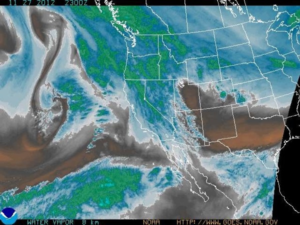
NOAA satellite image shows water vapor (white areas) swirling toward California.

“The biggest concern of all is where we had the fires during the summer,” says Powell. “They may have some debris flooding in some areas near the fires, because they just don't have the right soil [conditions].”

Sponsored

California’s Emergency Management Agency has issued a warning, saying, “local power outages are possible as a result of downed trees from gusting winds. Small stream flooding is also likely with weir overflow and runoff.” Weirs are gates that separate rivers from designated flood bypasses. The Weather Service says some reaches of the northern Sacramento River could overflow into bypasses during this event, which will arrive in waves.

CalEMA went on to warn that “it's critical that the public take a personal interest in preparing for this storm, and the storms that will follow throughout the winter season."

It’s still unclear what sort of wet season we’ll have overall. The usual signals from the Pacific Ocean are mixed. But these storms will help key reservoirs, many of which are below normal levels for this time of year.

Tips for storm preparedness are posted at the CalEMA website.

lower waypoint
next waypoint
California Preschools Wrestle to Comply With State’s Tightened Suspension RulesSan Francisco’s New Parking Rules Set to Displace RV Community Near SF StateA New Bay Area Clásico? SF's El Farolito and Oakland Roots Set to Battle in HaywardWhy Nearly 50 California Hospitals Were Forced to End Maternity Ward ServicesWhat the 99 Cents Only Stores Closure Means to CaliforniansDemocrats Again Vote Down California Ban on Unhoused EncampmentsCalifornia Legislators Take Aim at Construction Fees to Boost HousingBay Area Diaspora Closely Watching India’s Upcoming ElectionJail Deaths Prompt Calls To Separate Coroner And Sheriff's Departments In Riverside CountyFederal Bureau of Prisons Challenges Judge’s Order Delaying Inmate Transfers from FCI Dublin