upper waypoint

3.6 East Bay Quake Felt Throughout Region

Save ArticleSave Article
Failed to save article

Please try again

If you think you felt an earthquake at 7:05 p.m. in the Bay Area, you did. The U.S. Geological Survey reports that it was magnitude 3.6 tremor with an epicenter just outside the northwest Contra Costa County town of Hercules.

Note: The 3.6 shake was 65 minutes past the time, and much less Rapture-causing, than the earthquake predicted for this evening by radio evangelist Harold Camping.

Links
U.S. Geological Survey: Magnitude 3.6, San Francisco Bay Area, California
U.S. Geological Survey: 'Did You Feel It?' event page
KQED News Fix: At Harold Camping's Family Radio, It's Business as Usual on Air
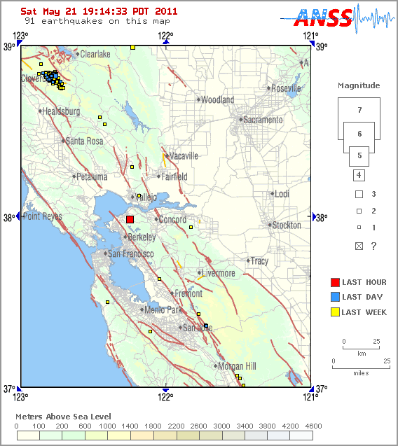
U.S. Geological Survey locator map of May 21, 2011, earthquake epicenter.

Sponsored

lower waypoint
next waypoint
California Legislature Halts 'Science of Reading' Mandate, Prompting Calls for Thorough ReviewProtesters Shut Down I-880 Freeway in Oakland as Part of 'Economic Blockade' for GazaForced Sterilization Survivors Undertake Own Healing After Feeling 'Silenced Again' by StateHalf Moon Bay Prepares to Break Ground on Farmworker HousingHow Aaron Peskin Shakes Up S.F.’s Mayoral RaceSilicon Valley Readies for Low-Simitian House Race Recount — but How Does It Work?Recall of Alameda County District Attorney Pamela Price Qualifies for a VoteFeds Abruptly Close East Bay Women’s Prison Following Sexual Abuse ScandalsTesla to Lay Off 10% of Workforce Amid Sluggish Salesare u addicted to ur phone