upper waypoint
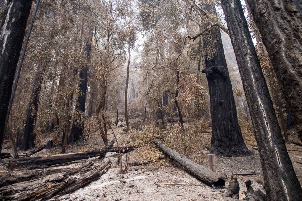
Redwood trees after the CZU Lightning Complex wildfires burned much of the area at Big Basin Redwoods State Park on Sep. 10, 2020. Beth LaBerge/KQED
Redwood trees after the CZU Lightning Complex wildfires burned much of the area at Big Basin Redwoods State Park on Sep. 10, 2020. (Beth LaBerge/KQED)

Evacuation Orders Issued for Santa Cruz Burn Areas as Big Storm Approaches

Evacuation Orders Issued for Santa Cruz Burn Areas as Big Storm Approaches

Save ArticleSave Article
Failed to save article

Please try again

The Bay Area and a wide swath of California are about to get a very wet, windy, cold reacquaintance with winter.

After a season that's featured little rain and long stretches of unseasonably warm weather, the National Weather Service says a storm rolling into the region Tuesday afternoon will bring periods of heavy rain and high winds to the entire Bay Area.

The storm, fueled in part by an atmospheric river wafting across the Pacific, could bring a prolonged deluge to areas burned by last year's epic wildfires.

The potential for massive debris flows in the fire zones led officials in Santa Cruz County to issue mandatory evacuation orders early Monday to about 5,000 people living in flood-prone areas near the CZU Lightning Complex burn scar.

Brian Garcia, warning coordination meteorologist with the National Weather Service's Bay Area office in Monterey, said Monday that areas in the Santa Cruz Mountains could get a foot of rain.

"The message I want to really drive home for people is if you are in an area that is on or near a burn scar and your county has put you on an evacuation warning or an evacuation order, take that seriously," Garcia said.

Santa Cruz County has set up temporary evacuation points at San Lorenzo Valley High School in Felton, Scotts Valley Community Center in Scotts Valley and Pacific Elementary School in Davenport. The county has also set up a call center at (831) 454-2181.

Garcia emphasized that residents of the southern Bay Area and Santa Cruz County, as well as areas of Monterey and San Luis Obispo counties, will need to remain vigilant through the end of the week.

"This is not just a Tuesday night into Wednesday event," Garcia said. "This is an extended, prolonged event that will be with us well into Thursday and it probably won't be until Thursday night that we see some relief from the rain."

Flash flood watches are also in place for other areas that burned during the summer, including: areas in an around the LNU Complex in Sonoma, Napa, Solano and Yolo counties; near the SCU Complex in eastern Alameda and Santa Clara counties and into neighboring San Joaquin, Stanislaus and Contra Costa counties; and the Glass Fire in Napa and Sonoma counties.

On Monday night, additional evacuation warnings were issued for parts of San Mateo County.

Sponsored

In addition to a big jolt of precipitation, the storm will hit the region with high winds for the second time in two weeks. This time, they will blow from the south, with many areas experiencing sustained wind speeds of 20 to 30 mph. Higher elevations could see gusts in the 50 mph to 70 mph range. Forecasters warn that could topple trees over a wide area and lead to extensive power outages.

Outside the Bay Area, the storm is also expected to bring a thick blanket of snow to much of Northern California, from the upper Sacramento Valley through the Sierra foothills to the high country above Lake Tahoe. As much as two feet of snow is forecast in foothill areas, with up to three feet on the shore of Lake Tahoe and seven feet at the highest mountain elevations.

more coverage

The weather system is forecast to begin moving across Sonoma County early Tuesday afternoon and then move steadily south through the Bay Area. Several hours of heavy rain and high winds are expected to accompany the passage of a cold front late Tuesday night and early Wednesday morning. At that point, the storm may ease in the northern and central Bay Area, with sunny periods possible during the day Wednesday.

But the onslaught is forecast to continue in areas to the south as the storm slows and the main plume of the atmospheric river moves slowly down the Monterey County coast to around San Luis Obispo, then shifts slowly back north to near Santa Cruz.

Even with the welcome soaking expected through the end of the week, virtually all of California will remain in a serious seasonal precipitation deficit.

Jan Null, a consulting meteorologist and veteran of the National Weather Service, points out that San Francisco has gotten only about one-quarter of its "normal" rainfall to date.

"Even if we double San Francisco's rainfall this week, we're going to go from 26% of normal to 50% of normal," Null said. He added that even with this week's storm, regional rainfall totals for the month of January will also wind up below average.
lower waypoint
next waypoint
Pro-Palestinian Protests Sweep Bay Area College Campuses Amid Surging National MovementAt Least 16 People Died in California After Medics Injected Sedatives During Police EncountersCalifornia Regulators Just Approved New Rule to Cap Health Care Costs. Here's How It WorksState Court Upholds Alameda County Tax Measure Yielding Hundreds of Millions for Child CareYouth Takeover: Parents (and Teachers) Just Don't UnderstandSan José Adding Hundreds of License Plate Readers Amid Privacy and Efficacy ConcernsViolence Escalates in Sudan as Civil War Enters Second YearCalifornia Law Letting Property Owners Split Lots to Build New Homes Is 'Unconstitutional,' Judge RulesSF Emergency Dispatchers Struggle to Respond Amid Outdated Systems, Severe UnderstaffingWomen at Troubled East Bay Prison Forced to Relocate Across the Country