All that rain and snow has pulled most of the state out of serious drought for the time being, and shifted attention to the existential threat of flooding. In March, Gov. Gavin Newsom eased some drought restrictions. But water constraints will continue to affect certain parts of the state, even those threatened by flooding. Most of the state’s wells for monitoring groundwater are still below normal levels.
“Even though we have this extraordinary snowpack, we know that the droughts are getting deeper and more frequent, and that means we have to use water efficiently, no matter what our hydrologic conditions,” said Karla Nemeth, director of the Department of Water Resources. “It is possible that … there will be simultaneously water supply challenges that come along with drought, but also water supply challenges that come along with very, very significant flooding.”
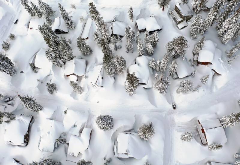
Climate change will make California’s precipitation levels more extreme. Last year, April snowpack was at 35% of average. This year, statewide automated snow sensors logged April 1 snowpack at 237% of average, higher than any other year since those sensors were installed in the 1980s, the Department of Water Resources said on Monday. As it melts in the spring and summer, the huge snowpack could send a deluge of water to parts of the state already overwhelmed with flooding and the effects of recent storms. Officials are preparing for disaster.
The Central Valley, which is home to millions of people and, as a region, grows a significant amount of the country’s food, is particularly vulnerable. A lake once considered the largest body of freshwater west of the Mississippi that’s been dry for decades has returned, flooding more than 10,000 acres of farmland; Tulare Lake has reappeared in past flood years, but on Monday, the Department of Water Resources said it was forecasting record-breaking spring snowmelt in the Tulare Lake region, including upwards of 422% of average runoff in one river watershed in the region.
Floods have already breached California levees that protect communities and farmland. California needs to devise both long-term and short-term solutions for climatic and hydrologic extremes, said José Pablo Ortiz Partida, a senior water and climate scientist at the environmental advocacy group the Union of Concerned Scientists.
“The short term is protecting those communities that are likely to get flooded,” Ortiz Partida said, adding that long-term planning should include efforts like restoring floodplains to let water flow and recharge underground supplies before it creates damage. California’s historic system of levees, dams and reservoirs controls where the state’s water is able to travel.
The Department of Water Resources’ Flood Operations Center “will remain on the ready” as melting begins, said Jeremy Arrich, manager of the department’s Division of Flood Management. How quickly the snow melts and flows to lower elevations will depend on spring temperatures as well as soil conditions — saturated soil and burned soil can contribute to runoff because the ground cannot absorb water. Scientists are also concerned about further rainstorms, which could spur faster melting if they creep into the mountains.
Based on current measurements, the snowpack’s snow-water content is greatest in the central and southern Sierra. Some northern parts of the state remain in drought, as do some areas along the border with Arizona and Nevada. California has been measuring snowpack since 1910 and has added sensor-driven measurements as well as aerial snow observations.
As of April 1, California’s water managers shifted from monitoring snow to monitoring runoff, using data and measurements to determine when and how much water will drain into certain parts of the state. Snow surveys usually begin in January and end in April. This year, officials also plan to conduct snowpack measurements in May.
“It is truly an extraordinary moment, but we don’t get to stop and enjoy that for too long. We are absolutely very focused on public safety and flood protection,” said Nemeth. “Much more work to be done to adapt to our new climate realities.”
Inside Climate News is a nonprofit, independent news organization that covers climate, energy and the environment. Sign up for the ICN newsletter here.