upper waypoint

Geological Side Trips from Interstate 80: Through Folsom to Loomis

Save ArticleSave Article
Failed to save article

Please try again

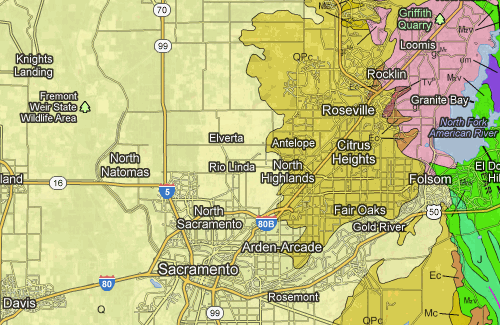
You could crawl through Sacramento during rush hour on your way to (or from) Reno and Tahoe, or you could take a 36-mile side trip through water, history, greenery and geology in the granite lands and early gold country of Folsom. Here's the route as it appears on Google Maps.

folsommap

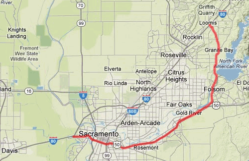
To make this side trip, turn off I-80 just west of Sacramento onto US 50. This point is the western end of US 50; you can stay on that historic route past South Lake Tahoe and across Nevada to reach the Atlantic at Ocean City, Maryland.

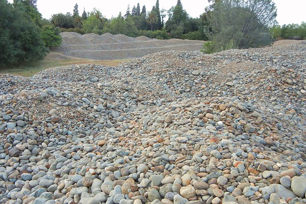
Route 50 starts at sea level and stays on the level ground of the Central Valley, following the American River toward the mountains. Twenty miles later you've climbed just 130 feet. All of the ups and downs of the road are related to interchanges and overcrossings, not topography. You won't see it from the highway, but most of the ground is gravel tailings, piled up over decades of gold mining in the bed of the American River. The river course is open to the public in Sacramento County's American River Parkway.

At Hazel Avenue, 21 miles into the drive, exit and turn left (just above the "E" in Gold River on the map). It's a few hundred yards to the Nimbus Fish Hatchery, which has been here since the 1950s. You can tour the hatchery, or you can sit and watch the river flow. The last dam on the river, the relatively low Nimbus Dam, is just to the east.

Nimbus Fish Hatchery
Photos by Andrew Alden

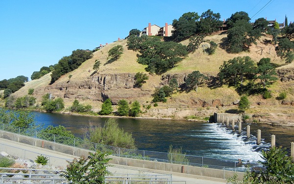
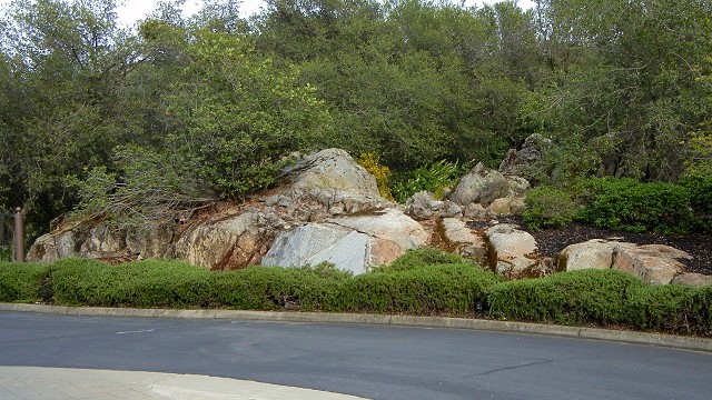
And here we finally have topography, and rocks. The rock in the cliffs is mapped as the Turlock Lake Formation, which consists of sandstone and siltstone about a half million years old. At that time the rising Sierra Nevada was shedding this sediment in vast fan-shaped aprons up and down the eastern Central Valley. The wonderful fossil beds of the Fairmead Landfill site, down by Chowchilla, are in this formation, but no one has reported anything like that around here.

Sponsored

Return to US 50, go east another mile, and take Folsom Boulevard north. Now let's look at the geologic map of the route (derived from the State Geologic Map).

folsomgeomap

The Turlock Lake Formation makes up most of the area marked QPc, and the pink area is granite. That's what you'll see in the northern half of this side trip, between the towns of Folsom and Loomis. But first you pass a high pile of clean boulder gravel, two miles from US 50.

folsomgravel

This is just a tiny bit of the tailings left behind by the gold syndicates, much of it over a century ago. Pull over if you can and climb on it. Folsom began as a gold-rush town, and if you have the time there's a lot of history to explore. Along here you'll also catch glimpses of the sprawling, monumental Folsom Dam, built in the 1950s for flood control and power generation. Folsom Lake behind it is a major outdoor asset for the capital region. There are several opportunities along the route to visit the lake and wet your feet in Folsom Lake State Recreation Area.

North of Folsom, the road will take you all the way to Auburn if you like, but we'll leave it at the town of Granite Bay and take Laird Road north to I-80 at Loomis. This is the pleasant, green part of the drive. By now you've surely noticed the abundant granite boulders and outcrops. They're all part of the Rocklin Pluton.

folsom-granite

This is the same rock that makes up the High Sierra, but here it's humble and charming instead of grand and rugged. If it were lifted up three miles and sculpted by erosion for a few million years, it would look like Yosemite. The Rocklin Pluton is an outlier, far to the west of most Sierran granitic intrusions. Its high-quality stone, so convenient to rail and river shipping, was first quarried early during statehood and has been used in public buildings and industrial infrastructure ever since. To get deeper into the subject, once back on I-80 you can take the next exit, Penryn Road, and visit the old Griffith Quarry.

lower waypoint
next waypoint