upper waypoint

Richard Misrach’s Cancer Alley: Documenting the Poisoning of America’s Wetland

Save ArticleSave Article
Failed to save article

Please try again

"Cypress Swamp, Alligator Bayou, Prairieville, Louisiana" (negative 1998, print 2012) Injet print by Richard Misrach. High Museum of Art, Atlanta.

In February 1970, in a special message to Congress, President Nixon served notice that American corporations had laid waste to the country’s land, air and water resources long enough. “We in this century have too casually and too long abused our natural environment. The time has come when we can wait no longer to repair the damage already done.”

Before the year was out, Congress authorized the Environmental Protection Agency to establish and enforce standards to protect the environment. Forty-three years later, it’s hard to think of a place where that mission has failed more miserably than Louisiana’s Cancer Alley.

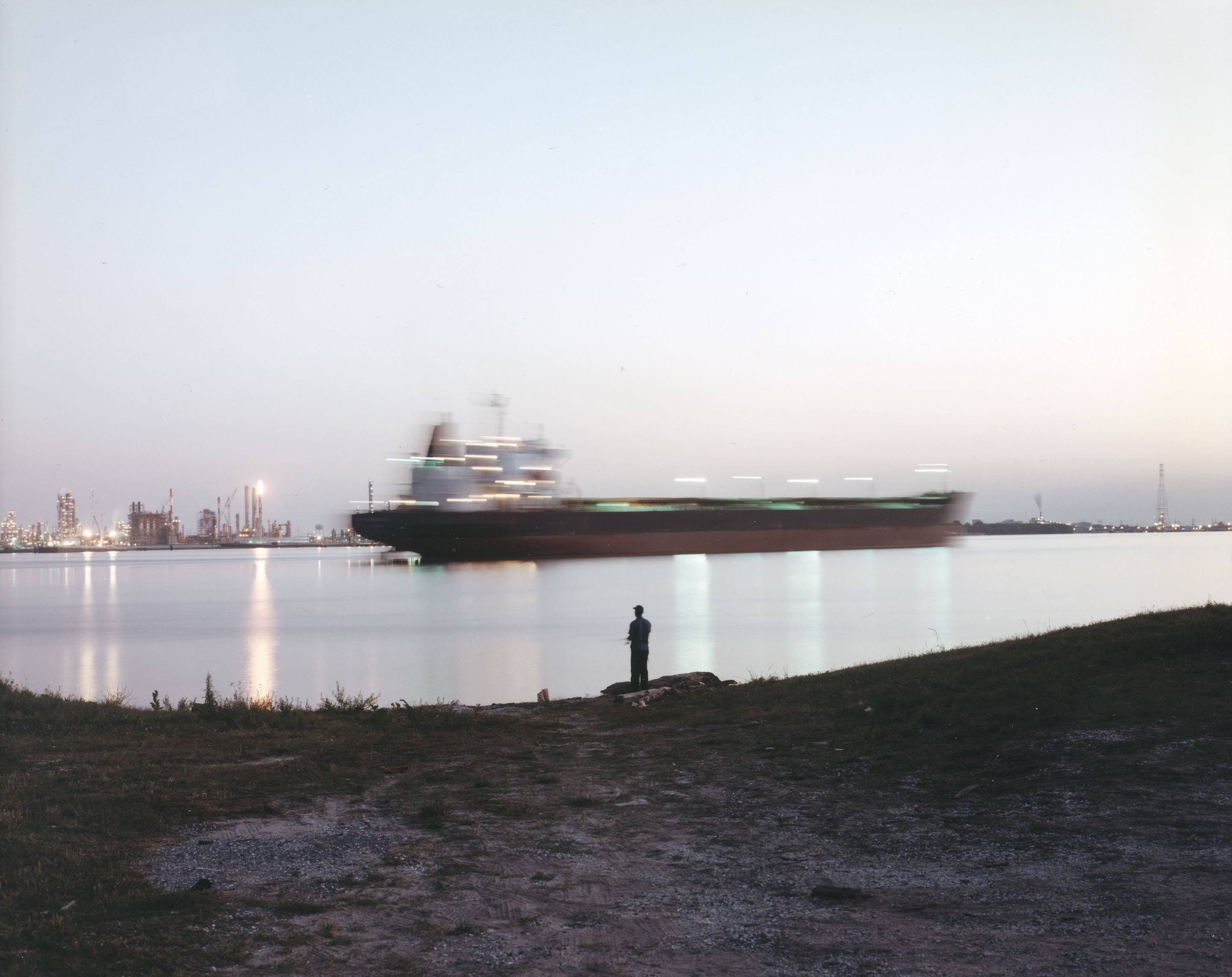
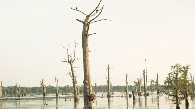
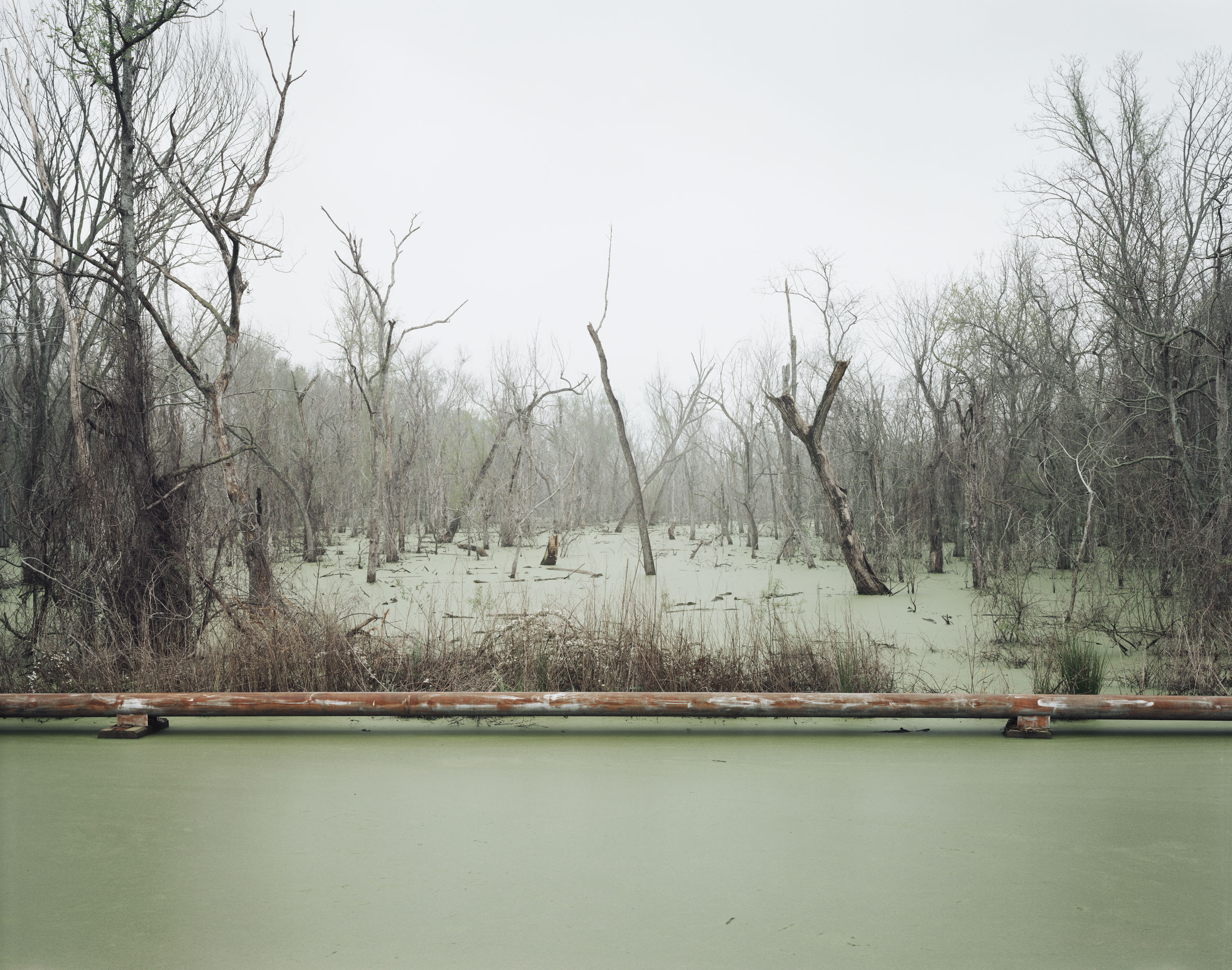
For the 85 miles between Baton Rouge and New Orleans, the haunting swamplands of the Mississippi River corridor—called America’s wetland for its biological value to the nation—bump up against the sprawling refineries and paraphernalia of the petrochemical industry. Industry leaders call this stretch of the Mississippi, sandwiched between 150-plus oil and gas plants on both sides of its devastated banks, Chemical Corridor. But locals—who blame the millions of pounds of toxic chemicals pouring out of industry smokestacks every year for high rates of miscarriages, cancer, respiratory ailments and other serious diseases—have another name for it. They call it Cancer Alley.

In 1998, Richard Misrach went to Cancer Alley to produce a series of photographs for an exhibition commissioned by Atlanta’s High Museum called “Picturing the South.” Misrach, known for penetrating portraits of human disturbances of the natural landscape, returned last year at the High Museum’s request. The museum displayed his new photos alongside the old series last year.

"Swamp and Pipeline, Geismar, Louisiana" (negative 1998, print 2012) Inkjet print by Richard Misrach. High Museum of Art, Atlanta.

Now you can see what’s changed—or not—in “Revisiting the South: Richard Misrach’s Cancer Alley” at Stanford University’s Cantor Arts Center.

Sponsored

Like any great artist, Misrach mines the troubles of his times—in this case, environmental devastation wrought by an petroleum-based economy—to raise broader questions of human existence. As you walk among the large-format photos, most measuring 6 feet by 5 feet, it’s hard not to get drawn into the destruction. Their imposing presence echoes the scale of the waste and brings us in intimate contact with it. Now that we see the consequences of our dependence on oil, what will we do to restore what’s been lost? If we do nothing to repair this ecological ruin, are we as guilty as the polluters?

I seemed to find my answer in “Holy Rosary Cemetery and Dow Chemical Corporation (Union Carbide Complex), Taft, Louisiana,” (1998): Dark clouds linger heavily over an industrial facility that serves as backdrop to a cemetery that once adjoined a church. But it is Jesus looming on the cross that catches your eye. Is he paying for our environmental sins? In the photo’s label, Misrach notes, “Dow (which now owns the complex) leaked 26,720 pounds of vaporized ethyl acrylate (EA), a Class II toxic air pollutant, into the atmosphere. No fine was levied, but Dow has pledged a $100,000 contribution to the Surpriya Jindal Foundation for Louisiana’s Children…).

"Night Fishing, Near Bonnet Carre Spillway, Norco, Louisiana" (negative 1998, print 2012) Inkjet print by Richard Misrach. High Museum of Art, Atlanta.

Most residents of Cancer Alley are poor and African American. Misrach makes sure you don’t miss the legacy of racism that has long plagued these communities, with “Restored Slave Cabins, Evergreen Planation, Edgard, Louisiana” (1998) and “Tour Guide, Nottoway Plantation, White Castle, Louisiana” (1998), showing an African American woman peering through the window in the grand foyer of an old plantation. Here, plantations persist among the petrochemical plants, and the specter of past injustices hovers over modern human rights violations, where all communities do not receive equal protection from environmental hazards.

There is no doubt that Cancer Alley is one of the most polluted regions in the United States. Less clear is what explains the high rates of cancers afflicting the community. It’s notoriously difficult to link cancer clusters to any particular exposures. Misrach seems to capture that ambiguity in several photographs—a hazardous waste site, a parking lot and a pipeline above a murky river, all shrouded in a dense haze. Is the haze just fog or is it a toxic chemical cloud?

In some cases, labels remove any doubt what the haze is meant to imply. In “Hazardous Waste Containment Site, Dow Chemical Corporation, Mississippi River, Plaquemine, Louisiana” (1998), you’ll learn: “Between 1958 and 1973 Dow buried forty-six thousand tons of toxic waste in unlined pits that now cover more than thirty underground acres. The company attempts to pump the waste back to the surface before it reaches the drinking water aquifer for the city of Plaquemine.”

You’ll leave wondering how anything could survive a decades-long onslaught of toxic releases into the land, air and waterways in such a concentrated area—and how the EPA could allow the poisoning to continue for so long in such an ecologically sensitive area with a long history of racial injustice.

Revisiting the South: Richard Misrach's Cancer Alley: Photographs. Through June 16. Cantor Arts Center, Stanford University, Stanford. (650) 723-4177.

lower waypoint
next waypoint