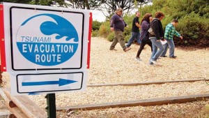
I attended a talk last night given by California's tsunami czar. She's a Sacramento geologist named Cindy Pridmore who works in the California Geological Survey, doing outreach activities around tsunamis and earthquakes. She reviewed some of the work that state and local governments have been doing since the tsunami that Japan sent us on March 12, 2011.
Most of us probably recall that while the tsunami caused horrific death and damage in Japan, by the time it reached our shores about 10 hours later it felt more like a reason to go sightseeing. Indeed, Pridmore reminded us, the single California fatality was the drowning of a man who went down by the Klamath River to shoot pictures. Even in that well-known fact there was a deeper significant detail: the body was recovered hundreds of miles north, carried there against the prevailing ocean currents by the tsunami's hydrological chaos. Tsunamis, even little ones, are nothing to mess with.
The relatively minor effects of California's tsunami included strong riptides and unusual currents rather than the black seas of death that visited Japan, yet that day the state counted up $100 million in damages to boats and harbor facilities. As the tsunami waves continued to ricochet around the Pacific and the tides came and went, California coastal communities felt the effects all that day and the following night. Tsunamis are not quick, one-shot events.
Last year we were lucky that barely a week before the great Tohoku earthquake, state agencies had set up tsunami observing teams assigned to different parts of the coast. The teams had worked out safe places to stand, lists of observations to make and the right phone numbers to call. Their information helped guide the state's immediate response and documented damages that helped coastal counties qualify for federal disaster assistance. Afterward, state workers collected all the camera footage they could gather from Coast Guard helicopters, broadcasters and amateurs. This data trove continues to be studied to help rebuild smarter and improve responses. Tsunamis can be mitigated and learned from.
The March 2011 tsunami uncovered some unforeseen problems. Spanish speakers, for instance, were not well served with information, and many of them fled unnecessarily for miles from the coast. Media reports misinterpreted tsunami "warning" announcements as "advisories," whereas warnings are actually the highest level of alert. Harbormasters had trouble with some boat owners desperate to leave the harbor after the safe cutoff time—Pridmore told of one scoffer who came back, chastened, after narrowly escaping death and now tells his cautionary tale to boating audiences. Tsunamis can be dealt with through public education and well-founded rules.