
Many Bay Area residents and visitors don’t realize the extent of our estuary’s connection outside of the Bay Area. It's the largest estuary on the West Coast of North America fed by ocean tides and tendrils of fresh water stretching east to the Sierras and north nearly to the Oregon border. Envisioning the watershed of San Francisco Bay is like constructing nesting dolls out of the landscape. Small watersheds are formed by creeks and drainages surrounding the bay, delivering surface runoff from the land and streets to the estuary. Larger creeks, like Coyote Creek, Alameda Creek, and the Napa River form larger watersheds that incorporate the small creeks. But our estuary also drains a much larger land mass. The delta brings water to the bay from nearly half of our state from the Sacramento and San Joaquin rivers. Take the virtual tour of the bay’s watershed in this interactive website from the Environmental Protection Agency. You can "fly" along the Sacramento and San Joaquin rivers to their headwaters.

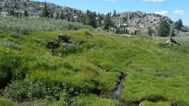
Last week I made my annual summer pilgrimage to the granite backbone of our state and a campsite at Lake Tahoe. As I floated down the Truckee River (which doesn’t empty into San Francisco Bay, but impressively drains water that may have been impounded for over 700 years in Lake Tahoe), I pondered the journey of Sierra water through the watershed. You might picture a drop of water falling on the rugged western Sierra slopes and trace its path from the high mountains into a clear, cold creek. The creek flows downhill and joins others, eventually reaching larger streams and rivers. Complex ecosystems are formed along the way. Mayfly and caddisfly larvae in the creeks feed trout. The water permeates the banks creating riparian habitats with willows and alders supporting nesting habitat for migratory songbirds from the tropics to raise their young. The water picks up nutrients from the creekbed as it travels downhill. Along the way, some of the water is dammed to provide the thirsty communities of the Bay Area with drinking water. The Calaveras Dam brings Sierra water from the Mokelumne River to East Bay MUD water recipients while the Hetch Hetchy water is delivered to San Francisco. The mighty Sacramento River wends through the valley and past the State Capitol, watering farmlands along the way. Its headwaters are in the Cascade Mountains north of Redding, but many other tributaries, including the American and Yuba rivers add to its flow. Further south, the creeks feed into the San Joaquin River which meets the Sacramento River at the Delta.

The health of our mountains and the ecosystems between here and there are vital to the health of our bay. Climate change, pollution and invasive species take a toll throughout the watershed. It’s important that we each do what we can to take care of our land. The land will reward us with a bounty of water to drink, food to eat and places to recreate and restore our weary urban souls. You can celebrate our amazing bay and learn more about it at the Saving the Bay website with an award-winning, local film (portions of the video are available as well as lesson plans for teachers on the website). Don't forget Coastal Cleanup Day coming up the third Saturday of September, too, where you can make a difference in your neighborhood or along the bay shoreline picking up trash.