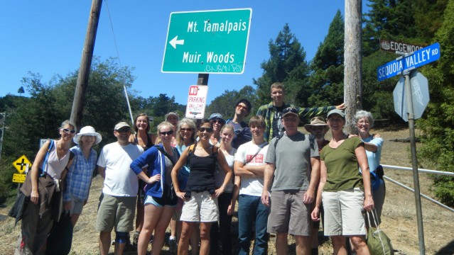

On a clear morning in Mill Valley, we set out on the Dipsea, intent on hiking from Mill Valley to Stinson Beach, transecting a variety of coastal habitats. The Dipsea is a trail of legend and lore, and the site of an annual trail race. The race is an “open” course: there’s a recommended route, but racers can take short cuts and find their own way from the starting point to the end. Its unique handicapping system makes it possible for six-year olds and much older racers to compete for the “win” with faster distance runners. Our intrepid group of East Bay hikers met at the Depot Coffee Shop, the starting point of the first Dipsea race in 1904. We were planning on a much more leisurely pace and enjoyed a nice latte on the back patio while the drivers shuttled our vehicles to the beach for our one-way trip.
We set out through the early twists and turns through the quiet hillside streets of Mill Valley -- up, up, up, stairway after shady, tree-lined stairway. We climbed the equivalent of a 50-story building in the initial ascent of the trail. It was a warm morning that became a hot afternoon. The trail snaked through a Douglas fir forest, with the cones reminding me of the legend that they harbored mice to shelter them from forest fires. You can still see their tiny hind legs and tails sticking out of the scales on the cones.

The trail emerged from the forest to coastal scrub with lots of coyote brush. I looked for the female coyote brush flower that looks so much like soft, white paintbrushes scattered over the plant. There were none to be found, but lots of flowers buds are waiting to unfurl later this month. The warm air carried the scent of maple syrup from the California everlasting flowers along the trail. The trail undulated and climbed through the open. Then, just when I regretted not bringing more water, we plunged into the shady forest. Ferns and redwoods were a welcome relief from the sun. Though part of the trail passes through Muir Woods National Monument where a small section of old-growth redwoods were spared the ax, most of the redwoods we walked underneath were smaller. Growing in the “fairy ring” formation of redwoods sprouted from the burl wood of the ancient tree, they are genetic clones of the original that grew after the parent tree was cut down. You can almost envision the “ghost” tree standing in the interior ring of these trees and picture the size of it.
My favorite moment on the trail was standing on a ridge on Mt. Tam, one of the most beloved and iconic mountains in the Bay Area, where we could take in a view of both San Francisco Bay and the Pacific. The Bay was clear with tiny white triangles of sail boats sprinkled over its beautiful blue face. The East Bay hills and Mount Diablo were visible in the distance beyond the Bay. A thick fog layer shrouded the Pacific, pulled close to shore by the inland heat. By the time we reached Stinson Beach, some 7+ miles after our start, I was ready to stop and enjoy the refreshing water and lunch with our companions. Squadrons of brown pelicans seemed to announce we'd reached the edge of the continent. It was epic and unforgettable, but I think I’ll just do a short section next time!

"All the wild world is beautiful, and it matters but little where we go, to highlands or lowlands, woods or plains, on the sea or land or down among the crystals of waves or high in a balloon in the sky; through all the climates, hot or cold, storms and calms, everywhere and always we are in God's eternal beauty and love. So universally true is this, the spot where we chance to be always seems the best." - John Muir