
If you've ever wished your camera could take a humongous photo that captures everything, then gigapans are for you. Gigapans are billion-pixel images that are stitched together, like a patchwork quilt, from hundreds of shots made by ordinary cameras. A special mount and software programs the camera to take precisely overlapping images, which are then seamlessly merged into one colossal shot tens of thousands of pixels across.
Many of us first witnessed the potential of gigapans when photographers compiled them during President Obama's inauguration ceremony on January 20, 2009. This example, by David Bergman, allows you to zoom in and study every face in the crowd that day, from four former presidents to Jane and Joe Blow (and Newt Gingrich is there too).
There are over 50,000 gigapans uploaded at gigapan.com. Their subjects range from the night sky, to cityscapes, to hotel room interiors.
Naturally I would want such a thing used for geology. First I would want to see eye candy, like the Grand Canyon. And places I'll never visit, like the South Pole. Scientists have made gigapans like those—how could they resist?—but they've also made real teaching and research tools.
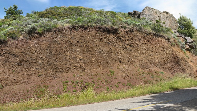
For instance, you and I in the Bay Area can easily drive to the Marin Headlands or elsewhere in Marin County and inspect all the deep-sea red ribbon chert we want. But geology teacher Ron Schott, the leading geological gigapanner, has captured a fine roadcut exposure in the image at the top of this post. Now his students in Kansas can zoom into it as close as being there, inches from the rock face:

Any teacher, anywhere, can assign a lab exercise built around this image that's almost as good as a day trip. Instructors can show students the classic wave-cut platforms of the California coast in a gigapan that's every bit as good for teaching as standing on the spot with binoculars—in fact there's a 3D version, too.
